On the afternoon of September 25, thunderstorms are developing and causing rain with thunderstorms and lightning in Can Gio, Nha Be, Binh Chanh, District 8, Binh Tan (HCMC). In addition, thunderstorms in Dong Nai are also moving towards HCMC.
In the next 0 - 3 hours, thunderstorms will continue to develop, causing showers, accompanied by thunderstorms and lightning in the above districts, then expanding to other neighboring areas.
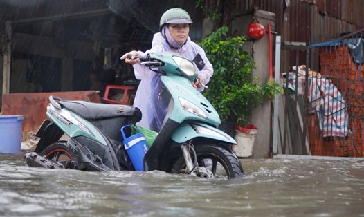
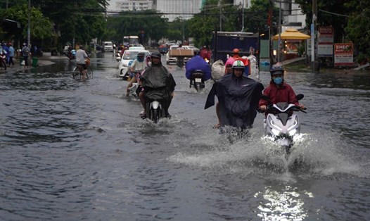
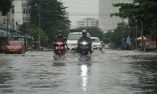
Rainfall is generally from 10-30mm, some places over 40mm. During thunderstorms, beware of tornadoes, hail and strong gusts of wind around level 5-7 (8-17m/s), heavy rain causing localized flooding.
The cause of thunderstorms in the area is due to the weakening of the continental high pressure. The low pressure trough with an axis through the North Central region is weak. The wind changes direction with weak intensity over the Southern sea. Above, the subtropical high pressure encroaches on the West, the axis through the South - South Central region.
Weather forecast for the next 24-48 hours, the low pressure trough with an axis over the Central region will gradually weaken. Above, the subtropical high pressure will encroach on the West and have an axis over the Central region.
From 72 hours to the 10th day, the subtropical high pressure continued to move west, gradually weakening from September 29-30. Around October 1, the cold continental high pressure strengthened to the north of our country, forming a low trough with an axis through the Central region connecting with the cyclone in the northeast of the Philippines.
Therefore, in the next 2-3 days, the Southern region will have widespread thunderstorms again. During thunderstorms, there is a possibility of tornadoes, lightning and strong gusts of wind. Beware of the possibility of heavy rain causing localized flooding in low-lying areas and areas with poor drainage capacity.