The National Center for Hydro-Meteorological Forecasting has issued a noteworthy weather trend forecast for February. This is still the main winter month, so cold air continues to operate, affecting both the weather patterns at sea and on land. Timely grasping climate trends will help people be more proactive in production and living activities.
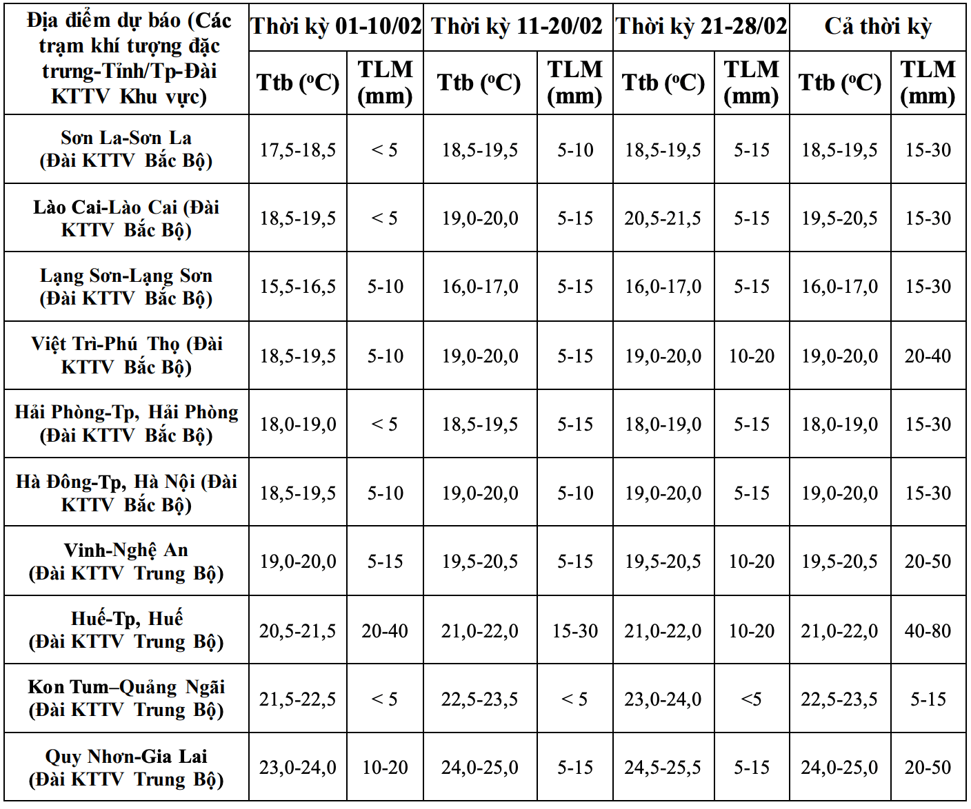
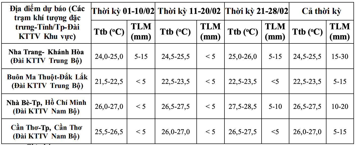
Regarding the temperature trend, across the country, the average temperature is generally approximately equal to the multi-year average of the same period, especially in the Northern region, it is 0.5 - 1 degree Celsius higher than the multi-year average, in some places it is 1.5 degrees Celsius higher.
According to Mr. Nguyen Duc Hoa - Deputy Head of the Climate Forecasting Department, National Center for Hydro-Meteorological Forecasting, cold air in February is likely to be weaker than the multi-year average.

However, there is still short-term severe cold - harmful cold phenomenon in the Northern region and Thanh Hoa - Nghe An provinces, which may be accompanied by frost in the high mountainous areas" - Mr. Hoa said.
Previously, in January, there were 4 cold spells on the night of January 1st, January 5th, January 21st and January 31st. Among them, 2 cold spells on January 5th and January 21st caused 2 widespread severe cold spells. It is noteworthy that the lowest temperature in the cold spell from January 21st in high mountainous areas was below 3 degrees Celsius in some places; especially in Mau Son (Lang Son), the temperature dropped to -0.1 degrees Celsius on January 22nd.
Regarding the rainfall trend, the meteorological agency forecasts that in February, the total rainfall in the areas from Quang Tri to Quang Ngai, the northern coast of the South Central Coast, the south of the Central Highlands and the South is generally higher than the multi-year average by 5 - 20 mm, in some places higher. Other areas are generally approximately the multi-year average of the same period.
During the forecast period, there is a possibility of widespread rain in the provinces from Ha Tinh to Hue city and the South Central Coast. The Southern region may experience some days of unseasonal rain" - Deputy Head of the Climate Forecasting Department added.
Dangerous weather phenomena such as thunderstorms, tornadoes, lightning, hail and strong gusts of wind are likely to appear locally.
Regarding dangerous weather phenomena, in February 2026, it is forecast that storms/tropical depressions are unlikely to appear in the East Sea area. According to multi-year averages, in February in the East Sea there are 0.1 storms/tropical depressions, not making landfall in Vietnam.
In the context of climate change, weather, and climate are increasingly complicated with many dangerous and extreme forms such as heavy rain in a short time, flash floods, landslides...
Therefore, the meteorological agency requests all levels of government and people to regularly update and integrate meteorological and hydrological forecasting and warning information in 1-3-day short-term bulletins, to promptly adjust production plans, appropriate response plans, especially appropriate reservoir operation plans, ensuring the safety of works and downstream areas, along with ensuring safety for production and people's livelihoods.


