
According to information from the meteorological agency, through monitoring radar weather images of Tam Ky, satellite cloud images and lightning positioning at 2:00 PM on July 31, convective clouds are developing in many communes and wards of Da Nang city, causing showers and thunderstorms. By the end of July 31, thunderstorms will continue to occur on a large scale and expand to many other areas.
The meteorological agency warns people to be wary of dangerous weather phenomena such as tornadoes, lightning, hail, strong gusts of wind and localized heavy rain with rainfall possibly reaching 30 mm/hour. The level of natural disaster risk due to tornadoes, lightning and hail is warned at level 1.
In Dong Giang commune, continuous heavy rain has caused many landslide points. Through actual inspection by the Commune People's Committee and the Economic Department, 4 landslide points appeared on Group A Duong 2 road, La Bo village, soil and rocks overflowed onto the road surface, causing traffic obstruction. On Vo Nguyen Giap route, Prao village also recorded one landslide point, affecting people's travel.
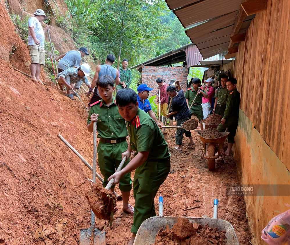
Heavy rain also poses a potential risk of unsafety for people and property. In Prao village, a household was also landslide behind their house and is being monitored and guided by the local authorities on safety measures. Heavy rain also caused many households in La Bo village to have landslides behind their houses, posing a potential risk of unsafety for people and property.
The commune government has mobilized police, military, grassroots security forces, youth union members and people to urgently clear soil and rocks, support households to move property and overcome the consequences. At the same time, functional forces continue to inspect key areas, closely monitor weather developments, and be ready to evacuate people when necessary to minimize damage caused by heavy rain and landslides.


