The storm is very strong, moving quickly, and has a wide circulation. In response to the complicated developments of the storm, this morning, November 5, Mr. Mai Van Khiem - Director of the National Center for Hydro-Meteorological Forecasting, Department of Hydro-Meteorology provided updated information about the storm.

Storm No. 13 will be strong when it reaches shore
Sir, when is the forecast for storm No. 13 to make landfall and landfall in which areas?
- At 5:00 a.m. on November 5, storm Kalmaegi entered the eastern sea of the central East Sea, becoming storm No. 13, level 13 intensity, gusting to level 16.
It is forecasted that around the afternoon of November 6, the storm will enter the sea area of Da Nang - Khanh Hoa city. Around the night of November 6 (after 9:00 p.m. on November 6) to early morning of November 7, the storm will make landfall in the provinces from Quang Ngai to Dak Lak, then move to Laos, weaken into a tropical depression and gradually dissipate.
Due to the influence of a wide storm circulation, it is necessary to be on guard against the risk of thunderstorms, tornadoes and strong gusts of wind both before and during the storm's landfall.
What are the notable characteristics of this storm, is the storm likely to strengthen or not, sir?
- The storm is very strong, moving quickly, with a wide storm circulation, operating on the tropical convergence zone, high sea surface temperatures, humid atmosphere, and weak cold air. Therefore, it is likely that the storm will strengthen after entering the East Sea.
International and Vietnamese forecasts are relatively consistent in trajectory and intensity.
Peak impact storm on November 6 - 7
Thus, the storm continues to head towards the Central region - an area that has just suffered a long period of natural disasters. What is the detailed forecast for the impact on rain and wind, sir?
- From the evening of November 6, on the mainland along the coast from South Quang Tri to Da Nang, the east of the provinces from Quang Ngai to Dak Lak, the wind will gradually increase to level 6-7, then increase to level 8-9, the area near the storm center will be strong at level 10-12. The focus is on the East of Quang Ngai - Dak Lak provinces, gusting to level 14-15. The strongest wind time is from the evening of November 6 to the morning of November 7.
The west of Quang Ngai and Gia Lai provinces will gradually increase to level 6-7, near the storm's eye will have strong winds of level 8, gusting to level 10.
Currently, the cold air is weakening, there are no signs of strengthening again on November 6-7, at this time the activity of the easterly wind zone is not strong, so this rain is mainly due to the circulation of storm No. 13.
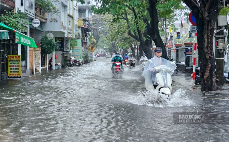
From November 6 to 7, the area from Da Nang to Dak Lak will have very heavy rain with common rainfall of 200-400mm/ods, locally over 600mm/ods; the area from South Quang Tri to Hue, Khanh Hoa and Lam Dong will have heavy to very heavy rain with common rainfall of 150-300mm/ods, locally over 450mm/ods. From November 8, heavy rain in the above areas tends to decrease.
From November 7 to 8, the North of Quang Tri to Thanh Hoa will have moderate rain, heavy rain with common rainfall of 50-150mm/ods, locally very heavy rain over 200mm/ods.
How is the hydrological situation forecast when the water level on the rivers has risen after the recent flood, sir?
- Due to the impact of heavy rain caused by storm No. 13, rivers from Quang Tri to Khanh Hoa are likely to experience a new flood; in which the flood and inundation levels on river systems in Hue and Da Nang are unlikely to be as serious as the recent flood, but special attention should be paid to some rivers that may rise above alert level 3.
Before affecting the mainland, how will storm No. 13 affect the weather in our country's sea, sir?
- The central East Sea area (including the sea area north of Truong Sa) will gradually increase to level 7-8, then increase to level 9-11; The area near the storm's eye will have strong winds of level 12-14, gusts of level 17, waves 5-7m high, the area near the storm's eye will be 8-10m high. The sea is rough. It is necessary to pay attention to the impacts on the Truong Sa special zone and coastal works.
From early morning on November 6, the sea area from Da Nang to Khanh Hoa (including Ly Son special zone) will have winds gradually increasing to level 6-7, then increasing to level 8-11, the area near the storm's eye will have strong winds of level 12-14, gusting to level 17. Coastal areas from Hue to Dak Lak have waves 4-6m high, near the storm's eye 6-8m high, and rough seas. It is important to note that the wind is very strong in Ly Son special zone.
Sincerely thank you!