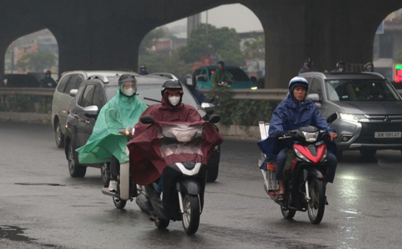
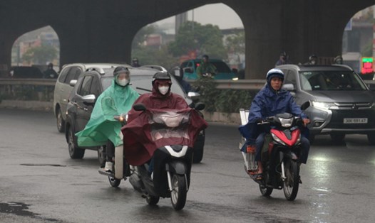
According to the National Center for Hydro-Meteorological Forecasting, last night and this morning (November 1), the area from South Nghe An to Da Nang city and the east of Quang Ngai province had moderate rain, heavy rain, locally very heavy rain and thunderstorms.
Rainfall from 7pm on October 31 to 8am on November 1 locally over 150mm in some places such as: Ky Lac station (Ha Tinh) 221.8mm, Phong Nha station (Quang Tri) 232.2mm, Tra Kot station (Da Nang) 210mm, Nghia Trung station (Quang Ngai) 276.2mm.
Central Central region has some places with very heavy rain over 700mm in 2 days
The area from Ha Tinh to Da Nang city and the east of Quang Ngai province from the morning of November 1 to the morning of November 3 is forecast to have heavy to very heavy rain with common rainfall of 200 - 450mm, locally over 700mm.
The south of Nghe An province and the west of Quang Ngai from the morning of November 1 to the morning of November 3 are forecast to have moderate rain, heavy rain with common rainfall of 70 - 150mm, locally very heavy rain over 250mm. Warning of the risk of heavy rain with rainfall greater than 150mm within 3 hours.
Day and night on November 3, the area from Ha Tinh to Quang Ngai will have heavy to very heavy rain with common rainfall of 100 - 200mm, locally over 350mm. Heavy rain in the Central region is likely to last until around the night of November 4.
The area from Gia Lai to Lam Dong and the South during the day and night of November 1 is forecast to have showers and scattered thunderstorms with rainfall of 10 - 30mm, locally heavy rain over 70mm. During thunderstorms, there is a possibility of tornadoes, lightning, hail and strong gusts of wind. Warning of the risk of heavy rain with rainfall greater than 70mm within 3 hours.
During thunderstorms, there is a possibility of tornadoes, lightning, hail and strong gusts of wind. The warning level of natural disaster risk due to heavy rain, tornadoes, lightning, and hail is level 1; in the area from Ha Tinh to Da Nang city and the east of Quang Ngai, it is level 2.
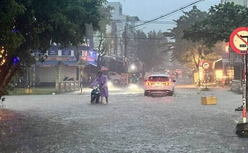
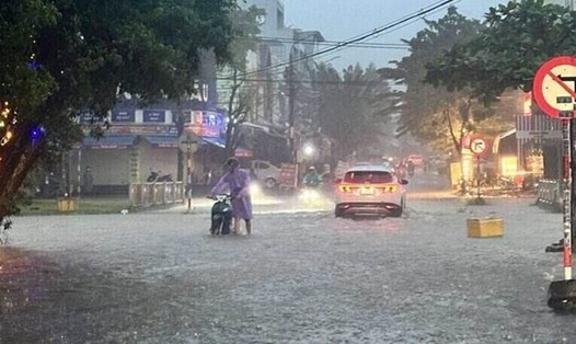
Heavy rain is likely to cause flooding in low-lying areas, urban areas, industrial parks; flash floods on small rivers and streams, landslides on steep slopes.
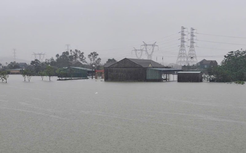
Floods on rivers from Quang Tri to Quang Ngai tend to rise again
Regarding the hydrological situation, currently, the flood on the Huong River (Hue city) is fluctuating above alert level 2. Floods on rivers in Ha Tinh and Tra Khuc River (Quang Ngai) are rising. Meanwhile, on rivers in Quang Tri, Hue city and Da Nang city, there were slight fluctuations.
At 8:00 a.m. on November 1, 2025, the water level on the Huong River at Kim Long station reached 2.45 m (0.45 m above alert level 2); on the Bo River at Phu Oc station was 3.28 m (0.28 m above alert level 2); on the Tra Khuc River at Tra Khuc station was 4.69 m (0.31 m below alert level 2).
In the next 12 hours, floods on rivers in Hue city will continue to fluctuate above alert level 2; Tra Khuc river will continue to rise but still below alert level 3.
In the next 24 hours, floods on rivers in Hue city will increase and reach below alert level 3, while Tra Khuc river will continue to rise and is likely to reach alert level 3.
From now until November 5, there is a possibility of a new flood on rivers from Nghe An to Ha Tinh, while floods on rivers from Quang Tri to Quang Ngai tend to rise again. During this flood, the peak flood level in the upper reaches of Ca River (Nghe An) may exceed alert level 1; the downstream of La River (Ha Tinh) may increase to alert level 1 - alert level 2; Ngan Sau, Ngan Pho rivers (Ha Tinh), Gianh River, Kien Giang River, Thach Han River (Quang Tri), and rivers from Hue City to Quang Ngai are likely to reach alert level 2 - alert level 3, even some places exceed alert level 3.
The flooding situation in Hue city is decreasing, but we still need to be vigilant against the risk of flooding in low-lying areas along rivers, residential areas and urban areas in provinces from Nghe An to Quang Ngai. There is a high risk of flash floods on rivers and streams and landslides in mountainous areas of these provinces.
Real-time warning information of flash flood and landslide risks is updated at https://luquetsatlo.nchmf.gov.vn and in separate warning bulletins.
The risk level of natural disasters due to floods is level 2. Floods on rivers and flooding in low-lying areas can affect waterway traffic, aquaculture, agricultural production, people's lives and socio-economic activities.
Forecast and warning information is calculated based on the assumption of regulating the operation of upstream reservoirs. The Hydrometeorological Agency will continue to update bulletins when there are changes in the discharge flow of reservoirs.