
Sitting fishing in the middle of the dry Red River

Bài và Ảnh: Tô Công |

Phu Tho - Compared to the time when the flood exceeded historical levels nearly 2 months ago, the current water level of the Red River has dropped, with people even sitting in the middle of the river to fish.

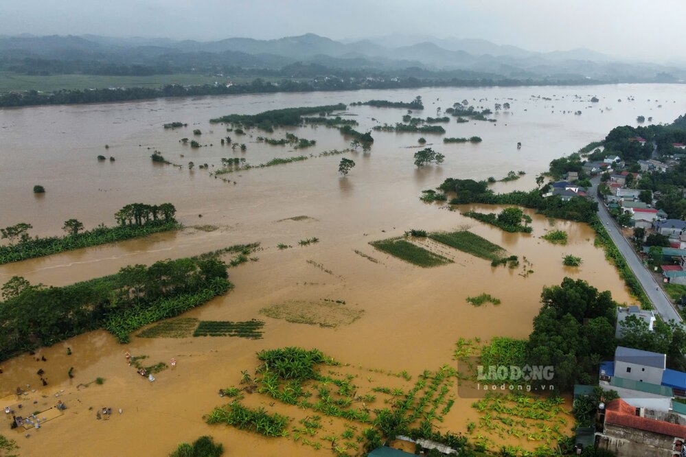
Hoi 6h ngay 11.9, muc nuoc tren song Thao (song Hong) tai Am Thuong, huyen Ha Hoa duoc ghi nhan la 27,90m, tren muc Bao dong 3 la 1,9m, vuot lu lich su nam 1971 (27,32m), hang chuc km ha luu song thoi diem do menh mong nuoc lu. Anh: To Cong.
At 6:00 a.m. on September 11, the water level on the Thao River (Red River) at Am Thuong, Ha Hoa District was recorded at 27.90m, 1.9m above alert level 3, exceeding the historic flood in 1971 (27.32m), dozens of kilometers downstream of the river at that time were flooded. Photo: To Cong.
Tuy nhien, theo ghi nhan cua phong vien Bao Lao Dong nhung ngay dau thang 11, tuc la chi chua day 2 thang troi qua, nhieu doan song Hong qua dia ban tinh Phu Tho bat dau can.
According to Lao Dong Newspaper reporters in early November, after nearly 2 months of flood peaks exceeding historical levels, many sections of the Red River passing through Phu Tho province are starting to dry up.
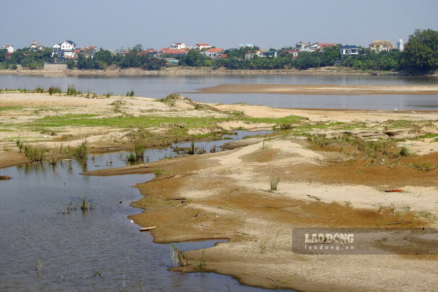
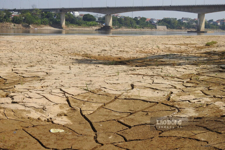
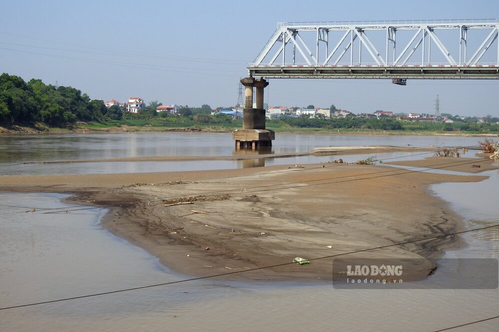
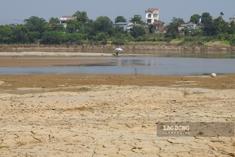
Co the thay, tai khu vuc cau Ngoc Thap (thi xa Phu Tho va huyen Tam Nong), sau khi nuoc rut, mot con cat lon da noi len giua song.
At Ngoc Thap bridge area (Phu Tho town and Tam Nong district), the alluvial layer cracked after the water receded and many days without rain.
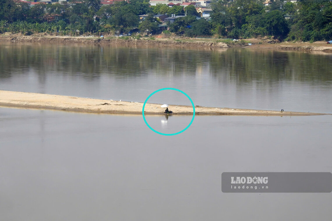
Mot nguoi dan ong ngoi tren con cat giua song de cau ca.
A man sits on a sandbar in the middle of the river to fish.
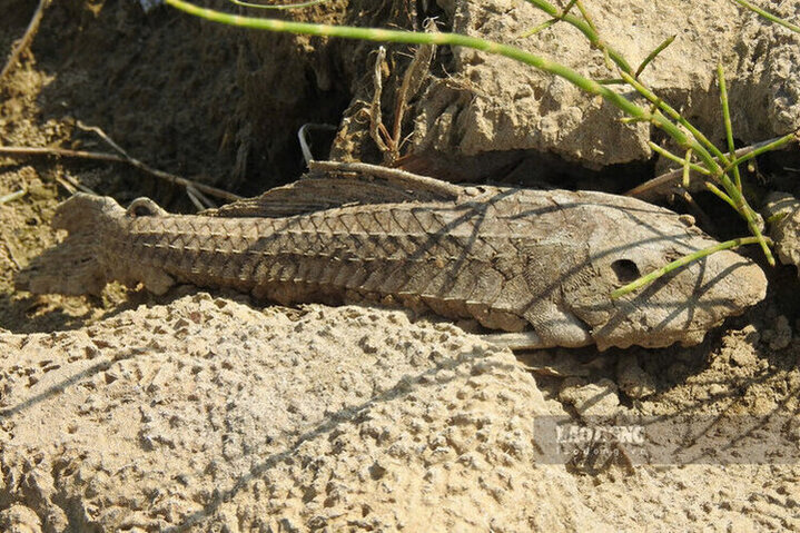
Mot con ca mac can tren con cat giua song.
A fish stranded on a sandbar in the middle of the river.
Nhung noi tung ngap trong nuoc lu nay co lau moc cao vut, hoa bung no.
Places that were once flooded now have tall grass and blooming flowers.
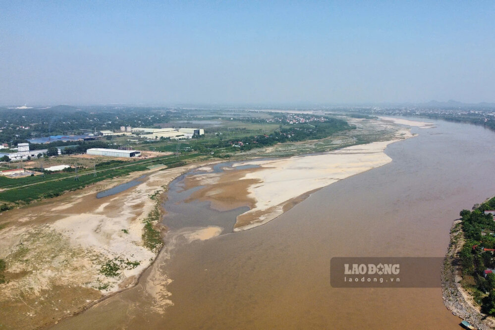
Doc song Hong hien tai co vo so con cat, bai boi phu sa dai ca cay so.
Along the Red River there are currently countless sand dunes and alluvial flats stretching for kilometers.
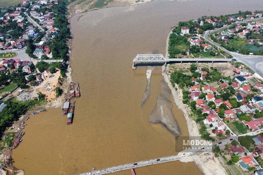
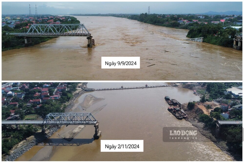
Tai khu vuc cau Phong Chau, sau khi nuoc rut, long song da nho hep lai.
At Phong Chau bridge area, after the water receded, the riverbed became narrower.
Cung co nhung con cat noi len canh doan cau cu sap duoc pha bo (phia xa Phung Nguyen, huyen Lam Thao).
There are also sand dunes emerging next to the old bridge section that is about to be demolished (on the side of Phung Nguyen commune, Lam Thao district).
So voi thoi diem sap cau Phong Chau cach day gan 2 thang (ngay 9.9.2024), muc nuoc song Hong khac biet ro rang.
Compared to the time of Phong Chau bridge collapse nearly 2 months ago (September 9, 2024), the water level of the Red River is clearly different.
Theo Trung tam Du bao khi tuong thuy van Quoc gia,
According to the short-term hydrological forecast and warning bulletin of the National Center for Hydro-Meteorological Forecasting on November 4, the actual water level measurement and forecast at Phu Tho station, at 1:00 a.m. on October 30, the water level of the Red River was nearly 12.50m, by 7:00 a.m. on November 4, the water level decreased to more than 11.90m, and it is forecasted that by 7:00 a.m. on November 5, the water level will decrease below the above level.
Bài và Ảnh: Tô Công
TIN LIÊN QUAN

Red River water level at Phong Chau bridge drops, revealing sand bottom

|

Phu Tho - Compared to the time of the Phong Chau bridge collapse, the water level of the Red River in the area is decreasing, and sand dunes in the middle of the river are starting to appear.

Phu Tho invites bids for urgent 66 billion VND package to build embankment on Red River bank

|

Phu Tho - The investor has just announced a bidding invitation for a package worth more than 66 billion VND in the project to handle landslides on the Red River bank in Lam Thao district.

Prime Minister requests early implementation of Tu Lien bridge across Red River

|

The Prime Minister requested that the Tu Lien bridge project be implemented soon, ensuring publicity, transparency, and harmonization of interests among people, businesses, and the State.

Wake up at 4am to hunt clouds in Dien Bien

|

Around October and November, many tourists coming to Dien Bien wake up at 4-5am to hunt clouds and capture the moment of sunrise.

Chay River bank erodes, risking sweeping away houses

|

Yen Bai - The lives of many families in Group 2, Thac Ba town, Yen Binh district are being seriously affected when the Chay river bank is eroding.

Gold price today 11/5: Gold rings continue to decline

|

Gold prices today, November 5, fell across both domestic and international markets. Investors are waiting for information from the US election.

Breaking rocks to open a hundred billion dong road in Tuyen Quang

|

Tuyen Quang - After 3 years of construction, the more than 4 km long Son Duong town bypass road still cannot be completed due to the hard rocky terrain.

Ms. Harris, Mr. Trump are evenly matched before the G hour of the US election

|

US election polls before G-hour show Ms. Harris and Mr. Trump are 9 to 10 in the race for the White House.

Red River water level at Phong Chau bridge drops, revealing sand bottom

Tô Công |

Phu Tho - Compared to the time of the Phong Chau bridge collapse, the water level of the Red River in the area is decreasing, and sand dunes in the middle of the river are starting to appear.

Phu Tho invites bids for urgent 66 billion VND package to build embankment on Red River bank

Tô Công |

Phu Tho - The investor has just announced a bidding invitation for a package worth more than 66 billion VND in the project to handle landslides on the Red River bank in Lam Thao district.

Prime Minister requests early implementation of Tu Lien bridge across Red River

PHẠM ĐÔNG |

The Prime Minister requested that the Tu Lien bridge project be implemented soon, ensuring publicity, transparency, and harmonization of interests among people, businesses, and the State.