The latest storm and low pressure news on June 17th from the Joint Typhoon Warning Center (JTWC) said that low pressure 92W is developing slowly as it moves northwest towards the Mariana Islands.
The low pressure is about 494 nautical miles southeast of Guam, moving northwest at a speed of about 19 km/h.
Depression 92W is showing some signs of better organization and JTWC storm forecasters have upgraded the possibility of this low pressure to a moderate level. This means that 92W is likely to become a tropical depression in the next 24 hours. JTWC noted that 92W is generally still weak and unorganized, with the possibility of slow development until June 19.
Guam and Mariana residents should prepare to respond to showers, thunderstorms, strong gusts of wind and the possibility of localized heavy rain when 92W passes through the Mariana Islands. 92W is very likely to be affected at the intensity of the tropical depression from the afternoon of June 18 to the evening of June 19. It is still uncertain about the path of 92W, with the possibility of passing through southern Guam or passing between Guam and Saipan.
This low pressure area is also being monitored by the Philippine Atmospheric, Geophysical and Astronomical Services Administration (PAGASA) and named 06b. Philippine weather forecasters say that this low pressure area is about 2,900km east of Eastern Visayas, Philippines and is likely to strengthen into a tropical depression in the next 24 hours.
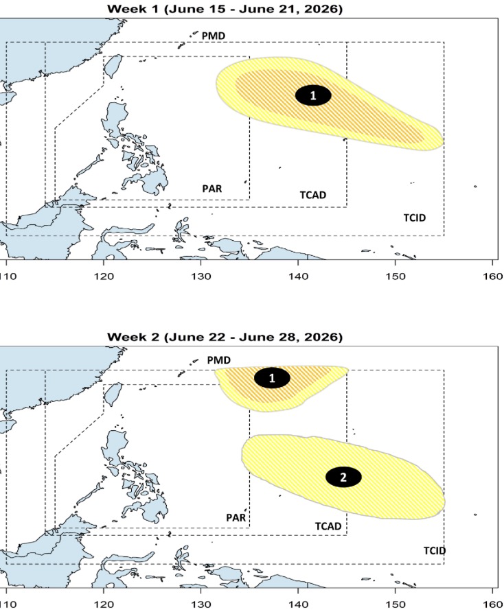
The appearance of this low pressure is consistent with the longer-term forecast that PAGASA issued on June 15, which predicted that in the week from June 15 to June 21, a low pressure will form in PAGASA's PMD forecast area, with the possibility of strengthening into a storm or a tropical depression at a low to moderate level. This low pressure is forecast to move westward and enter the Philippine forecast area (PAR) during this period.
According to forecasts, in the week from June 22 to June 28, this system continues to have the potential to strengthen into a storm or tropical depression at a low to medium level and shift direction to the northwest, towards southern Japan.
Also in the week from June 22 to June 28, another low pressure area is forecast to form in the east of PAGASA's PMD forecast area, with a low possibility of strengthening into a storm or tropical depression.


