
On August 30, according to typhoon news, the latest low pressure from the Philippine Atmospheric, Geophysical and Astronomical Services Administration (PAGASA), the low pressure area 08j located in the Philippine Area of Responsibility (PAR) has strengthened into the tropical depression Pilandok.
According to PAGASA, at 8 am (Philippines time), the center of the tropical depression Pilandok was located about 1,245km east of the northernmost point of Luzon Island. The system has the strongest wind at 45 km/h near the center, gusts up to 75 km/h and is moving west-northwest at a speed of 15 km/h.
By 11 am bulletin, Pilandok had moved closer, about 1,225km east of Luzon's northernmost point.
Previously, PAGASA's bulletin at 10:00 PM on August 29 assessed that this low pressure area has a high possibility of developing into a tropical depression within 24 hours.
However, Pilandok is not yet a direct threat to the mainland of the Philippines. PAGASA assesses that the system is unlikely to make landfall in this country because it is still very far from the shore. The agency also forecasts that Pilandok may be a tropical cyclone that will last for a short time and is likely to weaken in the Philippine Sea around September 1.
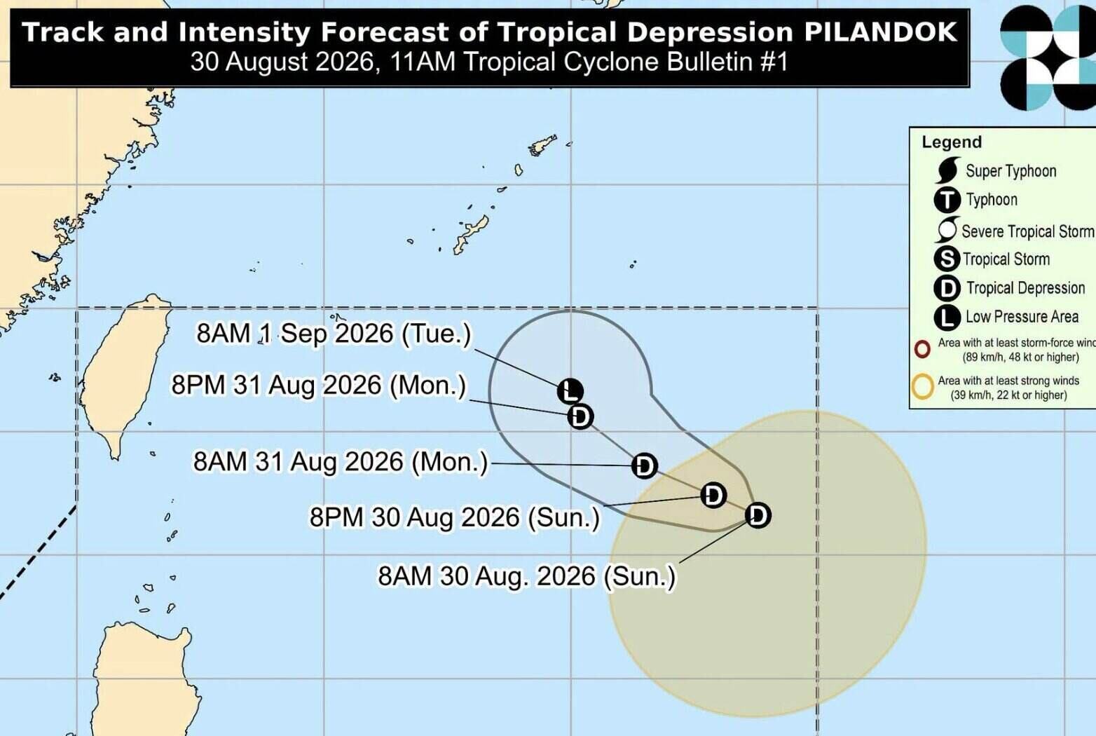
A more notable point lies in the indirect impact of Pilandok. As it moves westward, the system may strengthen the southwest monsoon (Habagat), which is causing rain in many areas of Luzon and Visayas.
According to PAGASA, Habagat continues to cause rain in some northern and central provinces of Luzon, while many other areas have scattered rain. Some places may experience heavy rain, leading to the risk of flash floods and landslides, especially in areas with vulnerable terrain.
Meanwhile, the remnants of Typhoon Saudel have weakened into a low pressure area. This system is located about 1,105km northwest of the northern tip of Luzon Island, outside PAR. PAGASA assesses that the low pressure area has a moderate possibility of strengthening again into a tropical depression.
PAGASA recommends that people continue to follow weather reports, especially in areas at risk of heavy rain, flash floods and landslides.


