
According to the latest weather forecast from the Philippine Atmospheric, Geophysical and Astronomical Services Administration (PAGASA), Typhoon Saudel is maintaining strong intensity as it moves over the Philippine Sea, with maximum winds of 175 km/h near the center and gusts of up to 215 km/h.
The tropical storm warning bulletin No. 4, broadcast at 11:00 AM on August 24 (Philippines time), identified the center of storm Saudel at about 1,480km east - northeast of the northernmost part of Luzon Island. Storm Saudel is moving in a west-northwest direction at a speed of about 30 km/h, while the pressure at the storm center is at 940 hPa.
Strong typhoon-level winds, in some places reaching typhoon levels, extending up to 540km around the storm center. PAGASA assesses that Saudel is currently near the super typhoon threshold and does not rule out the possibility of further strengthening into a super typhoon before or during its movement through the Philippine Area of Responsibility (PAR).
According to forecasts, Saudel will continue to move mainly west-northwest in the next 2 days, then gradually move west. After entering this area, Saudel will be given the local name Obet.
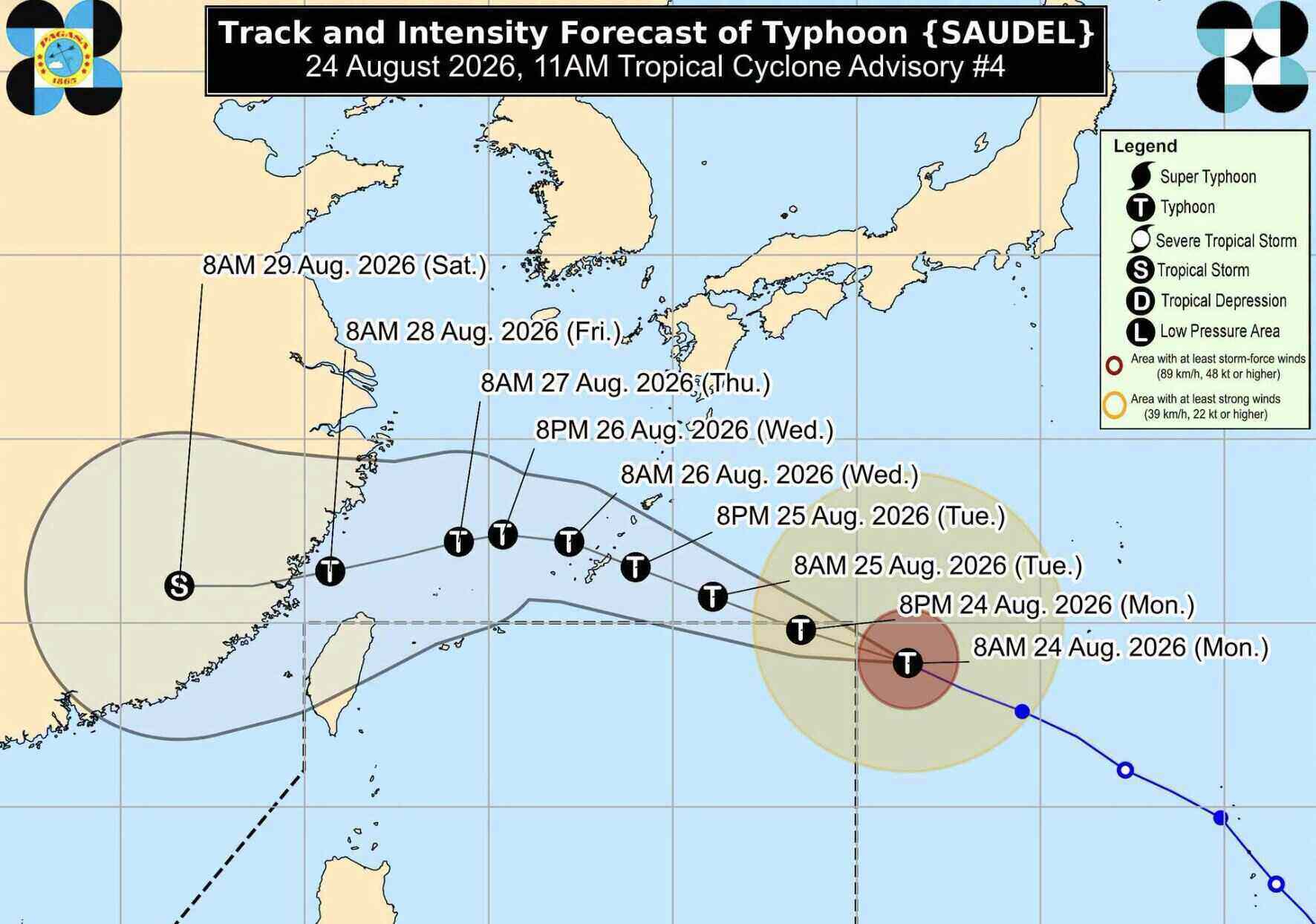
Current forecasts show that the storm is still active at sea and may leave the monitoring area on the evening of August 24 or early morning of August 25. However, if the storm moves in a more westward orbit in the next 24 hours, Saudel may stay longer than expected.
PAGASA assesses that Saudel has little chance of directly affecting the weather and sea conditions in the Philippines in the next 3 days. After reaching peak intensity, the storm is forecast to begin to weaken.
In addition to Saudel, the area also has 2 other tropical systems being monitored.
A tropical depression with the international name Gaenari, formerly known as Neneng, is outside PAR. Meanwhile, another tropical depression, previously identified as the LPA 08h disturbance zone, has strengthened into tropical storm Atsani and is also outside PAR.
PAGASA recommends that people continue to follow updates on the developments of these systems.


