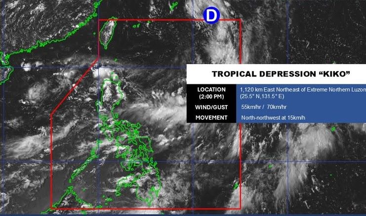
According to the latest storm information from the Philippine Atmospheric, Geophysical and Astronomical Services Administration, the low pressure area in the sea east of northeast Luzon strengthened into a tropical depression at 10:00 a.m. on September 3, internationally named Kiko.
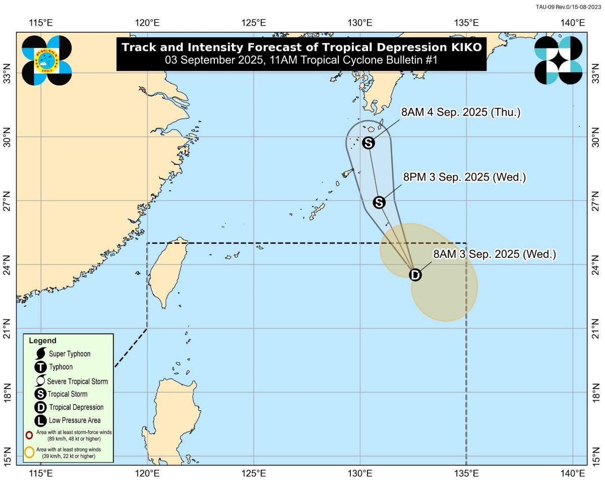
According to PAGASA, at 2:00 p.m. on September 3, the center of tropical depression Kiko was at about 25.5 degrees north latitude, 131.5 degrees east longitude, about 1,120km east-northeast of the northernmost tip of Luzon. The strongest wind near the center of the tropical depression is 55 km/h, gusting to 70 km/h, central pressure is 1,004 hPa, moving north at a speed of 15 km/h.
The strong wind range of the tropical depression from the center extends up to 320km. However, there are currently no storm wind warnings for land areas.
PAGASA forecasts Kiko to continue moving north or north-northwestward over the next 24 hours, towards southern Japan, then accelerate and exit the Philippine Forecast Area (PAR) in the afternoon of September 3. Kiko is expected to strengthen into a tropical storm tonight or early morning on September 4. This is the first storm to form in September near the Philippines.
Due to its long trajectory, Kiko is not expected to directly impact the Philippine mainland nor will it significantly affect coastal waters. However, the meteorological agency warns that localities and people still need to closely monitor the next storm forecasts, because the storm's developments may change.
PAGASA expects that in September, about 2-4 storms will form or enter the PAR region of the Philippines, most of which are likely to enter the East Sea. During the week of September 8-14, 2 low pressure areas are forecast to form in the northern part of the Philippine Sea, including one low pressure area that is likely to move into the East Sea.
PAGASA calls on disaster prevention agencies and communities to be ready to respond and follow the instructions of local authorities when there are warnings of heavy rain, flash floods or landslides.
Meanwhile, the Vietnam National Center for Hydro-Meteorological Forecasting noted that September is the main stage of the storm season, with the possibility of about 2-3 storms or tropical depressions appearing in the East Sea, of which 1-2 storms can directly affect the mainland of Vietnam. On a national scale, there is a continued possibility of dangerous weather phenomena such as thunderstorms, lightning, hail and strong gusts of wind.