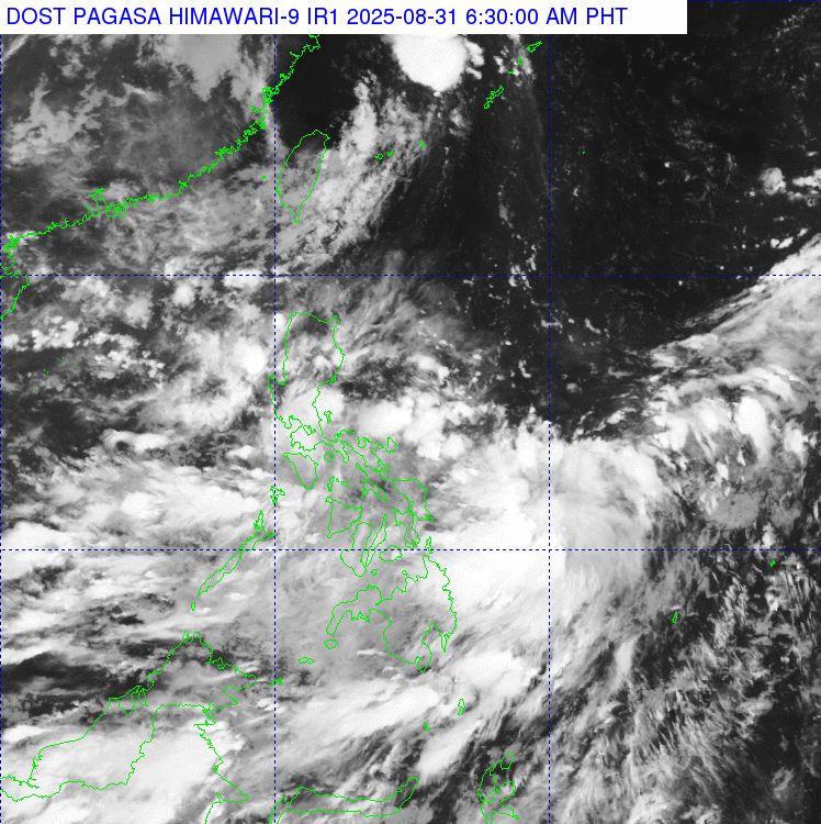
On the morning of August 31, the Philippine Atmospheric, Geophysical and Astronomical Services Administration (PAGASA) said it was monitoring two low pressure areas 08h and 08i operating in the Philippine Forecast Area (PAR).
According to the latest storm news from PAGASA, at 2:00 a.m. on August 31, low pressure at 08:00 was determined to be about 90km northeast of Camarines Norte province (14.5 degrees North latitude, 123.7 degrees East longitude). This low pressure area is unlikely to strengthen into a tropical depression in the next 24 hours.
Meanwhile, low pressure 08i is located in Eastern Visayas for about 900km (10.8 degrees North latitude, 133.0 degrees East longitude), and is only likely to develop into a tropical depression in the next 24 hours.
Along with the two low pressure areas, the southwest monsoon continues to affect Mindanao, the areas southwest of Luzon and the Visayas. It is forecasted that on August 31, many places in the Philippines will have showers and thunderstorms, along with the risk of flash floods and landslides.
Regarding winds and sea conditions, it is forecasted that the West Luzon area will have moderate southwest to southeast winds, waves of 1.2-18 m high. In the seas of Southeast Luzon, Visayas and Mindanao, there will be light to moderate winds, waves of 0.6-1.5 m, relatively safe for small ships.
Regarding storm No. 6 Nongfa, on the evening of August 30, the storm weakened into a low pressure area in the Central Laos region. The strongest wind in the center of the low pressure area is below level 6.
Regarding the forecast of rain in Vietnam, last night and early this morning (31.8), the Northern Delta, from Thanh Hoa to Ha Tinh had moderate rain, heavy rain, locally very heavy rain.
Rainfall from 7pm on August 30 to 3am on August 31 was over 70mm in some places, some notable points:
Quan Boat (Hung Yen): 150.2mm
Co Ngua (Hai Phong): 78.4mm
Dong Van 1 (Nghe An): 177.6mm
Lieu Dau (Ha Tinh): 125.2mm
Forecast for the day and night of August 31, in the Northern region and from Thanh Hoa to Ha Tinh: Scattered showers and thunderstorms, locally heavy to very heavy rain, rainfall 1535mm, locally over 100mm.
In the afternoon and evening of August 31, in the area from Quang Tri to the East of Quang Ngai, the Central and Southern Plateau: There will be scattered showers and thunderstorms, with rainfall of 10-30mm, locally over 80mm.
Dangerous warning: Risk of heavy rain (>80mm/3 hours). During thunderstorms, there is a possibility of tornadoes, lightning, hail and strong gusts of wind.
Potential impacts: Localized heavy rains can cause flash floods on small rivers and streams; landslides on steep slopes; and flooding in low-lying areas.
Regarding today's Hanoi weather forecast: Hanoi City: Lowest temperature 23-25 degrees. The highest temperature is 30-32 degrees. Cloudy, sometimes with showers and thunderstorms, locally heavy rain. North to Northeast wind level 2-3. During thunderstorms, there is a possibility of tornadoes, lightning and strong gusts of wind.


