Although no official storm has yet appeared, the Northwest Pacific is entering a state of high alert with 3 low pressure disturbances active at the same time.
In the storm forecast bulletin on June 27, the Joint Typhoon Warning Center (JTWC) assessed that all three disturbances are likely to develop into tropical depressions within the next 7 days.
Invest 97W - the current focus - is a low pressure area located northwest of Guam, causing scattered convective clouds with showers and thunderstorms.
Invest 97W is expected to move slowly northwest over the next few days. If it is not absorbed into the low pressure system east southeast, this disturbance area could strengthen and form an tropical depression early in the week after entering the sea east of the Philippines. The probability of formation within 7 days is average (60%).
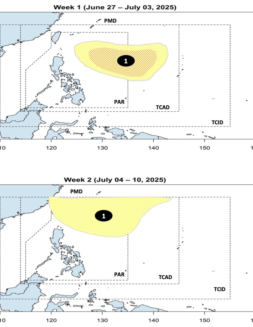
A disturbance nearby is another low pressure area active east of Guam. This area also creates a dense area of thunderstorms but does not have a clear structure.
If the system moves north, it could face a more favorable environment, opening up the possibility of developing into a tropical depression or even a subtropical depression early next week. The probability of formation in the next 7 days is average (60%).
Further west, a new low pressure area is forecast to form along the monsoon trough west of Palawan Island (Philippines) early next week. Although upper-level wind conditions in this area are only moderate, the JTWC warns of the possibility of forming a tropical depression around January 1 or 2.7 when the system moves north into the East Sea.
This could be a factor causing unstable weather for the coastal areas of Central and Northern Vietnam in the middle or the end of next week. The probability of formation within 7 days is average (40%).
JTWC noted that people in the area from Mariana Islands, Guam to the Philippines and coastal areas of Vietnam need to closely monitor weather forecasts and storm forecasts and warnings from the national meteorological agency in the coming days to have timely response plans.
Meanwhile, according to the Vietnam National Center for Hydro-Meteorological Forecasting, on June 28, the Northwest and Viet Bac regions of the North will have moderate rain, heavy rain and thunderstorms, locally very heavy rain with common rainfall from 30-60mm, locally over 120mm (rain concentrated in the late afternoon and night).
On the night of June 28 and June 29, the Northern region will have moderate rain, heavy rain and scattered thunderstorms, locally very heavy rain with common rainfall from 30-60mm, locally over 150mm. Warning of the risk of local heavy rain (>100mm/3 hours).
Heavy rain in the North is likely to last until July 2 (total rainfall from the night of October 28 to October 7 in the North is generally 100-300mm, locally over 500mm). During thunderstorms, there is a possibility of tornadoes, lightning, hail and strong gusts of wind.