According to the Philippine Atmospheric, Geophysical and Astronomical Services Administration (PAGASA), a new low pressure area may form northeast of Luzon Island between Saturday and Sunday (October 28-29).
If it develops as expected, the new low pressure system could bring widespread showers and thunderstorms to the eastern Bicol, Visayas, Caraga and Davao regions.
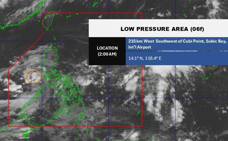
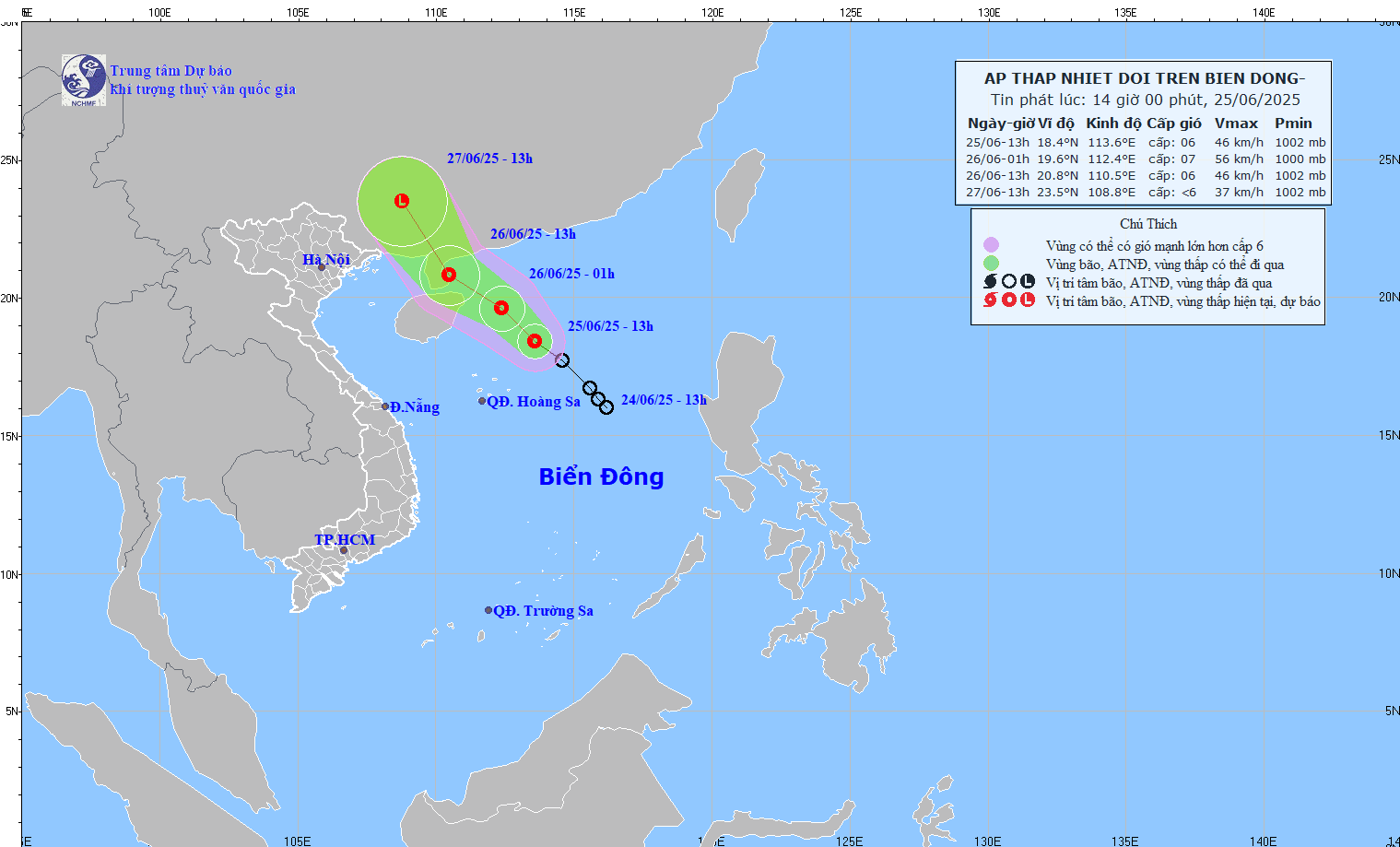
PAGASA weather forecaster Loriedin Dela Cruz-Galicia said at a press conference on the morning of June 25 that although the tropical depression in the East Sea has left the Philippine Forecast Area (PAR), people should not be subjective. The newly formed low pressure may affect the eastern provinces in the next few days.
As of 2:00 p.m. on June 25, the center of the tropical depression in the East Sea was at about 18.4 degrees north latitude; 113.6 degrees east longitude, 780km west of Sinait town, Ilocos Sur province and was being blown by the southwest monsoon away from Luzon.
Most of the rain is occurring offshore as the southwest monsoon is being attracted towards the tropical depression outside the PAR, explains Dela Cruz-Galicia.
Due to this impact, moderate to heavy rains are still possible in Palawan and part of Zambales province from 26-27 June, but overall the activity of the southwest monsoon will gradually decrease.
However, the situation could change rapidly by the end of the week if a new low pressure is truly formed. In that case, the western edge of the low pressure trough will begin to impact the mainland, bringing heavy to very heavy rain to the above areas. The risk of flooding and landslides is warned at a high level, especially in mountainous areas, along rivers and areas with weak terrain.
PAGASA said monsoon rains continue in western Luzon, although not as severe as in the early days of the week. People in low-lying areas and areas with a history of flash floods are advised to closely monitor weather forecasts and be ready to evacuate when ordered by local authorities.
PAGASA will continue to closely monitor the development of the new low pressure area and issue an official update if the system strengthens into a tropical depression or is likely to enter the East Sea early next week.