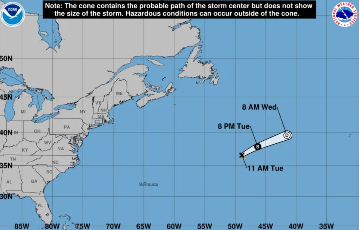
The first tropical storm of the 2025 Atlantic hurricane season was officially named Andrea on the morning of June 24 (US time), according to the US National Hurricane Center (NHC). However, instead of threatening the mainland, Andrea appears... in the middle of the storm.
Formed in a reclaimed sea between Bermuda and the Azores, Andrea is more than 1,900km from its nearest inland and moves northeast at a speed of about 27km/h. Maximum winds are currently recorded at 65 km/h, the minimum threshold to be classified as a tropical storm.
The US Meteorological Agency said Andrea will be a short-lived storm that will not make landfall in any area. The storm is forecast to dissipate on June 25 without affecting residents or maritime traffic.
Not only weak and isolated, Andrea also stands out for appearing in an unusual location - far north and east of typical early season storms. The reason is believed to be due to above-average sea surface temperatures in the area, creating conditions for storm formation even away from the main tropical region.
The first Atlantic storm typically appears around June 20. Andrea arrived a few days later, as storm-forming conditions were being suppressed by strong upper-level winds and dense Sahara dust - which brought dry air and cooling the sea surface.
However, meteorologists warn that the 2025 Atlantic hurricane season could still exceed the multi-year average. The latest hurricane forecast from the National Oceanic and Atmospheric Administration (NOAA) says there could be up to 10 major hurricanes (level 3 or higher) this season, significantly above the average of 7.
Although climate change does not increase the number of storms each season, it makes storms stronger, more rainy and accelerate more intensively. This is a trend that has been closely monitored in recent years.
Andrea, despite being a weak greeting, is still a signal that the 2025 hurricane season has begun. And if the forecast is correct, what follows may not be as peaceful.