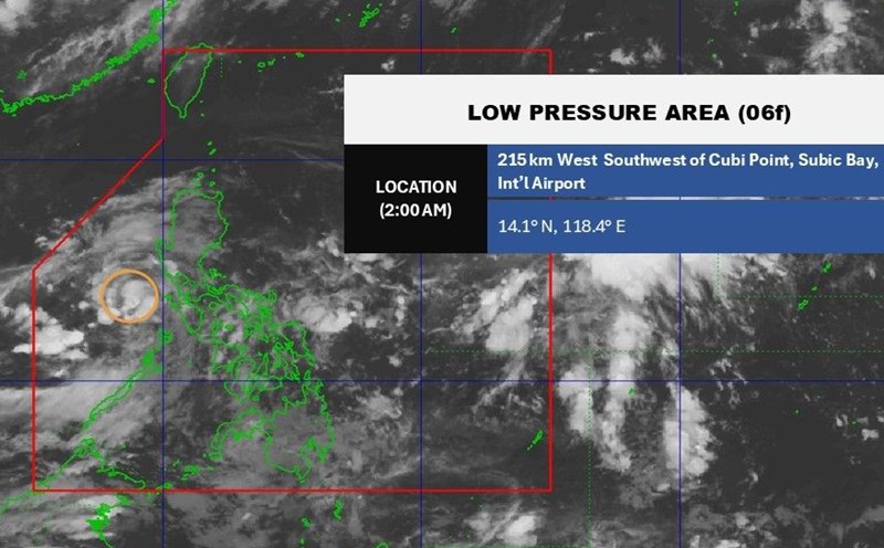
According to the latest storm information from the Philippine Atmospheric, Geophysical and Astronomical Services Administration (PAGASA), at 3:00 a.m. on June 24, the center of tropical depression 06f was at about 16.2 degrees north latitude, 116.2 degrees east longitude, in the North East Sea, 445km west of Dagupan City, Pangasinan, Philippines.
Tropical storm Sepat previously entered and exited the Philippine Forecast Area (PAR) at 8:00 p.m. on June 23.
Due to the influence of the tropical depression, many areas in the Philippines will experience cloudy skies with scattered showers and thunderstorms, including Pangasinan, Zambales and Bataan.
PAGASA warns residents in these areas of the possibility of flash floods or landslides due to moderate to heavy rains.
The southwest monsoon could also bring rain across the country, especially in Metro Manila, Calabarzon, Bicol, Mimaropa, Western Visayas, the Zamboanga Peninsula and the rest of Central Luzon.
The rest of the Philippines may also experience scattered showers or thunderstorms due to the southwest monsoon.
Meanwhile, the Vietnam National Center for Hydro-Meteorological Forecasting said that at noon on June 24, the center of the tropical depression was about 500km east-southeast of Hoang Sa archipelago. Intensity level 6 (39-49km/h), gust level 8.
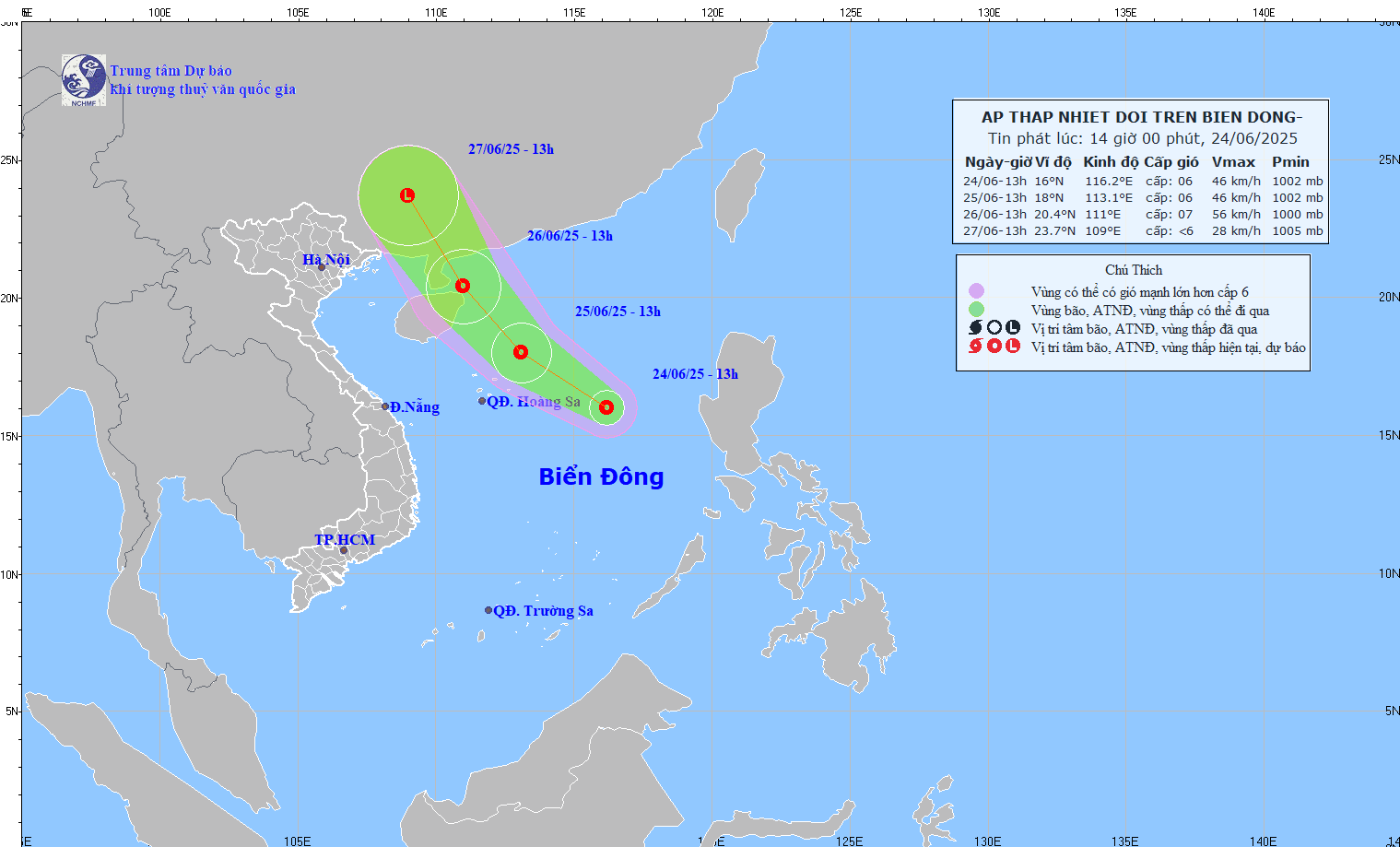
The tropical depression is moving northwest at a speed of 15km/h.
It is forecasted that by 1:00 p.m. on June 25, the center of the tropical depression will be at 18.0 degrees north latitude, 113.1 degrees east longitude; about 240km northeast of Hoang Sa archipelago. Intensity level 6, gust level 8. The tropical depression is moving northwest at a speed of 15-20km/h. The North East Sea area (including Hoang Sa archipelago) is at risk of level 3 natural disasters.
It is forecasted that by 1:00 p.m. on June 26, the center of the tropical depression will be at 20.4 degrees north latitude, 111.0 degrees east longitude; in the sea northeast of Hainan Island (China). Intensity level 6-7, gust level 9. The tropical depression is moving northwest at a speed of 15-20km/h. The North East Sea area (including Hoang Sa archipelago) is at risk of level 3 natural disasters.
It is forecasted that in the next 48 to 72 hours, the tropical depression will move northwest at a speed of 15-20km/h, gradually weakening.
Due to the impact of the tropical depression, in the North East Sea (including Hoang Sa archipelago), there will be thunderstorms and strong winds of level 6-7, gusts of level 9, rough seas. Waves are 2-4m high. Warning of danger to ships due to thunderstorms, tornadoes, strong winds, and large waves.