In the past few days, China's flooding situation has been complicated as the first red alert of the year (the highest level) has been issued across the central and southern provinces, from Anhui, Heinan, Hubei to Guizhou, Guangxi.
The China Meteorological Administration's weather bulletin said that this is a rare extreme rain, with rainfall that could collapse the flood prevention system, seriously threatening agriculture, infrastructure and the lives of millions of people.
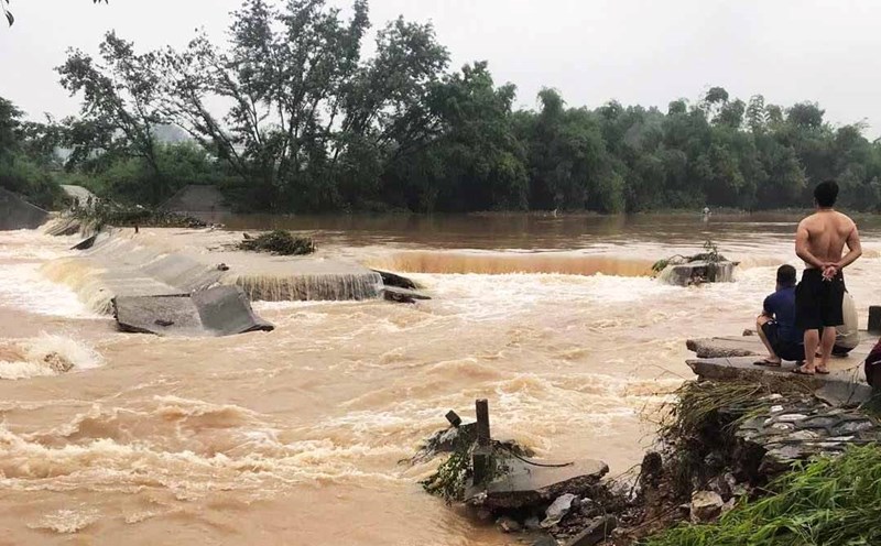
On June 19, the Le Thuy River in Hunan province witnessed the most serious flooding since 1998. The water level exceeded the safe threshold by more than 2m, sweeping away vehicles and flooding the roads. Video circulating on Douyin shows the river water rising, carrying mud and garbage rolling downstream.
In Trung Khanh, heavy rain and floods caused many apartment buildings to be flooded up to the upper floors, some vehicles were swept away and plunged down the slope. Rainfall measured in a mountainous district reached 304mm/day.
Hunan province is a hot spot as more than 53,000 people in localities such as Truong Gia Gioi, Tuong Duc, Hoai Hoa and the Western Tho Gia - Mieu Tay ethnic autonomous region have been forced to evacuate. In 4 communes of Tang Tri and Long Son districts alone, the rainfall exceeded 400mm - an extremely dangerous threshold.
The local government has raised the emergency response level for natural disasters and meteorological disasters from level III to level II, while increasing the flood control level from level IV to level III. 30 million yuan (about 4.2 million USD) has been urgently disbursed for relocation, relief and landslide risk handling.
Rescue forces from the National Fire Department deployed 230 people and 43 specialized vehicles to Hunan.

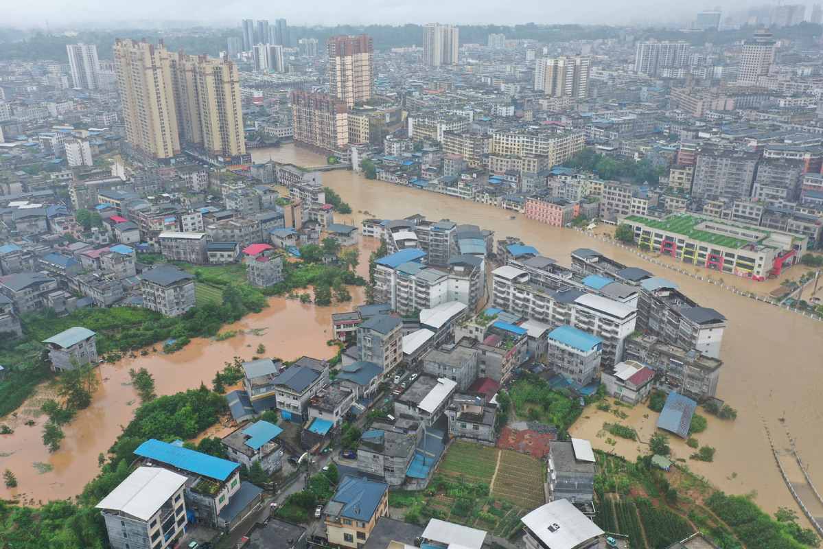
Meanwhile, Quang Dong province also recorded floods of more than 5m, breaking the historical record in Trieu Khanh city. Experts warn that the situation could worsen by the end of the week when the "plum rains" - the typical rainy season in East Asia - peak, with forecasts of up to 350mm of rain in many provinces such as Jiangsu, Anhui, Guizhou and Yunnan.
According to weather forecasts, heavy rain in areas such as Guangxi, Guizhou, Hunan, Hubei, Jiangsu and Anhui will last until June 23.
According to Chinese government data, natural disasters last year caused more than 10 billion USD in damage. This was three times higher than in 2020, when China endured a record-long rainy season of more than 60 days.
Meanwhile, the Vietnam National Center for Hydro-Meteorological Forecasting has also issued flood warnings on rivers in the Northern region.
From the afternoon of June 21 to June 22, 2025, in the upper reaches of Thao River, Lo River, downstream of Cau River, and small rivers in the Northern region, there is a possibility of a flood, with a flood amplitude on the rivers from 2-5m.
Flood peaks on small rivers are likely to reach alert level 1, alert level 2. The water level downstream of Thao River, Lo River, and Cau River is likely to be at alert level 1 to above alert level 1.
There is a high risk of flooding in low-lying areas along rivers, flash floods and landslides on steep slopes in the mountainous areas of the North.