The latest storm news from the Washington Post said that Erick is moving in the direction of possibly making landfall in Mexico on June 19 with strong winds and continuing to increase in intensity.
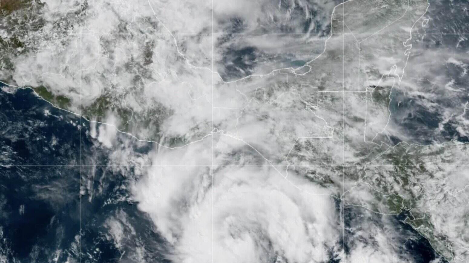
Erick is forecast to make landfall in the southeastern area of the coastal city of Acapulco, home to 850,000 people. With sustained winds of about 177 km/h, the storm is expected to reach its highest level as a Category 2 hurricane on the Saffir-Simpson hurricane scale, and is even likely to continue to strengthen into a Category 3 hurricane.
The area expected to make landfall has a sparse population density, but many towns, villages and coastal resorts are scattered. However, if the path of Erick is slightly off track, the center of the storm could move closer to densely populated areas.
In addition to strong winds and high tides causing coastal flooding, the US National Hurricane Center warns of the risk of serious flooding and life-threatening landslides, especially in steep mountainous terrain.
Due to the impact of Erick, rainfall in some areas could exceed 300 mm as the storm moves slowly inland.
Unfortunately, this could be the most dangerous storm for Mexico, as the system is expected to reach typhoon level as it approaches land, said Philippe Papin, a hurricane forecaster.
Hurricane Erick formed in the early morning of June 17, about 480 km south of the southern coast of Mexico and the Gulf of Tehuantepec.
On the morning of June 17, the storm had sustained winds of 72 km/h, moving west-northwest at a speed of about 15 km/h and gradually strengthening.
Erick is expected to gradually turn northwest on June 18 and slow down. Currently, the storm is active in the sea area with a temperature of about 29 degrees Celsius, in an environment with few wind shear, which are all favorable conditions for the storm to strengthen.
Erick is forecast to reach typhoon level by noon on June 18, with winds of at least 119 km/h, and there are only about 24 hours left until the storm makes landfall. The storm may continue to strengthen until it makes landfall at noon on June 19, reaching Category 2 storm status, with winds of 177 km/h, nearly reaching the level 3 storm threshold (level 3 storm starts from 178 km/h).
The hurricane bulletin said that the intensity forecast for Erick's landfall has been adjusted to increase by about 32 km/h compared to the original forecast.
"Some forecast models show that Erick could become even stronger," the US National Hurricane Center noted, warning of a high possibility of rapid intensification of Erick, meaning sustained winds of at least 56 km/h for less than 24 hours.
Erick is the earliest E- start to hit the East Pacific, a week earlier than the E- start on June 25 during the 2021 hurricane season.
Previously, Typhoon No. 4 Dalila also broke the record for the earliest formation compared to Typhoon Dolores in 1974, about a day earlier.
If the next storm Fabio forms before July 1, it will also become the earliest F- start storm ever recorded.
Weather models predict a high probability of one or two more storms forming in the eastern Pacific Ocean over the next 10 to 14 days. However, there are no signs of another strong Erick-like storm approaching land in the near future.