The latest storm news on June 17 said that the US National Hurricane Center (NHC) named the potential tropical depression in the eastern Pacific as 5-E.
Previously, the area of formation 5-E off the central United States was named the "Invest 94E" low pressure by forecasters.
According to forecasters from the US National Hurricane Center, potential tropical depression 5-E is likely to become tropical storm Erick on June 17 and then continue to strengthen into a hurricane on June 18.
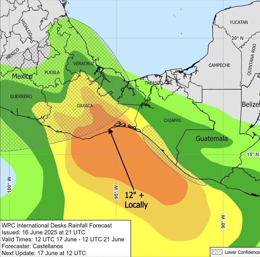
US hurricane forecasters say the latest storm, Erick, will bring heavy rain to Central America and southeastern Mexico this week.
The current location of potential tropical depression 5-E is off the coast of El Salvador, Guatemala and southeastern Mexico. These areas are expected to have common rainfall of 75-125 mm. Some areas may see localized rainfall of up to more than 200 mm.
Forecast models show Erick moving south of Mexico and are likely to make landfall by the end of the week, becoming the first storm of the 2025 hurricane season to make landfall.
Some computer models predict that the deep tropical moisture from Erick could continue to flow north and affect some parts of the extreme southern state of Texas, US, over the weekend.
If 5-E officially becomes Hurricane Erick, it will be the fifth storm to form in the eastern Pacific this year. Previously, the named storms in this basin in the past 2 weeks were: Alvin, Barbara, Cosme, Dalila.
The latest storm news from the Washington Post shows that the series of storms appearing in the eastern Pacific before potential storm Erick does not threaten land. And the storm is expected to continue to appear throughout June, in contrast to the Atlantic, where the ocean is calm and no storms have formed.
The storms in the Pacific Ocean form mainly in areas that are prone to storms at this time of year but with higher frequency than normal. Typically, the typhoon season in the eastern Pacific records up to three typhoons in late June or early July, and the No. 1 typhoon in the Pacific typically does not appear until the last week of June.
While the number of typhoons is remarkable, it is not a new development. In 2021, there were 3 named storms before June and by the end of June the storm season in the eastern Pacific will have 6 named storms.
Hurricane experts point out that a favorable period of tropical Madden Julian fluctuations (MOJ) is likely to have facilitated recent storms. The characteristic of Madden Julian fluctuations is the weather patterns moving eastward, causing either a phenomenon of rising air with storms, or a phenomenon of the air sinking down to create a stable state.
MJO's operation is expected to spread to several Atlantic regions in the coming time, but may stop before it passes Central America.


