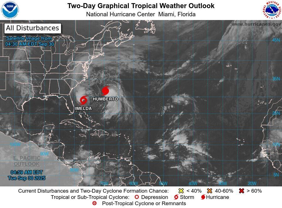
According to the US National Hurricane Administration (NOAA), Tropical Storm Imelda has strengthened with the strongest winds near the center of the storm at about 100 km/h, moving northeast, about 350 km from the Bahamas. The central pressure is now down to 985mb, a sign that the storm will continue to strengthen in the next few days.
The National Oceanic and Atmospheric Administration (NOAA) forecasts that Imelda could intensify in early October as it approaches Bermuda, USA.
In Cuba, heavy rains from Imelda's circulation caused localized flooding, especially in Santiago de Cuba and Guantanamo. At least two people have died in the landslide, while more than 18,000 have been urgently evacuated. Local authorities said 17 communities are still isolated due to flooded roads and landslides.
Although Imelda is unlikely to make landfall directly in the US, the storm's circulation will bring heavy rain and dangerous waves from Florida to the Central and South Carolina states. Experts warn that rainfall could reach 50-100mm, which could easily lead to flooding and landslides in low-lying areas.
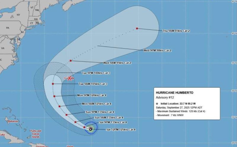
In addition, the Fujiwhara phenomenon - when the two storms rotate around each other - could occur between Imelda and the nearby Category 4 humberto. NOAA said the interaction could take Imelda further inland, reducing the risk of a direct landfall, but increasing uncertainty in forecast routes.
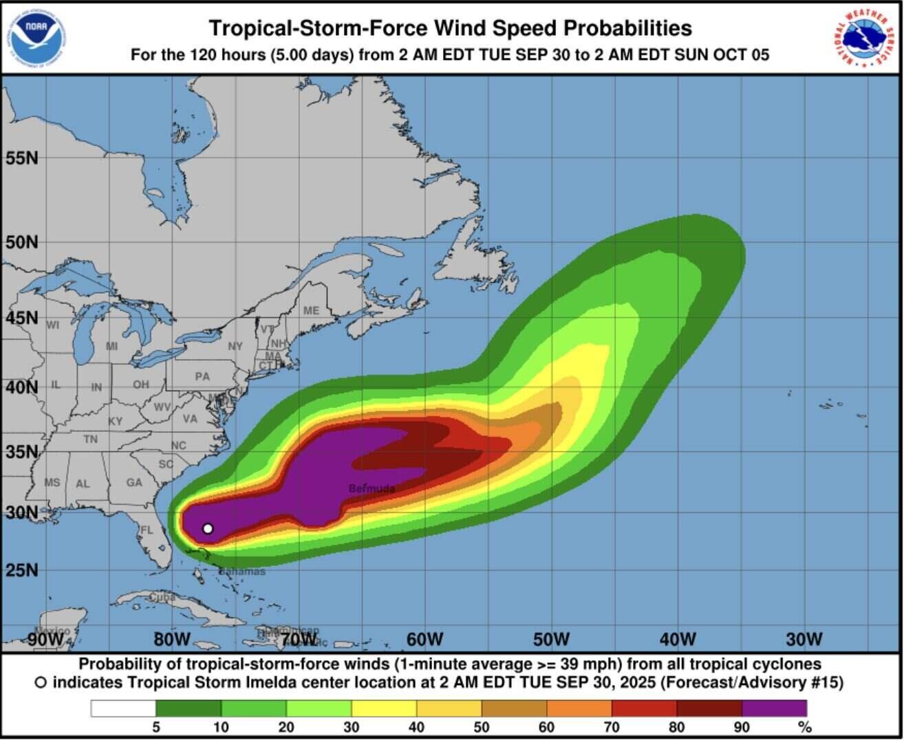
Imelda will continue moving northeast at a speed of about 15-20km/h. In the next 72 hours, the storm could approach Bermuda, bringing strong winds of level 1-2 and heavy rain. Bermuda has issued an emergency preparedness warning and called on people to stock up on necessities.
The increase in the frequency of strong storms in the Atlantic and Pacific is a signal that climate change is making the hurricane season more intense and unpredictable.
Climatists say Imelda is the ninth storm of the 2025 Atlantic hurricane season, and the frequent presence of strong storms such as Ragasa, Gabrielle and Humberto in September is a sign that the super hurricane season has begun.
The trend of warmer ocean waters due to climate change will make storms in the region stronger, longer and more unpredictable.