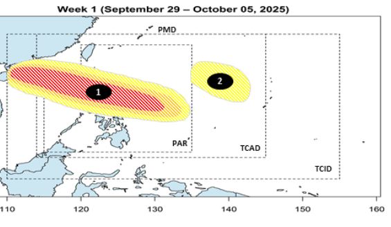
On the afternoon of September 29, the Philippine Atmospheric, Geophysical and Astronomical Services Administration said that a low pressure area had formed outside the country's forecast area (PAR), located east of the Bicol region.
It is forecasted that this low pressure area may enter PAR on the night of September 30 or the morning of October 1, with a high probability of strengthening into a storm when moving over the Philippine Sea. If it forms, the storm will be named storm Paolo, becoming the 16th storm to enter the PAR this year.
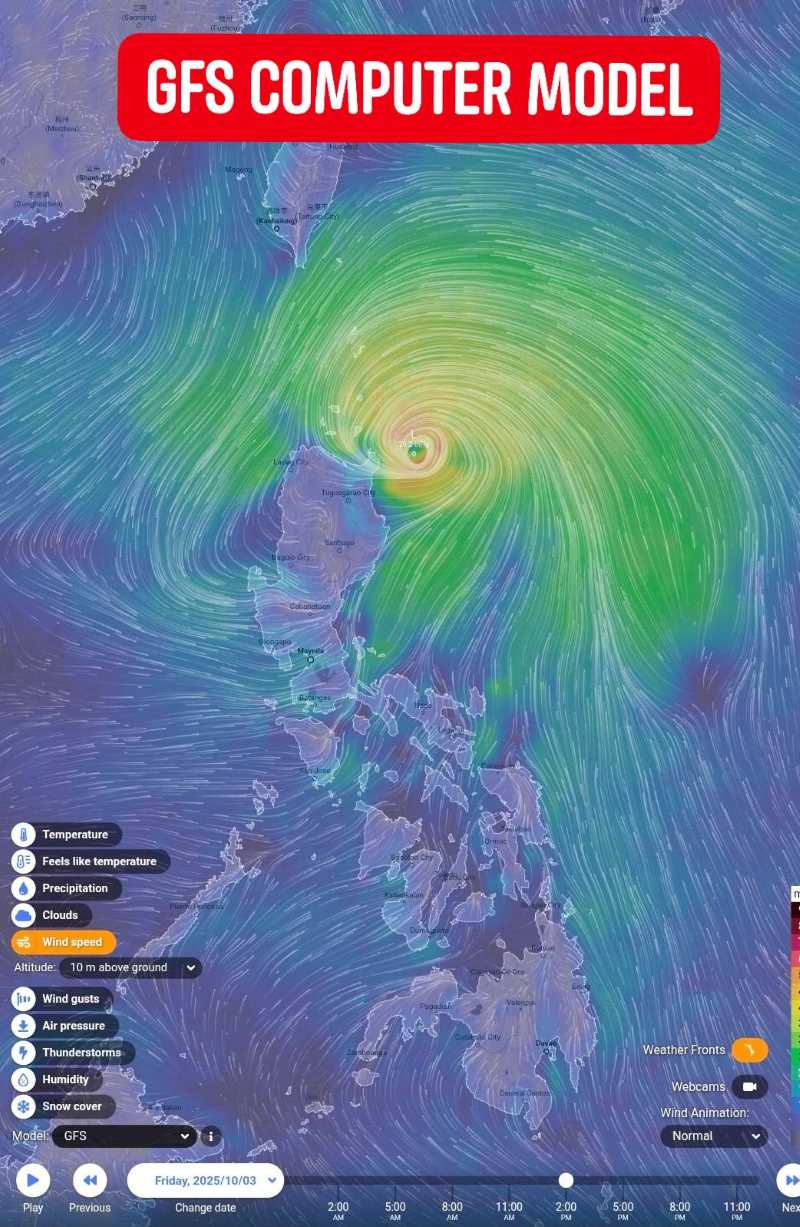
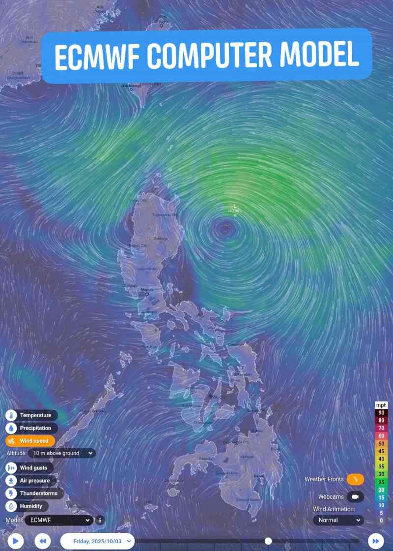
According to the GFS and ECMWF forecast models, the path of this low pressure/storm is approaching with a scenario of directly affecting Luzon Island, Philippines, from October 3-4. In case it strengthens into a storm, it is likely to enter the East Sea immediately after that, becoming the 11th storm in 2025.
Not only PAGASA, the Japan Meteorological Agency (JMA) also agreed that the strong convective cloud cluster in the east of the Philippines could develop into a tropical depression within the next 48 hours. The conditions around the disturbance area are quite favorable, with sea surface temperatures around 29 degrees Celsius and high humidity above 77%, easily creating an environment for storm formation.
The 999 hPa pressure scenario released by GFS on October 3 shows the possibility of Typhoon Paolo forming east of Luzon. If this scenario occurs, the storm will enter the East Sea from October 4, becoming the 11th storm, heading towards Hainan Island (China) and then North Central (Vietnam) from October 6.
Meteorological experts also note that this is a distant forecast, so the trajectory and intensity of the tropical depression/storm may change according to actual developments. However, the possibility of storm No. 11 appearing in the East Sea in the first days of October is relatively high.
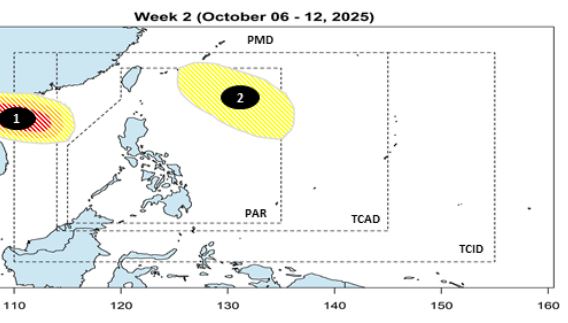
Previously, PAGASA forecasted that in October, there could be 2-4 storms/tropical depressions in the Philippines, some of which may enter the East Sea, affecting Vietnam.
According to the rules of movement, October storms usually follow 4 main directions: Riding towards Japan or Korea;
Sweep through Northern or Central Luzon and then towards Hong Kong (China) and mainland China;
Passing through Southern Luzon before entering the East Sea, it may affect Vietnam.
Directly passing through Visayas and then into the East Sea, it is likely to affect Central Vietnam.