
The latest typhoon bulletin on the morning of May 30 from the Philippine Atmospheric, Geophysical and Astronomical Services Administration (PAGASA) said that Typhoon Jangmi had strengthened from a tropical depression to a severe tropical storm on the evening of May 29.
On the morning of May 30, Typhoon Jangmi maintained this intensity when moving west-northwest over the sea area east of the Philippines.
The storm's eye is located about 970km east of Northern Luzon, Philippines.
The storm has maximum sustained wind near the center reaching 95 km/h, gusts up to 115 km/h, and central pressure of 990 hPa.
Currently, the Philippines has not issued any storm warning signals because Typhoon Jangmi is still far from the mainland. The latest storm is moving in a west-northwesterly direction at a speed of 15 km/h. The area of strong winds to strong gusts of the storm expands within a radius of 460 km from the center of the storm.
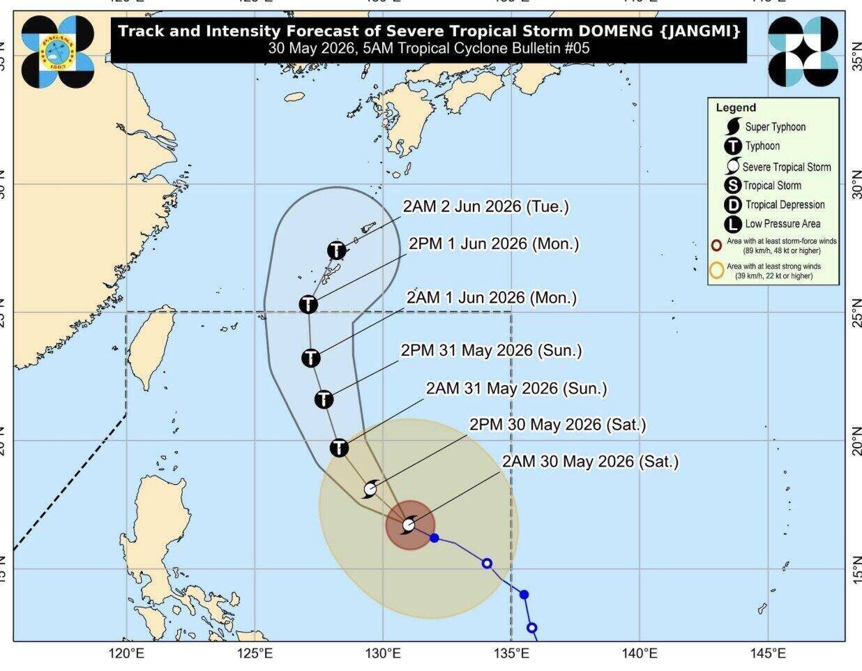
Typhoon forecasters in the Philippines noted that the latest storm is likely to change direction and move towards Japan in the coming days.
However, the expanded circulation of Typhoon Jangmi is causing scattered showers and thunderstorms in the Eastern Visayas, Sorsogon and Masbate areas of the Philippines. Authorities warn of the risk of flash floods and landslides in affected areas.
PAGASA predicts that Typhoon Jangmi may continue to strengthen into a typhoon over the Philippine waters on the evening of May 30. This system is also forecast to strengthen the southwest monsoon from May 31.
The intensified southwest winds may cause heavy rain to the western Philippines from May 31.


