
The latest storm and low pressure news on the morning of May 25 from the Philippine Atmospheric, Geophysical and Astronomical Services Administration (PAGASA) said that a low pressure trough of the low pressure area affecting Mindanao Island will cause cloudy skies, scattered showers and thunderstorms in Mindanao and Palawan Island on May 25.
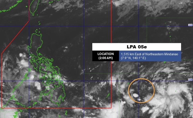
PAGASA's weather forecast bulletin stated that on the morning of May 25, low pressure 05e was about 1,515km east of the northeast of Mindanao, still outside the Philippine Area of Responsibility (PAR).
Forecasters predict that this system is likely to develop into a tropical depression in the next 24 hours.
Meanwhile, the area of Bicol and Quezon province is expected to be cloudy from low to cloudy, accompanied by showers or localized thunderstorms due to easterly winds.
Metro Manila area and other areas in the Philippines will have weather from low to cloudy, with scattered showers or thunderstorms due to locally tropical thunderstorms.
PAGASA warns that moderate to heavy rain or strong thunderstorms can cause flash floods or landslides in affected areas.
The weather forecast for May 25 states that Visayas, Mindanao, Palawan, Northern Luzon and the rest of Luzon Island will have light to moderate winds, light to moderate rough seas.
Previously, PAGASA said that at 3 pm on May 24, the low pressure outside PAR was about 1,340km east of the northeast of Mindanao. Forecasters predict that the low pressure outside PAR is likely to "averagely" develop into a tropical depression in the next 24 hours and the possibility of the low pressure strengthening will continue to increase in the coming days.


