
The weather phenomenon El Nino may make about 4-7 storms forecast to affect Hong Kong (China) this year strengthen into super typhoons, according to warnings from the Hong Kong Meteorological Station (China).
Due to the impact of El Nino and global warming, Hong Kong (China) is forecast to have higher than normal temperatures this year, with a high possibility of becoming one of the hottest 10 years ever recorded in history.
El Nino is a phenomenon of rising sea surface temperatures in the central and eastern tropical Pacific regions, which usually occurs every few years.
Mr. Choy Chun-wing - acting assistant director of Hong Kong Meteorological Station (China) - said that the El Nino phenomenon is currently forming and is likely to last from this fall until at the latest early 2027.
This causes storms in the northwest Pacific region to form further east.
According to him, this makes storms last longer at sea, absorb more energy and increase the possibility of strengthening into super typhoons.
“We forecast that the number of storms affecting Hong Kong (China) this year will be less than last year, with about 4-7 storms entering a radius of 500km around Hong Kong (China). However, the possibility of storms strengthening into super typhoons has increased,” he said.
Last year, Hong Kong (China) recorded a record of 14 storms. "As long as atmospheric conditions are favorable, stronger storms in the northwest Pacific region may enter the South China Sea," Mr. Choy warned.
Although El Nino often causes increased rainfall in spring and winter, Mr. Choy Chun-wing also warned of the risk of heavy rain, based on experience from 1982 and 1997.
He said that the upcoming El Nino is likely to reach at least medium intensity, while increasing the risk of abnormally high temperatures.
According to the Hong Kong Meteorological Station (China), the highest temperature on May 29 will reach about 35 degrees Celsius in the inner city area and about 2 degrees Celsius higher in the New Territories region.
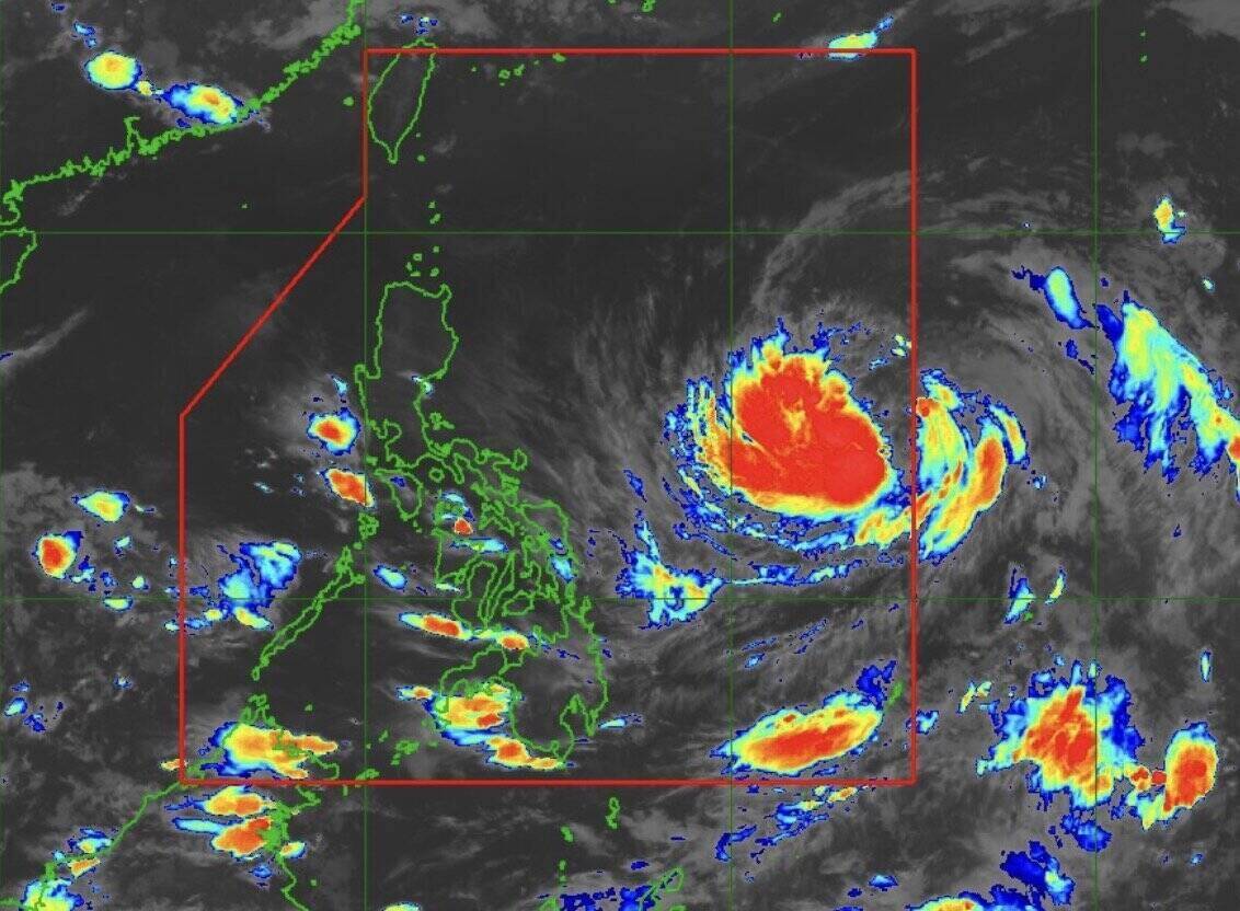
Currently, in the northwest Pacific basin, Typhoon Jangmi (Philippines name Domeng) is located in the Philippine Area of Responsibility (PAR).
On the morning of May 29, the center of Typhoon Jangmi was about 1,345km southeast of Luzon, Philippines.
The storm is currently having maximum sustained winds of 75km/h near the storm center, gusts up to 90 km/h. The storm is moving northwest at a speed of 20 km/h. Strong winds to strong gusts spread up to 400km from the storm center.
Philippine storm forecasters say that Typhoon Jangmi is unlikely to directly affect the weather conditions of the Philippines in the next 24 hours.
However, the southwest wind intensified by Typhoon Jangmi may cause heavy rain in the western areas of the Philippines starting from May 31.


