
According to the latest storm news from the US National Hurricane Center (NHC), at 11:00 AM on August 14 (Hawai time), the center of Typhoon Lala was located about 676km east-southeast of Hilo and about 1,022km east-southeast of Honolulu. Current forecasts show that Lala may continue to strengthen into a Category 1 storm as it approaches Hawaii.
On August 14, Hawaii was issued a storm warning, while Maui was in the tropical storm warning zone. Oahu and Kauai were placed under tropical storm monitoring. Warnings may continue to be adjusted as Lala's path and intensity change.
According to the weather forecast of the US National Weather Service (NWS), Hawaii needs to prepare for storm winds from August 15, in which areas in high terrain may record stronger gusts. Rain began to affect Hawaii from August 14 and then gradually spread westward through other islands during the weekend.
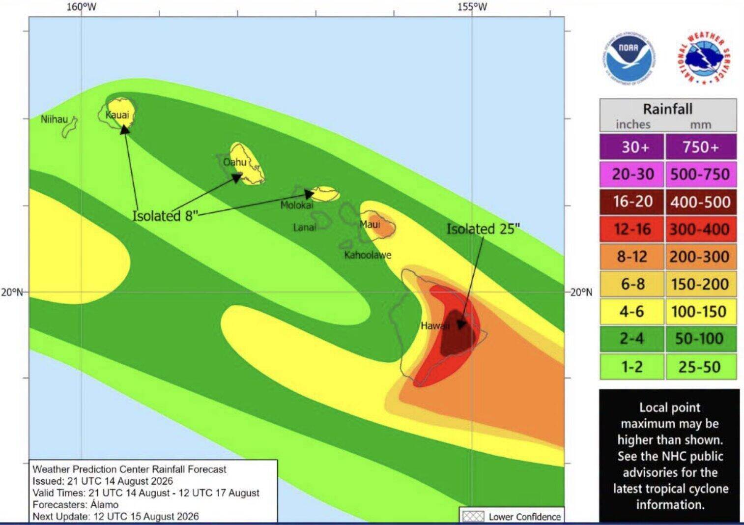
Typhoon Lala can also cause heavy rain from 203 - 381mm in some areas. Prolonged rain increases the risk of life-threatening floods and landslides, especially in areas with steep terrain. People are advised to closely monitor flood and landslide warnings as the storm approaches.
In addition to wind and rain, large waves and dangerous offshore currents are also forecast to appear throughout the state. The Honolulu Weather Service said waves on the east coast of Hawaii and Maui Islands could rise sharply as Typhoon Lala approaches. In some areas, waves could reach 4.6 - 6.1m on August 15.
According to NWS, Typhoon Lala is forecast to move through or just south of Hawaii islands by the weekend, but the impact of wind, rain and large waves may appear throughout the state.
The NHC currently broadcasts updates on Lala every 6 hours, at 5:00 AM, 11:00 AM, 5:00 PM and 11:00 PM Hawaii time. The path and intensity of the storm may continue to change as it approaches the archipelago.


