
Information from the latest storm and low pressure forecast bulletin of the Philippine Atmospheric, Geophysical and Astronomical Services Administration (PAGASA).
PAGASA's bulletin said that it is expected that from now until August 16, right while Typhoon Peilou is operating in the northeast of PAGASA's PMD forecast area, a new low pressure area is expected to form in the northeastern border area of the Philippine Area of Responsibility (PAR). Philippine forecasters say that this low pressure has a wide affected area but is unlikely to strengthen into a storm or tropical depression.
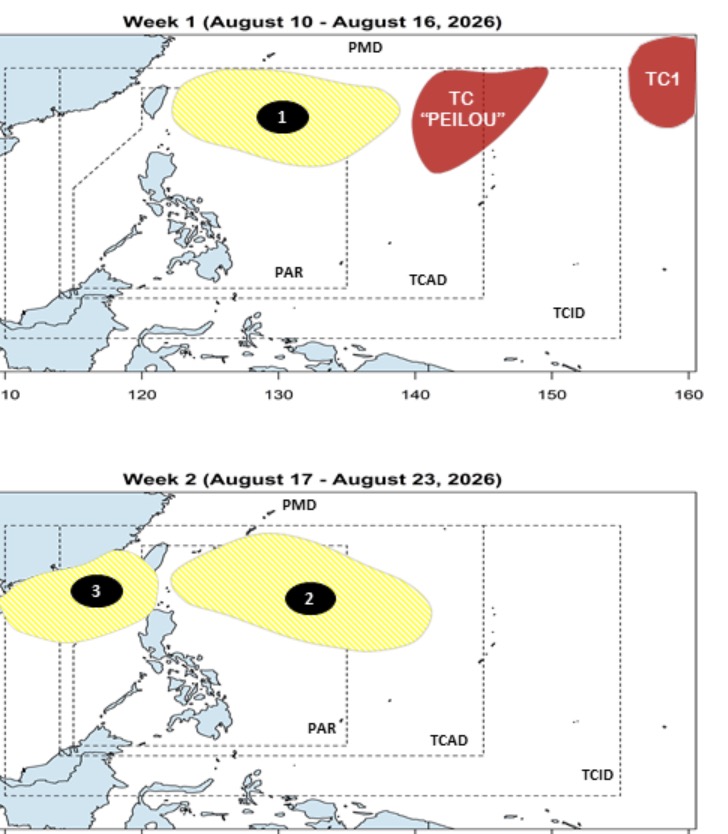
In the week from August 17 to August 23, 2 consecutive low pressures will form around the East Sea. Among them, the low pressure at the northeastern border of the PAR and TCAD forecast areas is expected to form first, with a very wide area of influence and approaching the Philippines.
Meanwhile, the remaining low pressure is the low pressure in the East Sea, expected to form in the northern area of the East Sea with a wide area of influence from the Philippines to Hainan Island (China).


