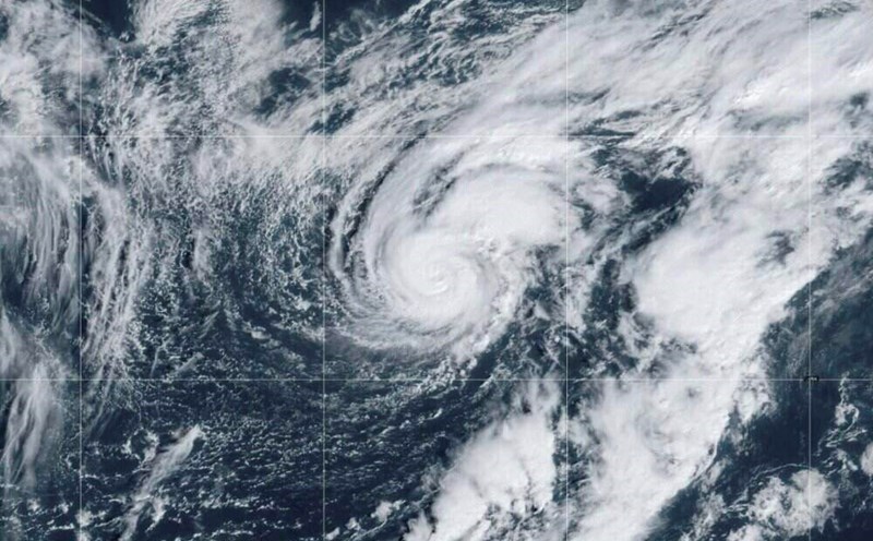
USA Today's latest hurricane report says the latest storm has arrived right after Helene made landfall in Florida last week, causing heavy rain and flooding across the Appalachians.
According to the latest storm information from the US National Hurricane Center, Kirk formed about 1,700km west of the Cabo Verde Islands, with maximum sustained winds of about 120km/h, becoming a Category 1 hurricane.
Kirk is forecast to continue moving west-northwest, then gradually turn northwest on October 2 and 3.
"Kirk is expected to strengthen over the next 48 hours and become a major hurricane by October 3," the US National Hurricane Center's afternoon bulletin on October 1 stated.
A major hurricane is a Category 3 or higher on the Saffir-Simpson hurricane scale.
Colorado State University hurricane forecaster Philip Klotzbach said Hurricane Kirk is the third storm to form since September 25, after Hurricanes Helene and Isaac. And it was also the first time since 1851 that the Atlantic Ocean has had three hurricanes form between September 25 and October 1.
Current hurricane models show that the latest storm, which follows Helene, is heading north into the mid- Atlantic, away from the United States.
In addition to the strengthening of Kirk, the US National Hurricane Center is also monitoring two depressions, including one in the Caribbean Sea.
Forecasters are closely monitoring the low pressure trough that causes showers and thunderstorms in the northwest Caribbean Sea.
"A tropical depression could form over the next few days as the system moves northwest across the northwest Caribbean Sea and southern Gulf of Mexico," the bulletin said.
AccuWeather's hurricane forecast says a tropical storm could form from the depression next week and move across part of the southeastern United States, which was strongly affected by Helene.
Another depression, Invest 91L, is several hundred kilometers south of the Cabo Verde Islands. With favorable environmental conditions, the tropical depression is expected to form in the next few days as Invest 91L moves slowly westward across the eastern part of the tropical Atlantic.
The latest storm and low pressure forecast from the US National Hurricane Center states that there is a 90% chance that Invest 91L will strengthen into a tropical depression in the next 48 hours and a 90% chance of strengthening in the next 7 days.
If it strengthens into a tropical storm, it could be named Leslie.
Last week, Hurricane Helene devastated much of the southeastern United States after making landfall in Florida as a Category 4 storm. The storm moved northward, causing heavy rain and flooding, particularly affecting western North Carolina. More than 1 million people remained without power as of the afternoon of October 1 due to the impact of Helene.
With the death toll rising to at least 162 across six US states, Helene is the second deadliest storm to hit the US mainland in the past 50 years. The deadliest storm - Hurricane Katrina in 2005 - claimed at least 1,833 lives.


