USA Today's latest hurricane report says the arrival of Tropical Storm Alvin has ended an unusual " drought" of tropical storm activity in the Northern Hemisphere.
Typhoon No. 1 Alvin formed in the eastern Pacific on May 29, becoming the first named storm in the Northern Hemisphere this year's typhoon season.
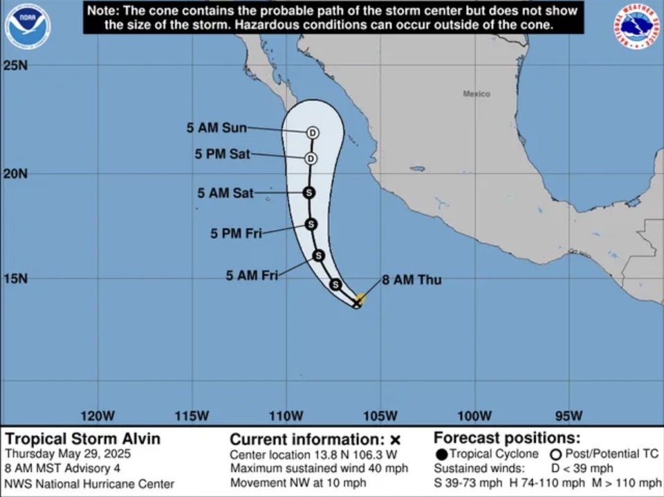
Forecasters at the US National Hurricane Center (NHC) said that this storm does not directly threaten the US but could cause localized heavy rain and strong winds near the west-central coast of Mexico over the weekend.
The formation of Alvin marks the end of an unusually unstable period of no storms and tropical depressions in the Northern Hemisphere.
In mid-May, forecasters noted that at this time of year, there are usually a few typhoons, especially in the Northwest Pacific.
This unusual development does not affect the US National Oceanic and Atmospheric Administration (NOAA) forecast for a more intense than average Atlantic hurricane season.
Although the Atlantic is currently quiet, forecasters are still monitoring some potential weather systems before the official hurricane season begins on June 1.
According to AccuWeather, Alvin is likely to strengthen into a hurricane. However, the latest storm is expected to gradually weaken as it moves north toward Mexico over the weekend. The first storm of the season is likely to encounter colder waters and areas with strong wind shear, which could disrupt the storm's structure.
At 11:00 a.m. on May 29, ET, the center of Alvin was about 1,078 km south-southeast of the southern tip of Mexico's Baja Peninsula. Alvin is moving northwest at 16 km/h with maximum sustained winds of 64 km/h.
Typhoon No. 1 Alvin marks the early start of the storm season in the eastern Pacific. According to the US National Hurricane Center, the average date for the first storm to form in the area is typically June 10.
AccuWeather hurricane expert Alex Sosnowski said that Alvin "may still go far enough north along the west coast of Mexico to get some moisture from the storm, in the form of clouds and heavy rain, which could spread to some areas in Texas or New Mexico as early as this weekend".
Tropical storms and hurricanes in the eastern Pacific rarely have a significant impact on weather in the United States.
Although most of the eastern Pacific storms move northwest and dissipate in the ocean, there are still storms making landfall, as seen in 2023 as the remnants of Hurricane Hilary in the southwestern United States and Hurricane Otis in Acapulco, Mexico, Weather.com meteorologist Sara Tonks said in an online hurricane bulletin.
In the 2025 hurricane forecast released on May 22, NOAA said that this year's hurricane season in the eastern Pacific is likely to be below average. An average of 15 named storms each season.
The official hurricane season in the eastern Pacific begins on May 15, two weeks ahead of the Atlantic hurricane season, and ends in late November.


