Scientists warn that the Cascadia Subduction Zone (CSZ) - where the Pacific tectonic plateau slides below the North American plateau - is accumulating huge energy.
When a major earthquake occurs, coastal waters in Oregon, Washington and British Columbia could sink up to 2m, causing seawater to flood in, submerging many residential areas and infrastructure in just a few minutes.
The scary thing is that this flood does not come from sunny or high tides, but from the "landfall" right at the people's feet.
The expansion of coastal flooding after an unprecedented Cascadia earthquake has been documented, and the impact on land use planning could last for decades, said lead author Tina Dura, University of Virginia Tech.
The study, led by Dura, analyzed 24 coastal river mouths - which are home to many residential areas, roads and water treatment plants - to simulate subsidence scenarios.
When the ground level is lowered, the boundary of the area that is likely to be flooded once every 100 years will shift deep into the mainland.
Many residential areas are currently outside the risk zone and could be put on a flood map after just one earthquake.
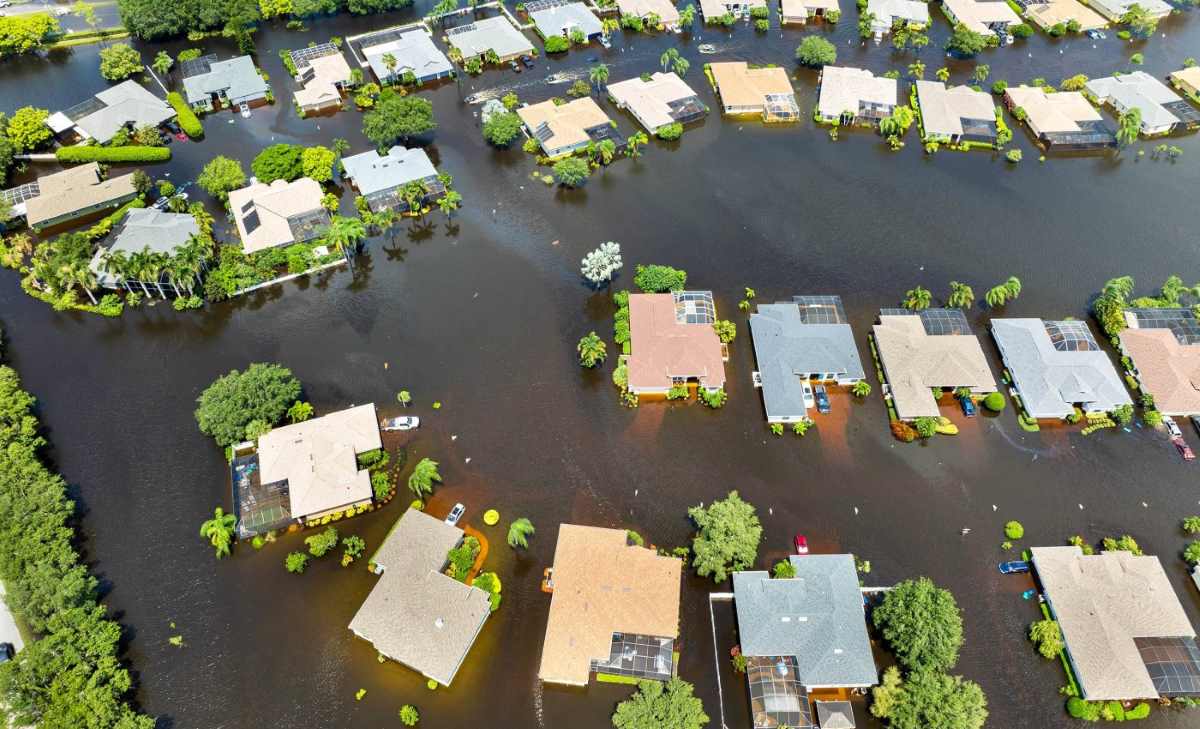
In the scenario of a slight subsidence, the additional flooding area is equivalent to a medium-sized city. However, in severe cases, flooded areas can expand many times, covering residential areas, traffic routes and critical infrastructure.
Researchers warn that this is not a temporary phenomenon, when the ground has dropped, it will not lift itself for centuries.
The situation got worse when combined with factors such as rising sea levels due to climate change. If it happens at the same time, safe areas could become flooded hotspots, with thousands of people and hundreds of kilometers of roads affected.
These two dangers, called dual risks, do not eliminate each other but accumulate damage, making the response more complicated than ever.
Geologists stress that the recovery process after the earthquake is very slow. Natural embankment or land elevation requires decades to hundreds of years. Meanwhile, subsided areas will have to coexist with the risk of long-term flooding - a new normal after the disaster.
Currently, many US disaster planning and response maps still consider separately the earthquake, Tsunami and rising sea levels, leading to shortcomings in overall assessment.
This study calls for local agencies to integrate geological factors into construction planning, transportation and health, to ensure that key projects, such as hospitals, emergency command centers or wharves, do not paralyze when soil collapses and water floods.