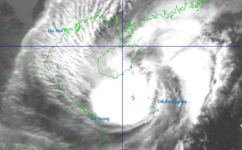
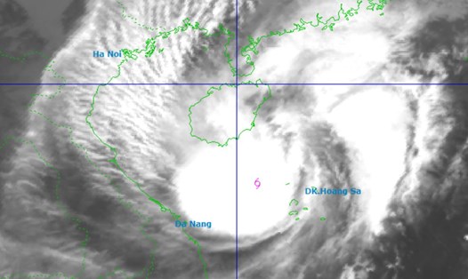
The Philippine Atmospheric, Geophysical and Astronomical Services Administration (PAGASA) said that at 3:00 a.m. on October 26, a low pressure area appeared at about 6.0 degrees north latitude; 127.0 degrees east longitude, 210km east of General Santos City.
The depression is located along the tropical convergence zone, affecting Palawan, Visayas and Mindanao. The low pressure is unlikely to strengthen into a tropical depression in the next 24 hours.
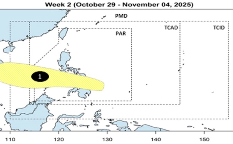
Also according to PAGASA, during the week of October 24-30, 2 low pressure areas are forecast to appear.
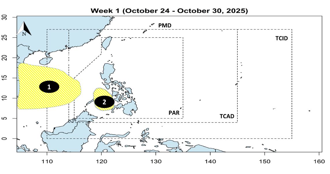
Low pressure 1 is expected to form west of the Philippine Forecast Area (PAR) right next to the East Sea, while low pressure 2 is expected to form over the Sulu Sea. Both low pressure areas are unlikely to strengthen.
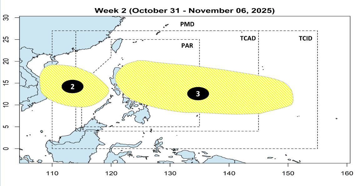
During the week from October 31 to November 6, low pressure 2 is expected to leave PAR and enter the East Sea. At the same time, low pressure 3 appeared east of the Philippines. Both low pressure areas are unlikely to strengthen.
Meanwhile, according to the Vietnam National Center for Hydro-Meteorological Forecasting, due to the influence of the low pressure trough connecting with the low pressure area in the central East Sea, on the day and night of October 26, the northern part of the North East Sea: has strong northeast winds of level 6, sometimes level 7, gusting to level 8-9; rough seas, waves from 3.0 to 5.0m high, northeast waves.
Gulf of Tonkin: Northeast wind gradually increases to level 6, gusting to level 7-8; rough seas, waves from 1.5 to 3.0m high, northeast waves.
The sea area from South Quang Tri to Da Nang has strong northeast winds of level 5, sometimes level 6, gusting to level 7-8; rough seas, waves from 2.0 to 4.0m high, northeast waves.
During the day and night of October 26, in the sea area from Quang Tri to Ca Mau, Ca Mau to An Giang, the Gulf of Thailand, the North and Central East Sea (including the special zone of Hoang Sa), the South East Sea (including the special zone of Truong Sa), there will be scattered showers and thunderstorms.
During thunderstorms, there is a possibility of tornadoes, strong gusts of wind of level 6-7 and waves over 2.0m high.
Regarding cold air, on the morning of October 26, cold air affected the Northeast region, then affected the North Central region and some places in the Northwest and Central Central regions. The northeast wind inland is strong at level 2-3, coastal areas at level 3-4.
In the Northern provinces, Thanh Hoa and Nghe An, the night and morning are cold, and the mountainous areas are cold. The lowest temperature in this cold air mass in the Northern region, Thanh Hoa and Nghe An is generally from 19-22 degrees Celsius, in mountainous areas it is below 17 degrees Celsius.
Hanoi weather forecast: Cold at night and in the morning. The lowest temperature in this cold air mass is generally 19-21 degrees Celsius.