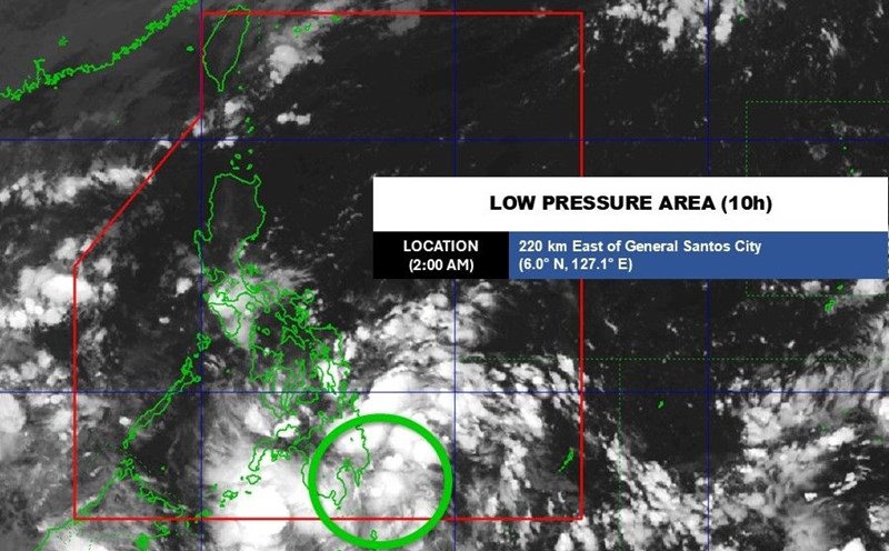
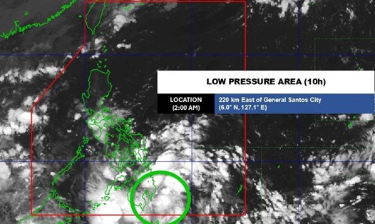
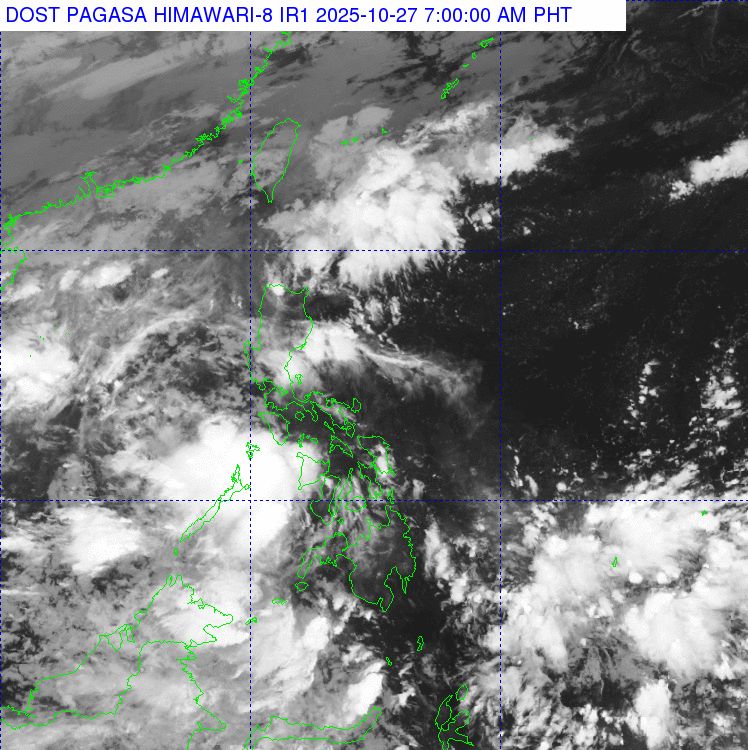
The storm/low pressure information from the Philippine Atmospheric, Geophysical and Astronomical Services Administration (PAGASA) said that at 3:00 a.m. on October 27, the center of the low pressure was at about 8.3 degrees north latitude; 121.0 degrees east longitude, about 260km west of Dipolog City, Zamboanga del Norte Province.
The possibility of developing into a tropical depression in the next 24 hours is assessed as "low". PAGASA forecasts the low pressure to move westward and may enter the East Sea on October 28-29.
If it strengthens into a storm while still in the Philippine Forecast Area (PAR), it will be named Tino - the 20th storm of 2025 in the Philippines.
In the next 24 hours, heavy rains are expected to be concentrated in the areas of MIMAROPA, Western Visayas, Negros Island, Central Visayas, Zamboanga Peninsula and Bangsamoro Autonomous Region (BARMM).
On the afternoon of October 26, prolonged heavy rains caused by the low pressure caused flash floods in Barangay Tagpangi and the Mangalay Bridge area (Barangay Dansolihon), Cagayan de Oro City.
According to the report of the City's Disaster Management Office, floods originating from high mountains and overflooding low areas have caused many houses to be flooded, and some roads to be temporarily cut off. Rescue forces assessed the damage and cleared the mud that afternoon.

International typhoon and weather forecast models, including Google FNV3, GFS and ECMWF, show signs of a 1-2 new typhoon forming in early November, possibly towards the Philippines and the South China Sea. However, meteorologists stress that this scenario is still volatile and needs to continue to be monitored in the coming days.
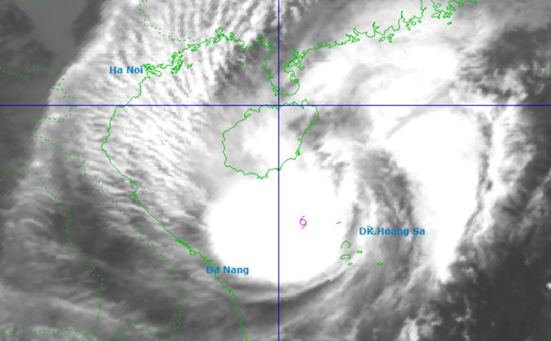
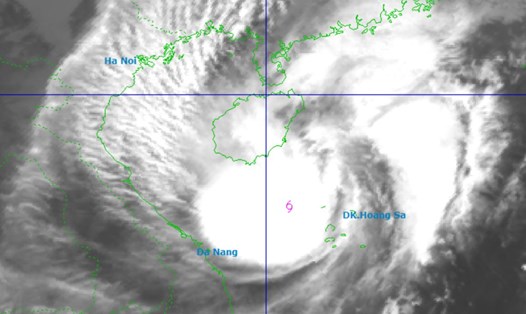
Meanwhile, according to the Vietnam National Center for Hydro-Meteorological Forecasting, on the day and night of October 27, the northern sea area of the North East Sea (including the northern sea area of the Hoang Sa special zone) will have strong winds of level 6-7, gusting to level 8-9. Strong sea, waves 3-5m.
Gulf of Tonkin wind level 6, gust level 7-8. Rough seas, waves 1.5-3m. From South Quang Tri to Quang Ngai, the wind will be level 5, sometimes level 6, gusting to level 7-8. Rough seas, waves 2-4m, high tides.
Regarding the forecast of rain from early morning on October 27 to early morning on October 29:
The area from South Quang Tri to Da Nang City and the east of Quang Ngai province will have heavy to very heavy rain, total rainfall is 200-400mm, locally over 600mm.
The area from Ha Tinh to North Quang Tri will have moderate rain, heavy rain and thunderstorms, with common rainfall of 100-200mm, locally over 350mm.
From early morning of October 27 to early morning of October 28, the eastern areas of the provinces from Gia Lai to Dak Lak will have moderate rain, heavy rain and thunderstorms with common rainfall of 40-80mm, locally very heavy rain over 150mm.
Warning of the risk of heavy rain over 150mm/3 hours.
During the day and night of October 27, in the Central Highlands, Khanh Hoa, eastern Lam Dong and the Southern region, there will be rain, moderate rain and thunderstorms with rainfall of 20-40mm, locally heavy to very heavy rain over 100mm.