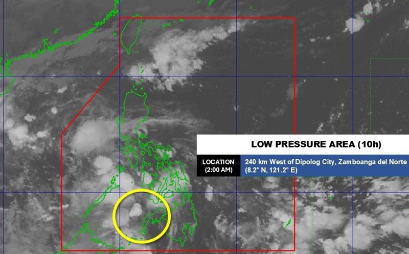
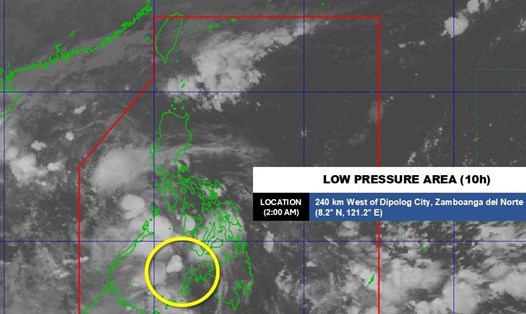
According to the Philippine Atmospheric, Geophysical and Astronomical Services Administration (PAGASA), at 3:00 a.m. on October 28, the center of the low pressure was at about 10.9 degrees north latitude; 116.8 degrees east longitude, about 250km east of Pag-asa Island in Kalayaan Islands, Palawan Province. The low pressure is located on the tropical convergence zone, causing rain in Palawan, Visayas and Mindanao.
Although this low pressure is unlikely to strengthen into a tropical depression in the next 24 hours, it will continue to move west-northwest, entering the East Sea today. PAGASA warned that localized heavy rains in Palawan and neighboring areas could cause temporary flooding, especially in low-lying areas and riverside areas.
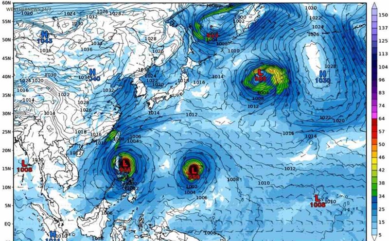
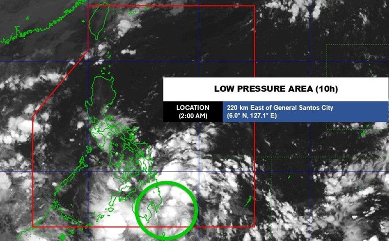
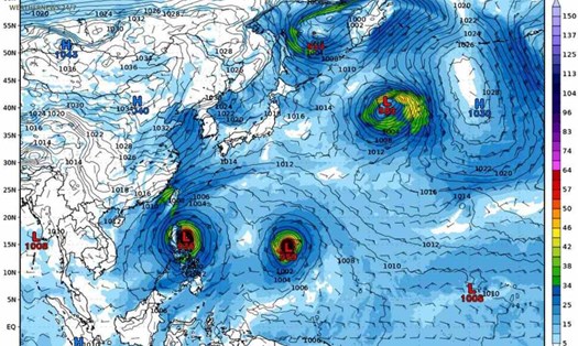
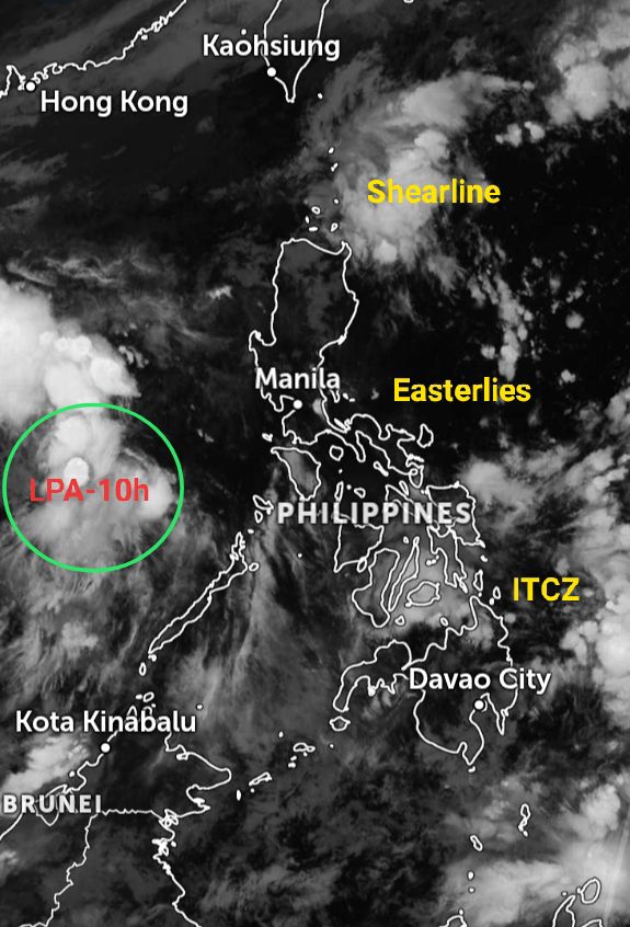
At the same time, many other weather patterns are affecting the Philippines and neighboring areas at the same time.
The Intertropical Convergence Zone (ITCZ) is active over Mindanao and the Visayas, causing heavy rains and thunderstorms.
The northeast monsoon affects the northernmost tip of Luzon, causing the weather in this area to turn cold, with scattered showers.
Theshearline continues to bring prolonged rain to Northern Luzon, especially in the eastern coastal provinces.
The easterlies carrying moist air from the Pacific are active in the Bicol, Aurora and Isabela regions, creating showers and thunderstorms, with the possibility of tornadoes and lightning.
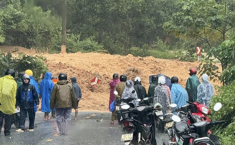
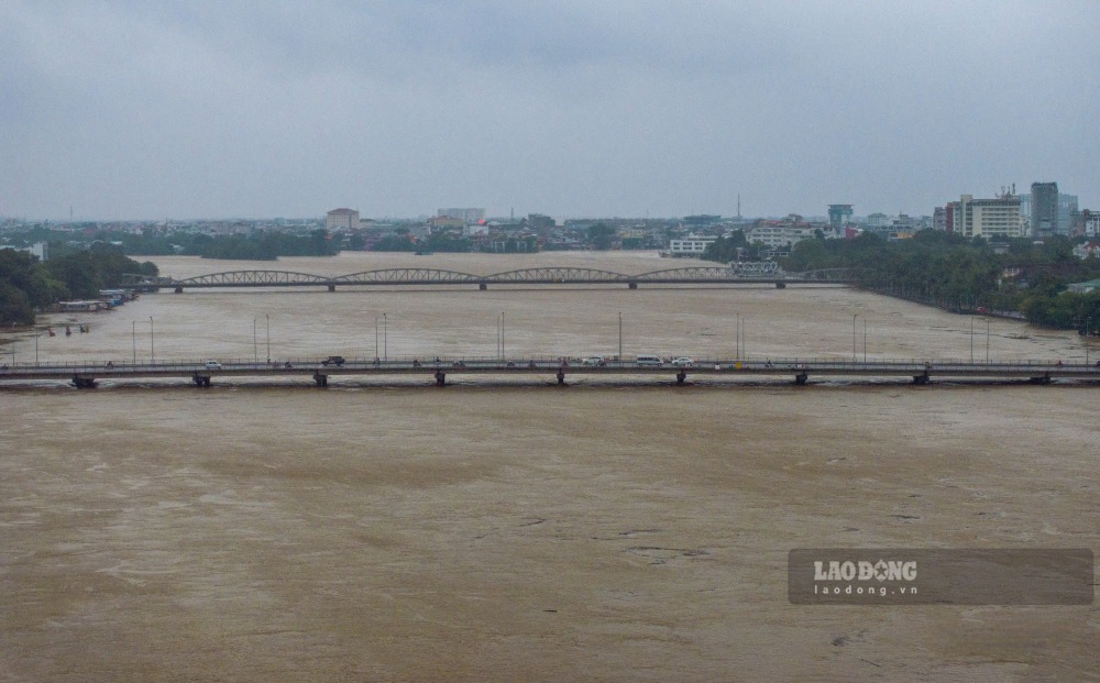
The low pressure is forecast to enter the East Sea in the context of complicated flood situations in Hue and Da Nang. According to the Vietnam National Center for Hydro-Meteorological Forecasting, floods on the Huong River (Hue City) have peaked and are receding, the flood peak at Kim Long station is 5.05m (20am on October 27), 1.55m above alert level 3.
Floods on the Vu Gia - Thu Bon River (Da Nang City) are fluctuating at their peak. Floods on the Bo River (Hue City) and Tra Khuc River (Quang Ngai) are receding.
In the next 12 hours, the flood on the Vu Gia river at Ai Nghia station peaked at 1.2m above alarm 3, then decreased; on Thu Bon River at Cau Lau station peaked at 5.3m, above alarm 3 1.3m, then fluctuated at high level; Huong River at Kim Long station is gradually falling and is above the alarm level 3 0.6 m; Bo River at Phu Oc station fell below alarm level 3 by 0.2m. The flood on the Tra Khuc River gradually subsided and was below the alert level of 2 0.7 m.
In the next 12-24 hours, floods on rivers will gradually decrease; the Bo River at Phuoc station will be below alert level 3 by 0.6m; the Huong River at Kim Long station will be below alert level 3; the Vu Gia River at Ai Nghia station will be below alert level 3 by 0.1m; the Thu Bon River at Cau Lau station will be above alert level 3 by 0.6m; the flood on Tra Khuc River at Tra Khuc station will fluctuate above alert level 1.
Warning: Deep and widespread flooding in Hue city, Da Nang city, localized flooding in Quang Ngai province; high risk of flash floods on rivers and streams and landslides on steep slopes of provinces from Quang Tri to Quang Ngai.