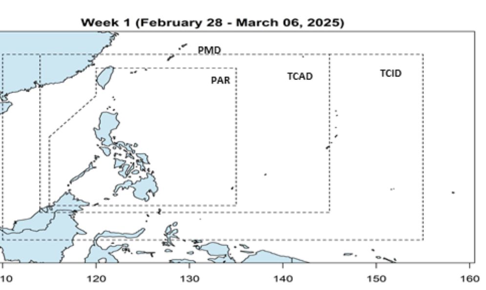
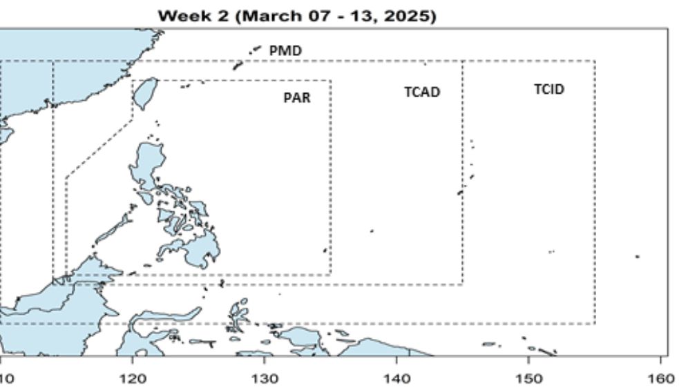
The storm bulletin on February 28 of the Philippine Atmospheric, Geophysical and Astronomical Services Administration (PAGASA) said that during the week from February 28 to March 6, 2025 and the week from March 7 13.2025, no low pressure or storm is expected in the Philippine PAR forecast area, as well as near the East Sea.
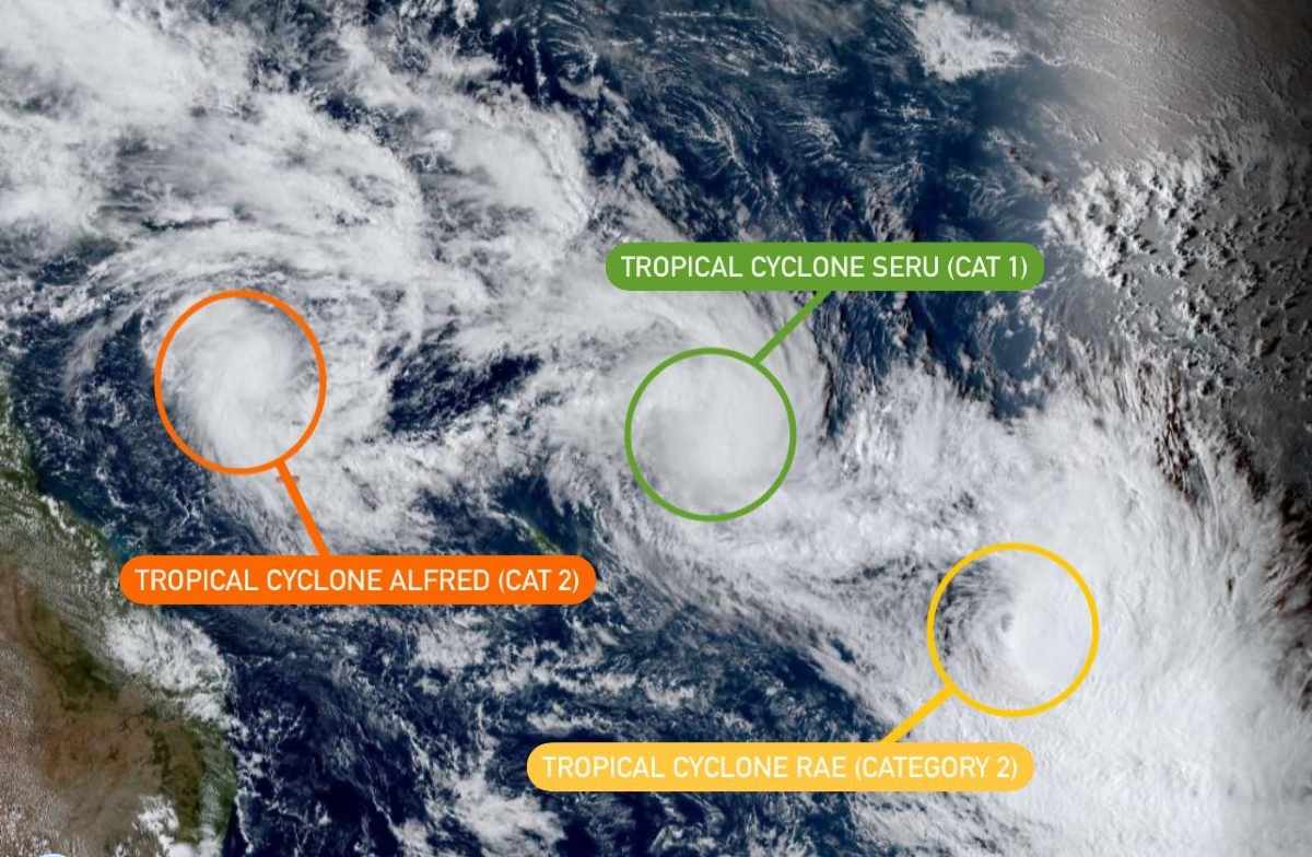
Last week, a rare meteorological phenomenon occurred with up to 6 tropical storms active at the same time in the Southern Hemisphere, many of which were alarmingly close together.
Three storms have appeared in the Southwest Pacific Ocean, with severe tropical storm Alfred forming on February 20 in the San Ho Sea, northeastern Australia. By February 27, Alfred had strengthened to a Category 4 storm on the Saffir-Simpson scale, with maximum sustained winds of 170 km/h and gusts of up to 225 km/h.
On 1 March, storm Alfred is moving south, parallel to the coast of Australia, Australia. Although there are no signs of making landfall, the Australian Bureau of Meteorology is still closely monitoring the developments as it is unclear how close to shore Alfred will get.
Longer east, two other tropical storms, Rae and Seru, have also formed, reaching the intensity of a Category 2 storm. Typhoon Rae appeared on February 22 in northern Vietnam and swept across the island nation, causing serious damage with heavy rain, wind gusts of 160 km/h and high waves.
Meanwhile, Seru developed on February 24 south of the Solomon Islands, moving across eastern Vanuatu and New Caledonia but not making landfall.
Three other storms also picked up in the Indian Ocean during the week. In the Southeast Indian Ocean, severe tropical storm Bianca will appear from February 18-27 in the Timor Sea, northwest Australia. Bianca reached the intensity of a Category 3 storm before moving south, curving around the Australian mainland without making landfall.
Meanwhile, in the southwest Indian Ocean, two typhoons are claiming the Philippines. Typhoon Garance, as strong as a Category 3 storm, formed in northeastern Japan on February 24 and moved south.
On February 28, Typhoon Garance strongly affected France's Reunion Island, with gusts of 190 km/h and up to 600 mm of rainfall.
At the same time, Typhoon Honde (level 1) is developing in the Mozambique Channel and is sweeping across southern Japan.
Although not common, having 6 tropical storms together in the Southern Hemisphere is not uncommon. However, it is rarer for them to appear in a single ocean basin.
Meteorological history records that the Pacific Ocean had 6 storms at the same time in August 1974, while the Atlantic record was 5 storms in September 2021.
The Southern Hemisphere is entering the peak of the storm season, and with the number of active storms as it is now, the coming weeks promise to continue to be a period of turmoil over the seas from the Indian Ocean to the Pacific.