The latest storm and depression forecast from the Philippine weather agency PAGASA states that from now until the end of October, many depressions will appear continuously near the Philippines, including depressions that are likely to enter the East Sea and strengthen into storms.
The storm and low pressure forecast released by PAGASA on October 18 clearly shows that there are two low pressure areas likely to develop during the forecast period until October 31.
Philippine weather forecasters said low pressure systems near the Philippines are expected to develop east of PAGASA's PMD forecast area.
The first low pressure area near the Philippines is likely to develop during the week of October 18-24 in the eastern part of the PAR and TCAD forecast areas (pictured). This low pressure area has a high chance of becoming a tropical storm and entering the PAR before moving east of Luzon, Philippines.
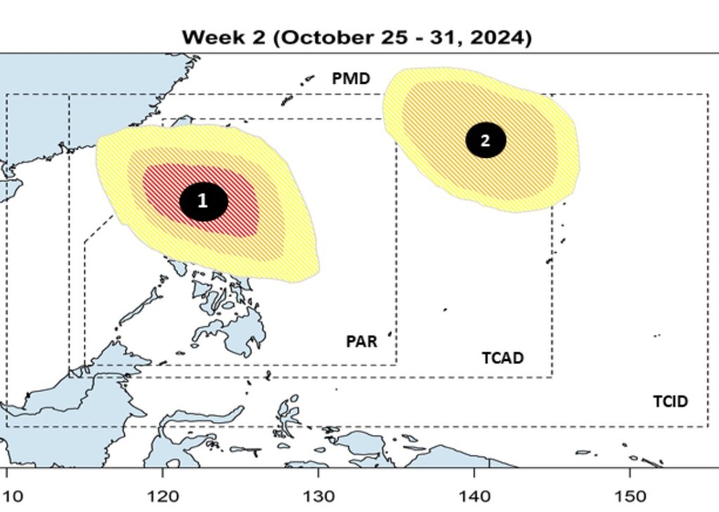
Next week from October 25-31, this low pressure near the Philippines is forecast to move towards northern Luzon, Philippines and has a high possibility of strengthening into a tropical storm.
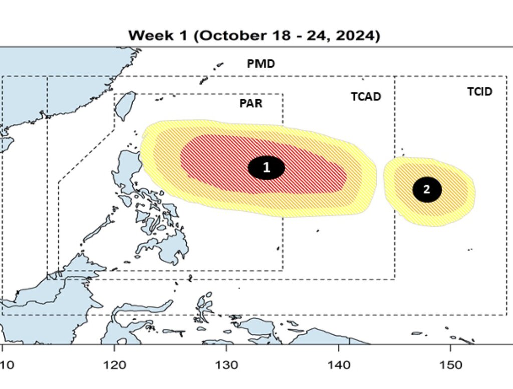
A second low pressure area near the Philippines is forecast to form east of the PAGASA TCID forecast area boundary during the week of October 18-24. It is expected to have a low to moderate chance of becoming a typhoon near the Philippines.
The second low pressure area near the Philippines is expected to move northwestward during the week of October 25-31, towards the northeastern part of the TCAD forecast area. Philippine typhoon forecasters say that during this period, this low pressure area is likely to strengthen into a low to medium storm.
In its forecast for the fourth quarter of the 2024 typhoon season, PAGASA forecasts a possibility of 4-7 typhoons forming within or entering the Philippine PAR forecast area, with 2 or 3 typhoons forecast to occur in October and 1 or 2 typhoons in November and December.
According to PAGASA Climate Monitoring and Forecasting Division Head Ana Solis, tropical storms tend to make landfall and sweep across the Philippines during this period. Most of the storms in October hit Luzon while those in November and December mainly hit Bicol, Eastern Visayas and Eastern Mindanao.
The next storm names for the 2024 Philippine typhoon season on PAGASA's list include Kristine, Leon, Marce, Nika, Ofel, Pepito, Querubin.
The most recent storm to develop from a depression near the Philippines was Julian (international name Krathon), which formed on September 27. By September 29, Tropical Depression Julian had intensified into a severe tropical storm, threatening Batanes and the Babuyan Islands of the Philippines. After making a strong impact in the Philippines, Krathon strengthened into a super typhoon on October 1 and left the forecast area of the Philippines. The storm later made landfall in Taiwan (China) on October 3.