The latest storm/low pressure forecast bulletin of the Philippine Atmospheric, Geophysical and Astronomical Services Administration (PAGASA) said that at 2:00 a.m. on October 18, the cloud cluster outside the Philippine forecast area (PAR) developed into a low pressure area of 10c.
The center of the low pressure is located at about 12.8 degrees north latitude, 144.2 degrees east longitude, about 2,020 km east of Eastern Visayas. The possibility of low pressure 10c developing into a tropical depression in the next 24 hours is low.
Meanwhile, the US Joint Typhoon Warning Center (JTWC) is monitoring Low Pressure Area 93W. According to JTWC, this large low pressure area located southeast of Guam (US) - previously a small low pressure area - continues to create a large area of disorganized showers and thunderstorms.
This low is interacting with another developing low to its west-northwest (94W or 10c in PAGASA terms) and is not expected to develop significantly before merging with the new low.
According to the JTWC, Low Pressure 94W is located west-northwest of Guam, across the Mariana Islands. Low Pressure 94W is forecast to merge with Low Pressure 93W into a large disturbance in the Philippine Sea in the next few days.
Environmental conditions are expected to be favorable for the development of this system and a tropical depression is likely to form on October 21 as the system moves mainly west-northwest. The chance of a tropical depression forming in the next 7 days is as high as 70%.
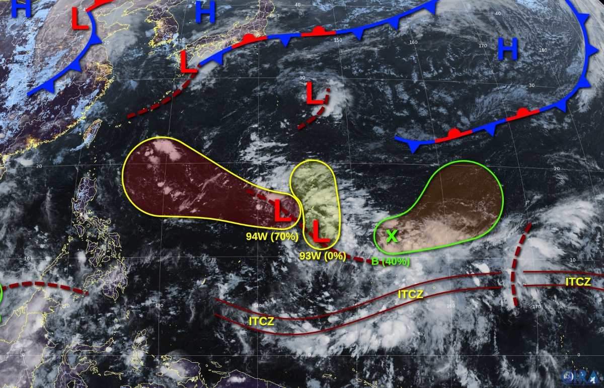
A third low (B) is forecast to form along the weakening shear line east of Guam early next week.
The system is likely to develop gradually as it moves slowly and erratically to the northeast, and a tropical depression could form by midweek as the system remains well away from inhabited land areas. The JTWC assesses the 7-day chance of development at a moderate 40%.


