The latest storm/low pressure news from the Philippines says that a new low pressure area may move into the storm forecast area (PAR) next week, and it is possible that this will be the first storm of the year in PAR.
Weather forecast models show that the low pressure area is expected to approach some areas of Caraga, Eastern Visayas and Bicol in the period from January 13-16, 2026.
According to the Philippine Atmospheric, Geophysical and Astronomical Services Administration (PAGASA), the first storm in 2026 will be named after the local name Ada.
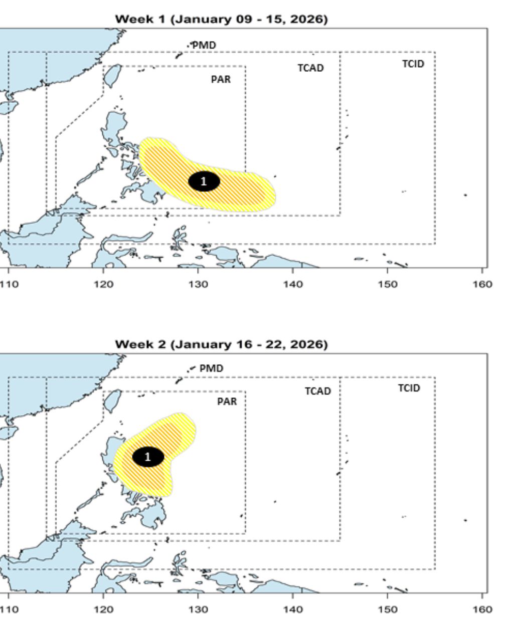
Previously, PAGASA forecast that from January 9-15, 2026, a low pressure area is expected to appear in PAR, moving to East Mindanao - East Visayas. This low pressure area is likely to strengthen into a storm at a low to medium level.
In the week from January 16-22, 2026, this low pressure will continue to move south of Luzon and is still likely to strengthen into a storm at a low to medium level.
Meanwhile, according to the Vietnam National Center for Hydro-Meteorological Forecasting, in the first 3 months of 2026, the ENSO phenomenon is likely to gradually shift to a neutral state, with a probability of about 65 - 70%, but the possibility is still leaning towards the cold phase (La Nina).
By mid-year, the weather may be dominated by a neutral ENSO state and by the end of the year, it is likely to be affected by the El Niño heat wave.
With the continuous phase transition nature of such a large-scale ENSO phenomenon, the atmosphere - ocean conditions will be in an unstable state. This may be the cause of extreme weather and climate phenomena such as strong storms, heavy rainfall... appearing in 2026.
Regarding cold air, from January to March, temperature forecasts are likely to be close to the multi-year average in most areas of the country. The intensity of the northeast monsoon is likely to be close to the multi-year average.
In January and February 2026, beware of severe cold spells. Especially in the northern mountainous areas, frost and freezing may appear.


