As the rainy season is starting, the Philippine Atmospheric, Geophysical and Astronomical Services Administration (PAGASA) has issued a notable typhoon forecast: There may be up to 19 storms forming or entering the Philippine Forecast Area (PAR) from June to November this year.
Some of these are likely to directly affect the East Sea, causing heavy rain, strong winds and threatening maritime safety in the area.
Based on climate forecast images and statistics from PAGASA (Philippine Atmospheric, Geophysical and Astronomical Services Administration), it is possible to analyze the number and path of storms from June to November 2025 as follows:
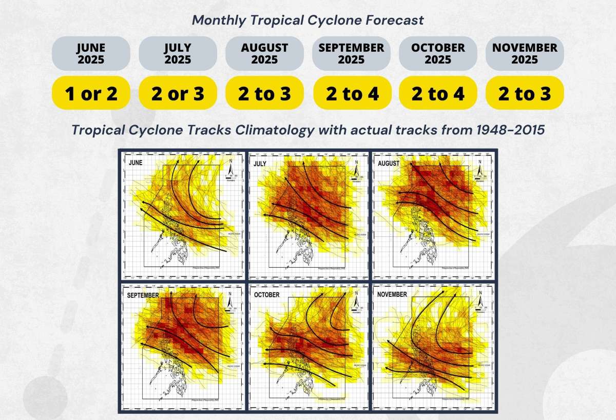
Forecast of the number of storms per month: Month 6: 1-2 storms; month 7: 2-3 storms; month 8: 2-3 storms; month 9: 2-4 storms (peak season); month 10: 2-4 storms (continued as peak months); month 11: 23 storms.
Analysis of the storm's path in recent years shows that storms often form east of the Philippines, then move westward through Luzon or Visayas, then enter the East Sea. Some storms turn north, towards Taiwan (China), Japan or enter the East China Sea.
August to October is the period of strongest and most intense storms of the year, even super typhoons.
The East Sea is located entirely within the area with a dense storm path from July to October, especially in September and October.
Storms passing through Luzon or deviating south of the Philippines can easily move into the East Sea and towards the Central, South Central or Northern regions of Vietnam.
Although there are few, there is still a chance of storms in June and November, especially if the atmosphere has unusual fluctuations (such as El Nino, La Nina).
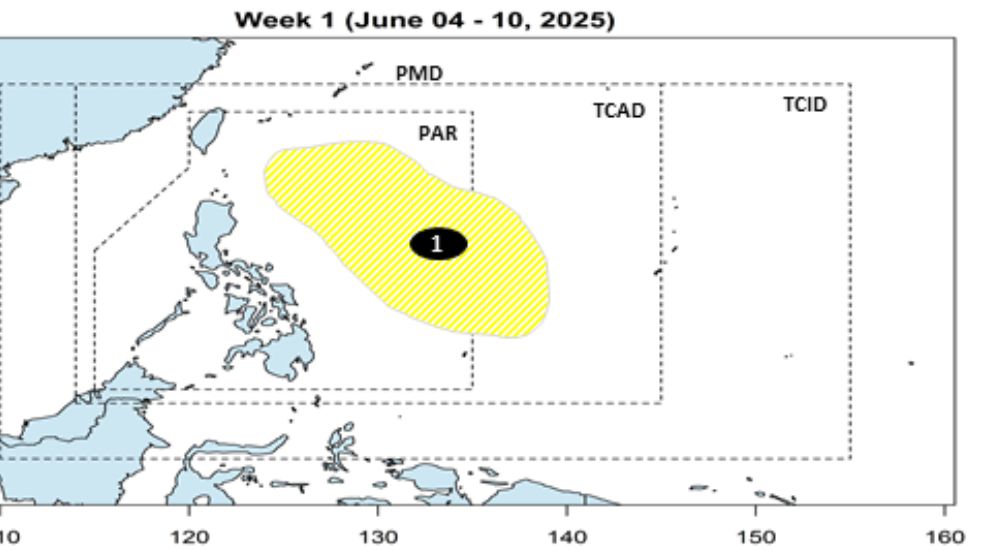
During the period from June 4-10, PAGASA forecasts that no tropical cyclones will be detected within the PAR range. However, a low pressure area is likely to form in the Philippine Sea, although the chance of developing into a storm is very low.
From June 11-17, another low pressure may appear in the northern part of the West Philippine Sea (South China Sea), but it is also assessed to have a very low chance of developing into a storm.
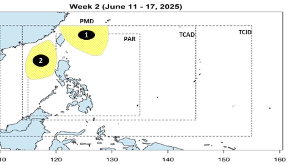
With the above signals, the risk of storms in the first 2 weeks of June is assessed as low. However, the meteorological agency emphasizes that the forecast model may change, and will continuously monitor and update when necessary.
The Vietnam National Center for Hydro-Meteorological Forecasting said that on June 5, the northern sea area of the North East Sea, the southern East Sea (including the Truong Sa archipelago), the sea area from Binh Thuan to Ca Mau, Ca Mau to Kien Giang and the Gulf of Thailand will have scattered showers and thunderstorms. During thunderstorms, there is a possibility of tornadoes, strong gusts of wind of level 6-7, waves over 2m high.


