June 1 marks the official start of the 2025 Atlantic hurricane season. In the second week of June, the Caribbean, Gulf of Mexico and the southern United States could see the first storm form, opening a season that is forecast to be above normal.
According to the US National Oceanic and Atmospheric Administration (NOAA), there is a 60% chance that this year's hurricane season will be stronger than average, with 13 to 19 named storms forecast; 6 to 10 of which could strengthen into major hurricanes, of which 3 to 5 are forecast to become Category 3 or higher super typhoons.
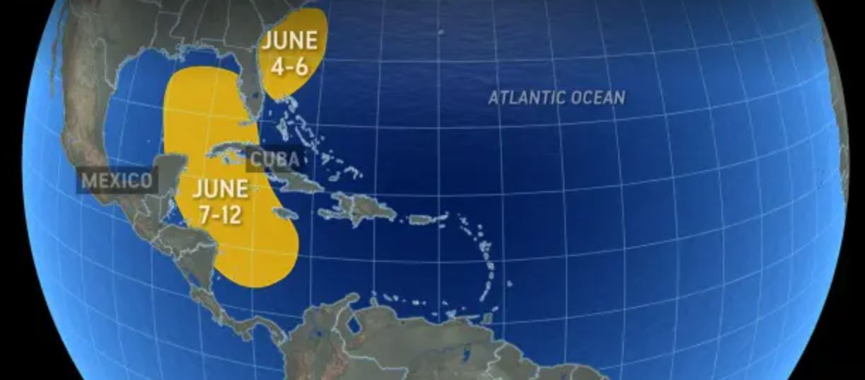
However, super typhoons typically appear later in the season, usually in August and September. Currently, meteorologists warn of the possibility of the formation of the No. 1 storm of the Atlantic hurricane season around June 7- 12.
Based on the latest weather forecast model, a meteorologist from AccuWeather said: A slow-moving atmospheric depression across the Caribbean and Gulf of Mexico, combined with high humidity and weak wind shear, could create conditions for the formation of a tropical depression or tropical storm around June 7-12,
If this scenario happens, it will be the number 1 storm of the 2025 hurricane season, with the name Andrea on the list prepared for the Atlantic hurricane season.
Although not yet qualified to become a super typhoon, experts warn that any storm in the early season could cause heavy rain, flash floods or localized flooding in coastal and inland areas.
If a depression or storm forms, its path will depend on the wind direction and intensity. The depression/storm could enter Central America, southeastern Mexico or Cuba, or move into the Gulf of Mexico, affecting the US coastal area.
A representative of Duke Energy - a company that supplies electricity to 6 US states - emphasized: "Let's consider the first day of the hurricane season as a necessary reminder for everyone to prepare. If you live heavily on medical equipment or in low-lying areas, make sure to have an evacuation or reserve plan.


