As the United States enters summer, the Atlantic begins to warm in true sense and sense. AccuWeather meteorologists are monitoring two areas that could potentially become tropical depressions or storms, one near the southeastern coast of the United States and one in the western Caribbean that could directly affect the United States in the next few days.
A convective cloud area scattered from the Bahamas to South Florida and Cuba is starting to drift slowly in a north-northeast direction, pouring rain over Florida, southern Georgia and the Carolina coastal area from now until the end of the week.
Although rainfall may help reduce the drought in some areas, there is a short-term risk of heavy rain causing urban flash flooding, especially in major cities such as Miami, Fort Lauderdale (Florida), Charleston (South Carolina) and Wilmington (North Carolina).
Not only rain, this young low pressure area also carries large waves, strong winds and dangerous offshore flows, which can lead to coastal erosion and coastal flooding.
Accuweather's leading storm prediction expert, Mr. Alex Dasilva said: "The sea surface temperature right next to the shore has not exceeded 27 degrees C - the necessary landmark for the storm to form.
In the second week of June, a large, gyre type low pressure is forecast to form in the western and central Caribbean. This is a large-scale tornado system, which could be the "cradle" for strong tropical depressions and even major storms.
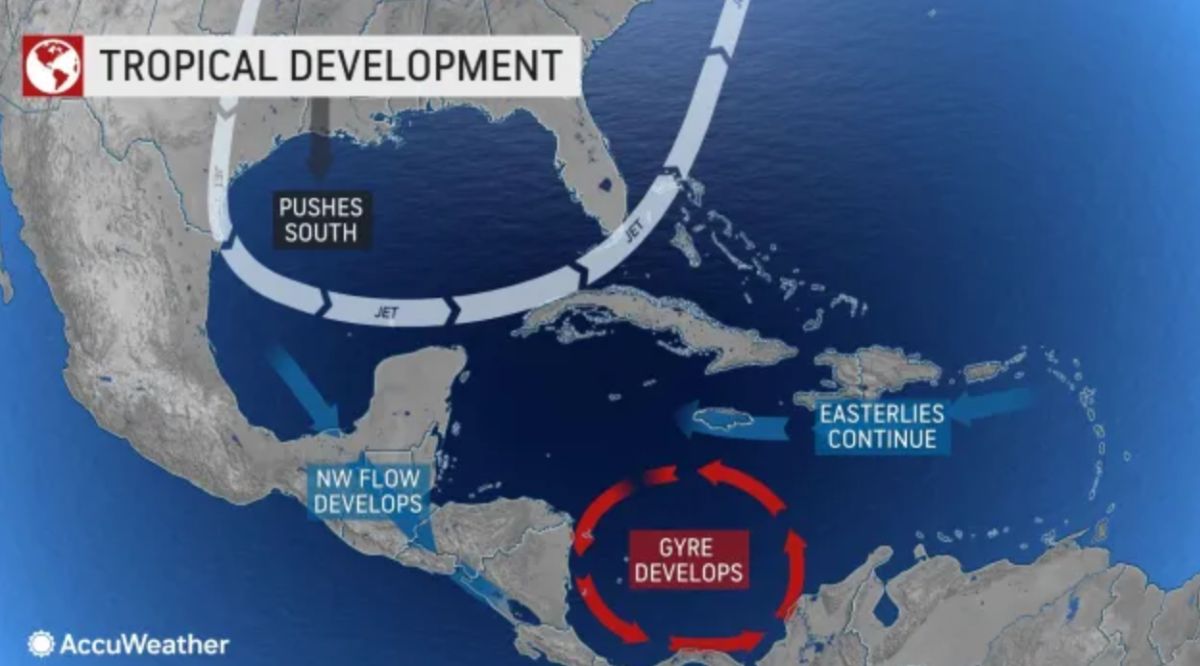
The Central American Gyre region is preparing to form, DaSilva said. When the trade wind from the east meets the westerly wind at low level, this area will swirl up to form a large low area, which can create storms.
The most likely time for hurricanes to form is from June 8 13.3, when the Caribbean Sea will be warm enough to fuel a strong cyclone.
If the storm forms early next week, it could move into the Gulf of Mexico and then into Louisiana or Florida, added Paul past past past past past, AccuWeathers long-term forecaster. But if it develops later, it is likely to make landfall in southern Mexico or Central America.
AccuWeather warned that the 2025 hurricane season could be busy from the start, with 3-6 storms/low pressure likely to directly impact the United States. The mid-season may ease a bit, but it may flare up again at the end of the season when favorable climate conditions return.