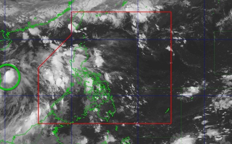
The US Joint Typhoon Warning Center (JTWC) said that low pressure 91W has been closely monitored because the possibility of tropical storm formation in the East Sea has decreased significantly, but this system still has the potential to cause widespread heavy rain in many places in the region this weekend.
According to the latest storm news from JTWC, on May 30, low pressure area 91W, located south of Hainan Island (China), has clearly lost its organizational structure in the past 24 hours.
Data from the scatterometer satellite shows that the system's spiral is still there, but convective cloud activity - a key factor in the formation of storms - has become clearly disrupted, the main reason being the strong increase in northwest wind shear.
In addition, low pressure 91W has also begun to interact with the rainy season low pressure trough (Front Meiyu/Tsuyu) - a complex weather system that often causes prolonged rain in East Asia in early summer. This interaction has almost eliminated the possibility of the 91W depression forming a storm.
The JTWC assessed the probability of developing into a tropical depression or storm in the next 7 days as very low, only about 10%.
Although not qualified to be classified as a tropical cyclone, 91W still carries a significant amount of moisture, which can trigger heavy, even extreme rains in many areas in the next few days.
Accordingly, heavy rain is forecast in the Northwest and North Central regions of Vietnam; South China (especially Guangdong, Guangxi, and Hainan Island); Taiwan (China), Northern Luzon (Philippines), Yaeyama and Ryukyu Islands, including Okinawa (Japan).
The time of strongest increase in rainfall is expected to fall this weekend to early next week, coinciding with the convergence of summer air flows in the western Pacific.
Mountainous and riverside areas, especially in southern China and northern Philippines, may face the risk of flash floods and landslides due to sudden heavy rains, even without direct storms.
For Vietnam, the Vietnam National Center for Hydro-Meteorological Forecasting said that on the night of May 29, in the Northwest region, there will be showers and thunderstorms, with some places having heavy rain; the North Central and South regions will have rain, moderate rain, and some places having heavy to very heavy rain.
Rainfall from 7pm on May 29 to 3am on May 30 was over 70mm in some places such as: Phi Nhu (Dien Bien) 71.5mm, Phong Phu (Hoa Binh) 78.8mm, Yen Cat (Thanh Hoa) 132.2mm, Muong tip (Nghe An) 161.8mm, Phuoc Hoa (Ba Ria Vung Tau) 114.6mm, Thong Binh (Dong Thap) 110.4mm...
In the early morning and morning of May 30, in the Northwest and North Central regions, there will be moderate rain, heavy rain and thunderstorms, locally very heavy rain with common rainfall from 15-30mm, locally over 80mm.
Risk of local heavy rain: >80mm/3 hours
During thunderstorms, tornadoes, lightning, hail, and strong gusts of wind may occur.
From the afternoon of May 30, heavy rain in the Northwest and North Central regions will tend to decrease.