The Vietnam National Center for Hydro-Meteorological Forecasting said that at 1:00 a.m. on May 29, the low pressure trough with an axis at about 11-14 degrees north latitude connected to the low pressure area located at about 12.5-13.5 degrees north latitude, 110.0-111.0 degrees east longitude, in the sea off Phu Yen - Khanh Hoa.
The latest storm information at 2:00 a.m. on May 29 from the Philippine Atmospheric, Geophysical and Astronomical Services Administration (PAGASA) said that the above low pressure area (kg signal 5d) is outside the Philippine forecast area (PAR), unlikely to strengthen into a tropical depression in the next 24 hours.
Meanwhile, the Joint Typhoon Warning Center (JTWC) said that regarding the low pressure area (invest 91W signal) appearing near the central coast of Vietnam, in the past 24 hours, thunderstorms around this area have increased significantly and the tornado structure has begun to form more clearly, according to data from satellites and scattered radar waves.
Currently, this tornado is still extending and most of the convective clouds are moving south and center the low pressure, showing that the system is not really balanced. However, experts warn that the risk of tropical depression or light storm formation in the next few days is real, with a probability of about 60% within 7 days.
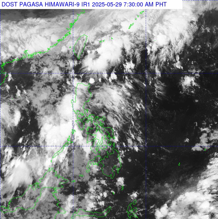
If the Invest 91W low pressure develops as forecast, the system will move northeastward, away from the coast of Vietnam by the weekend. However, before leaving, it could cause heavy rain, rough seas and the risk of landslides in some coastal areas of the Central region.
The forecast bulletin of thunderstorms, tornadoes and strong gusts of wind issued at 4:00 a.m. on May 29 by the Vietnam National Center for Hydro-Meteorological Forecasting said that in the sea area from Quang Ngai to Ca Mau, the North East Sea (including the sea area of Hoang Sa archipelago), the Central and South East Sea (including the sea area of Truong Sa archipelago) there were showers and thunderstorms.
Date and night forecasts of May 29, in the Tonkin Gulf, the waters from Da Nang to Ca Mau, Ca Mau to Kien Giang and the Gulf of Thailand, the North China Sea region (including Hoang Sa Archipelago), the middle and South China Sea (including Truong Sa Archipelago) with showers and thunderstorms. In the evening and on the night of May 29, the waters from Quang Tri to Hue have scattered showers and thunderstorms.
Warning of the possibility of tornadoes and strong gusts of wind of level 6-7, waves over 2m high during thunderstorms. All ships operating in the above areas are at risk of being affected by tornadoes and strong gusts of wind.
From early morning of May 29 to early morning of May 30, the North and North Central regions are forecast to have widespread rainfall of 30-80mm, locally over 180mm.
From early morning of May 29 to the night of May 29, the South Central, Central Highlands and Southern regions are forecast to have widespread rainfall of 30-70mm, locally over 120mm.
Risk of local heavy rain >100mm/3 hours


