This winter has truly entered a harsh period and is forecast to continue for many weeks in most of the Midwest and East Coast regions of the United States.
After the volatile period in December and early January, when deep cold air waves and snow interspersed with short warm periods, the cold weather is currently clearly dominant.
According to the latest weather forecasts, the temperature in many areas will continue to be lower than the historical average by about 6-17 degrees Celsius, at least until the beginning or mid-February, with only short breaks. On some days, the highest temperature in the day is only equivalent, even lower than the average seasonal low temperature.
In the 10-day period from January 17-21, Minneapolis city recorded an average temperature lower than normal by about 9 degrees Celsius. Chicago lower by about 8 degrees Celsius, Detroit 7 degrees Celsius, St. Louis 6-7 degrees Celsius, while Pittsburgh and Nashville lower by about 5-6 degrees Celsius compared to the multi-year average.
Many cities are experiencing a long series of consecutive days with temperatures not exceeding 0 degrees Celsius. In New York, meteorologists forecast that temperatures will remain below freezing for at least 12 consecutive days.
Washington D.C., Philadelphia and a series of other cities in the Northeast region are also forecast to record prolonged cold spells in the highest group in history.
Experts believe that this is the first serious winter since the 2017-2018 season in many major cities such as New York, Philadelphia or Hartford, and this winter has been classified as "harsh" in dozens of cities in Central and Northeastern America.
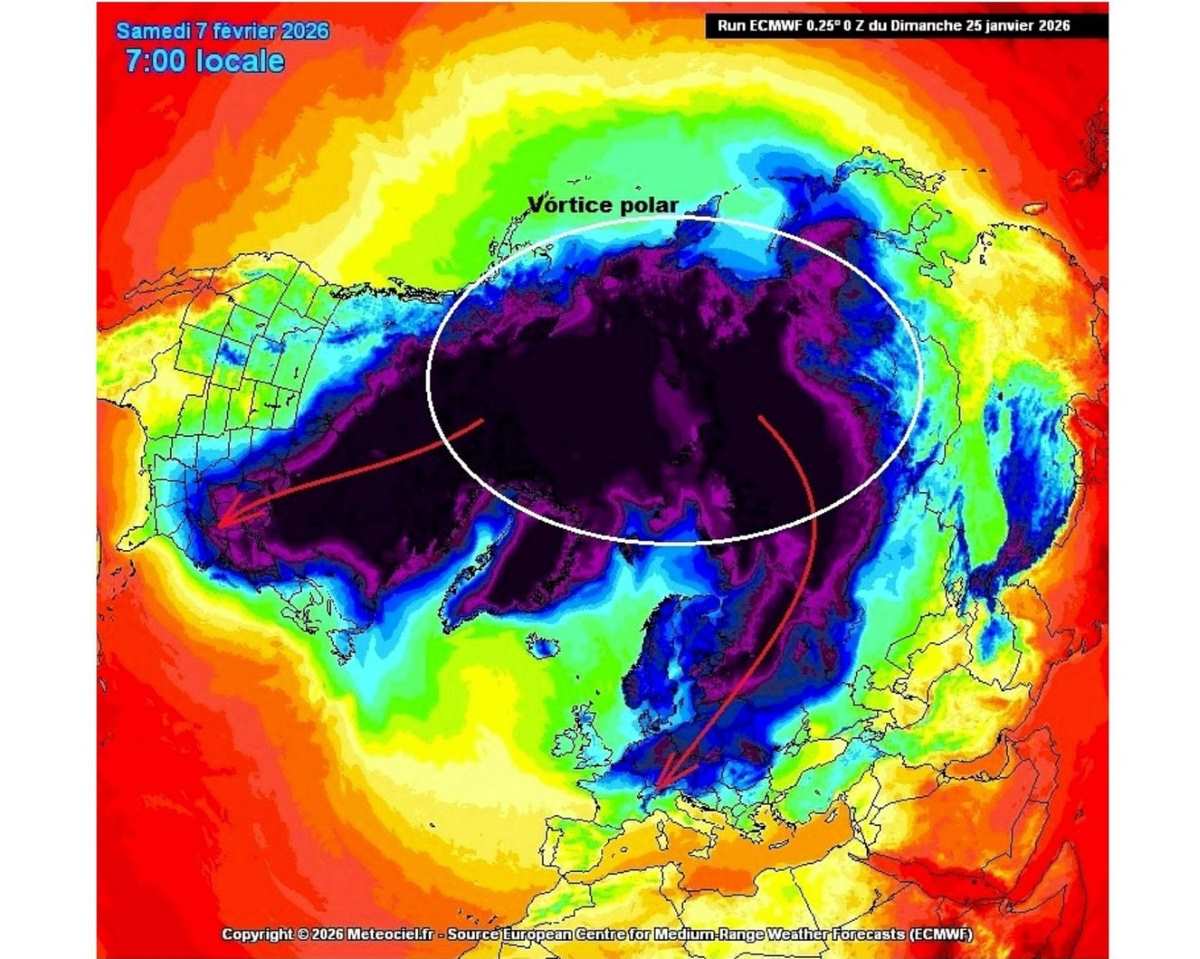
In the coming weeks, cold air waves from the Arctic are expected to continue to pour down from Canada. A significant intensification may appear this weekend, increasing the possibility of a strong storm forming along the East Coast or offshore the Atlantic Ocean.
If it develops into a strong storm, this phenomenon can cause strong winds, coastal flooding from North Carolina to New England, accompanied by the risk of heavy snowfall due to strong gusts of wind.
In Vietnam, according to current forecast models for the period from the end of January to the beginning of February, cold air waves still mainly maintain an easterly trend. Instead of going straight from the mainland of China down (dry cold), the cold air mass will pass through the Gulf of Tonkin, carrying moisture from the sea in. Therefore, the North is expected to have frequent light rain, drizzle and fog.
Currently, the North is relatively warm before another cold air wave comes on January 31.
Regarding the weather for the Binh Ngo Lunar New Year 2026, the National Center for Hydro-Meteorological Forecasting said that the temperature in the Northern and Central regions tends to be higher than the multi-year average at 0.5 to 1 degree C.
After the northeast monsoon on January 31 - February 1, subsequent cold air waves will have low intensity, with little chance of causing widespread severe cold and frost in the North.


