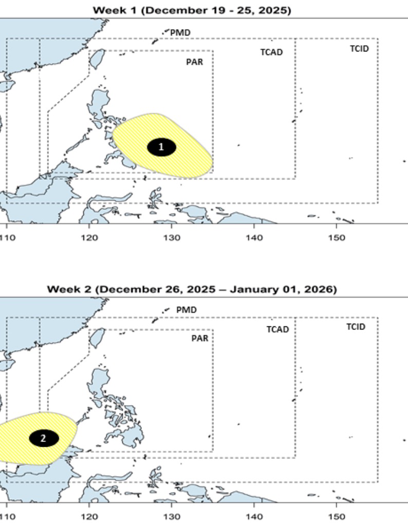
The latest storm and low pressure information on December 20 from the Philippine Atmospheric, Geophysical and Astronomical Services Administration (PAGASA) said that 2 new low pressure areas are forecast to appear in the last days of December 2025.
The first low pressure is forecast to appear during the week from December 19 to December 25. The new low pressure is forecast to form near the southeast of the Philippine Forecast Area (PAR). This low pressure near the East Sea is forecast to approach the Bicol, Visayas, Mindanao regions of the Philippines, with little chance of strengthening into a storm or tropical depression.
The second low pressure is expected to form during the week of December 26, 2025 to January 1, 2026. This low pressure formed in the East Sea, southwest of PAGASA's PMD forecast area, near south of Palawan, Philippines. Philippine weather forecasters said that the new low pressure in the East Sea is unlikely to strengthen into a storm or tropical depression during the forecast period.
Typhoons or tropical depressions that form in December in the Philippines often have five main paths of movement.
First, a low pressure or storm forms in the western Pacific Ocean, entering the PAR but loops towards Japan right from the eastern part of the PAR.
Second, a low pressure or storm forms in the western Pacific Ocean, entering the PAR but loops towards Japan just northeast of the PAR.
Third, the low pressure or storm will make landfall in Northern Luzon or Central Luzon of the Philippines, enter the East Sea and head towards Hong Kong (China).
Fourth, the depression or storm sweeps through Southern Luzon - Northern Visayas, then enters the East Sea and heads towards Vietnam.
Fifth, the depression or storm sweeps through the South Visayas - North Mindanao, enters the East Sea and then heads towards Thailand.


