In the latest storm news , the Philippine Atmospheric, Geophysical and Astronomical Services Agency (PAGASA) spoke up about rumors of super typhoon Lakas making landfall.
Super typhoon Lakas is said to be as strong as super typhoon Yolanda (international name Hai Yen) which landed in the Philippines in November 2013.
However, PAGASA affirmed that super storm Lakas does not exist.
"There is no" this super storm, PAGASA's weather department confirmed to Inquirer when asked about Lakas.
“Lakas” is also not on the list of storm names that PAGASA gives to tropical storms that could enter or form in the Philippine forecast area (PAR) during the 2024 typhoon season.

A post on social media said that super typhoon Lakas has maximum wind speeds or gusts of up to 250 km/h and affects the southern region of the country.
However, according to Inquirer, the link attached to the post detailing the areas affected by super typhoon Lakas leads to an online shopping website.
Similarly, the latest storm news from GMA Integrated News also said that the Philippine state weather agency PAGASA has rejected fake news that the Philippines is suffering from super typhoon Lakas as powerful as super typhoon Hai Yen that killed thousands of people in 2013.
In the advisory, the Philippine Astronomical, Geophysical and Atmospheric Administration stated: "Avoid trusting and sharing information from unconfirmed and unreliable sources."
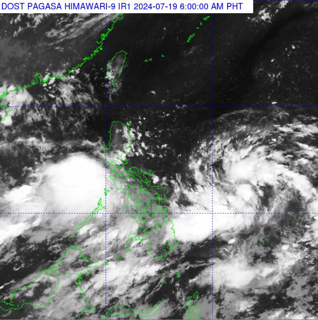
There are currently no active typhoons in the Philippines. However, a low pressure area near the East Sea has been recorded near the country in the past few days.
PAGASA's latest tropical storm and depression forecast bulletin on the morning of July 19 stated that at 3:00 a.m. on the same day, this low pressure area was about 135km from Calapan city, Oriental Mindoro.
Notably, the news said, a new low pressure area is also being monitored by PAGASA about 880 km from Eastern Visayas.
Philstar's latest tropical depression news said that Philippine weather forecasters said that the low pressure area near Calapan city, Oriental Mindoro is unlikely to strengthen into a tropical storm.
It is forecast that this system will leave the Philippine forecast area on July 20 or 21.
It is expected that the low pressure area near Calapan will cause scattered rain and widespread thunderstorms in Mimaropa, Western Visayas and Batangas.
Due to the low pressure trough, cloudy skies with scattered showers and thunderstorms may also be reported in Metro Manila, Central Luzon, Bicol Region and the rest of Calabarzon.
In addition to information about low pressure near the East Sea , PAGASA's July 19 weather forecast said that the southwest monsoon or hagabat is expected to cause scattered showers and thunderstorms in Mindanao and the remaining areas of Visayas. Areas in Luzon will have a chance of showers or localized thunderstorms.