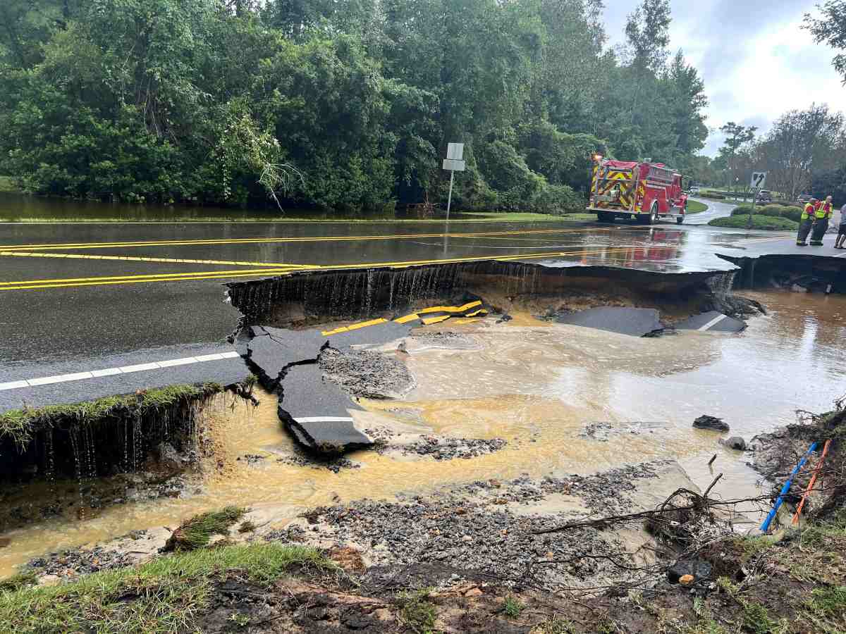
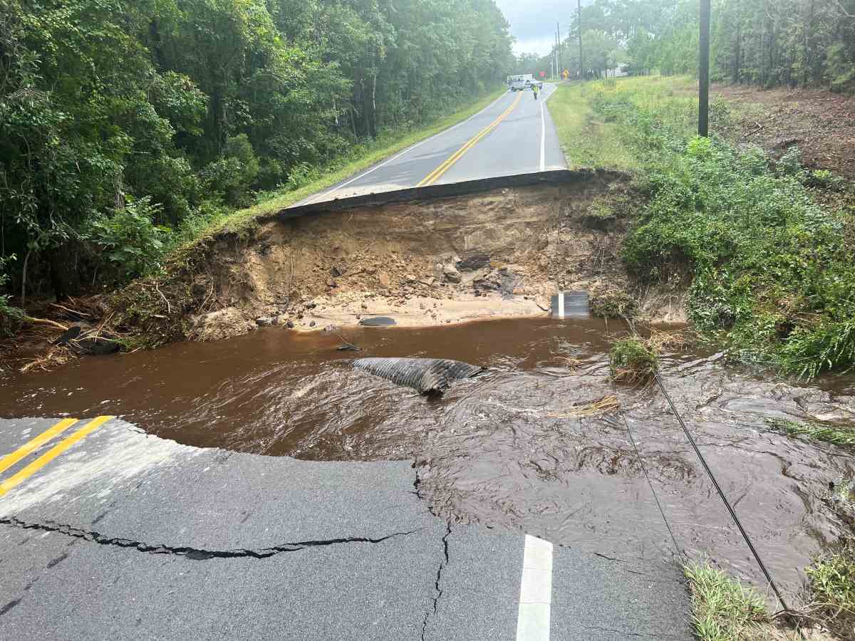
Floodwaters submerged homes and vehicles in coastal North Carolina on September 16 after a tropical storm-like system dumped record amounts of rain in just a few hours, CNN reported.
"This is probably the worst flooding any of us have ever seen in Carolina Beach," said Carolina Beach Mayor Bruce Oakley of the tourist town not far from Wilmington.
Carolina Beach was placed under a state of emergency on September 16 after a historic 18 inches (450mm) of rain fell in 12 hours, a once-in-a-thousand-year event, according to the National Weather Service in Wilmington.
Carolina Beach Elementary School was closed and students were dismissed early after classrooms began flooding.
Flooding also increased in neighbouring Brunswick, with rainfall reaching 100-120mm per hour at times. The town of Sunny Point received 230mm of rain in just three hours.
The extreme rainfall and flooding are another stark reminder that it doesn’t take a named storm to cause extremely dangerous conditions. The atmosphere is ripe for the kind of downpours that are becoming more common as the world warms from fossil fuel pollution.
Floodwaters began to recede in Carolina Beach early Tuesday afternoon as torrential rains moved west of the area. But cars left behind in the worst of the flooding remained on deserted streets.
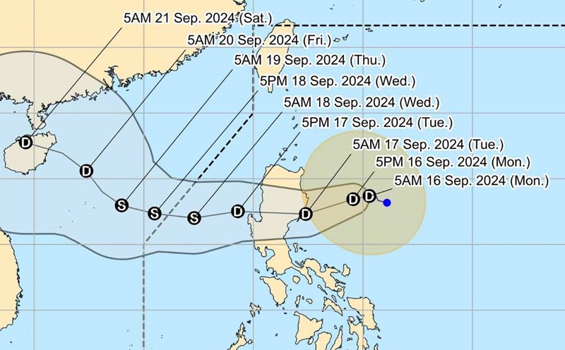
Tropical storm warnings for the Carolina coast have been canceled as of Tuesday evening, according to the U.S. National Hurricane Center. The system is being called a potential tropical storm because it is not yet strong enough to be classified as a tropical or subtropical storm.
The center of a storm is typically where the strongest winds and heaviest rains occur, but that’s not the case with potential Tropical Storm 8. Satellite imagery shows that most of the system’s heaviest rain and gusts are away from the poorly defined center.
The Carolinas were inundated with 6-12 inches of rain from Hurricane Debby in early August, leading to a flash flood emergency near Charleston, South Carolina.