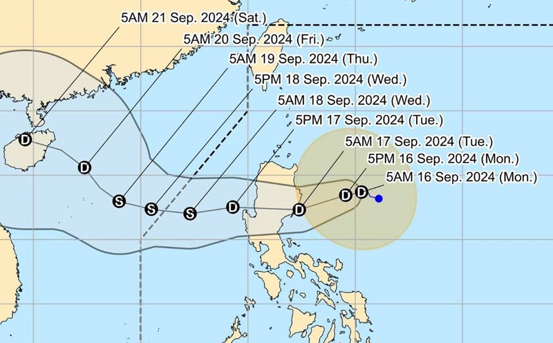
The latest storm information from the Philippine Atmospheric, Geophysical and Astronomical Services Administration (PAGASA) said that at 4:00 p.m. on September 16, the center of tropical depression Gener was at about 17.4 degrees north latitude, 124.5 degrees east longitude, 290km east of Tuguegarao City, Cagayan (Philippines).
The strongest wind near the center of the tropical depression is 55 km/h, gusting to 70 km/h, central pressure 996 hPa.
The depression is moving northwest at 10 km/h. Strong winds extend outward up to 360 km from the center of the depression.
Gener is expected to make landfall in Isabela or Aurora on the night of September 16 or early morning of September 17 and will likely be over the coastal waters of La Union or Pangasinan by noon on September 17.
The tropical cyclone will then move westward over the South China Sea until September 18 before turning northwest on September 19 and heading south of mainland China.
Gener may exit the Philippine forecast area (PAR) around late evening of September 17 or early morning of September 18.
Gener is likely to cross the Luzon mainland as a tropical depression, although the possibility of strengthening into a typhoon or weakening slightly before making landfall cannot be ruled out.
In the East Sea, tropical depression Gener may reach tropical storm level on the evening of September 17 or morning of September 18.
The Japan Meteorological Agency (JMA) said that the path of this tropical depression is quite similar to that of storm No. 3 Yagi, also passing through the northern Philippines, into the East Sea, through China's Hainan Island and into the Gulf of Tonkin.
According to the bulletin of the Vietnam National Center for Hydro-Meteorological Forecasting at 2:00 p.m. on September 16, the tropical depression is expected to move into the East Sea on September 17 and strengthen into a storm on September 18.
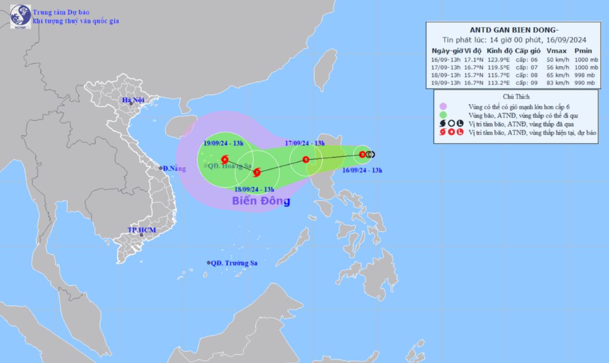
From the morning of September 17, the eastern sea of the North East Sea will have showers and strong thunderstorms, strong winds of level 7 (50-61 km/h), gusts of level 9 (75-88 km/h), rough seas. The eastern sea of the North East Sea will have waves 2-4m high.
Vessels operating in the above mentioned dangerous areas are susceptible to the impact of strong winds and large waves.