The outbreak on August 2 covered the villages with crushed stone. No casualties were reported immediately.
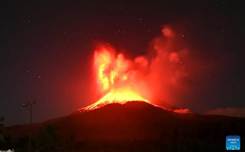
Previously, another landslide on the evening of August 1 created clouds of ash up to 10km high and lit up the night sky with brilliant fog and lightning. The two explosions occurred in less than 5 hours.
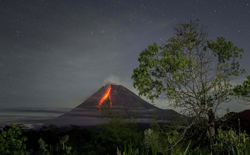
The Indonesian Geological Agency recorded hot air clouds mixed with rocks and condensation moving up to 5km down the mountainside. Unmanned observation shows deep magma movements, causing seismic shocks recorded on seismic trackers.
Volcanic materials, including thumb-shaped hot stone, have been eroded up to 8km from the cape, covering nearby villages and towns with a thick layer of volcanic sediment.
The Indonesian Geological Agency has urged people to be vigilant against heavy rains that could cause portents flowing out of rivers originating from volcanoes.
The August 2 outbreak was one of Indonesia's largest since 2010, when Merapi, the country's most volatile volcano, issued on the densely populated island of Java. That outbreak killed more than 350 people and forced hundreds of thousands to evacuate.
The 2.8 outbreak also came less than a month after the major outbreak on 7.7, causing dozens of flights at Bali's Ngurah Rai airport to be delayed or canceled, and covering the roads and rice fields with mud and heavy gray rocks.
Lewotobi Laki, a 1,584m high volcano on the remote island of Flores, has been placed at its highest warning level since the outbreak on June 18, and the ban has been doubled to a radius of 7km as the outbreaks become more frequent.
The Indonesian government has previously permanently relocated thousands of residents after a series of landslides here killed nine people and destroyed thousands of homes.
Indonesia is an archipelago with more than 280 million people, and is prone to frequent earthquakes. The country has 120 active volcanoes and is located along the "Ring of Fire", a chain of horse-to-head earthquake fractures surrounding the Pacific basin.