
The latest storm news on the morning of August 1st from the US Navy's Joint Typhoon Warning Center (JTWC) said that super typhoon Dolphin is in category 4 super typhoon status on the US Saffir-Simpson hurricane scale.
This super typhoon is 787km west of Wake Island and has moved northwest at a speed of 22 km/h in the past 6 hours.
Dolphin is continuing to move northwest. In the next 36 hours, the latest storm of the 2026 storm season will gradually shift westward, towards the Ryukyu Islands.
It is forecasted that the storm will enter a cycle of replacing it as a storm eye in the next 12-24 hours, helping the storm strengthen into a super typhoon of level 5 in a short time, with winds of 260 km/h.
However, a noteworthy point is that super typhoon Dolphin is expected to expand significantly in scale in the next few days, although its maximum intensity is decreasing.
Storm forecasters believe that Super Typhoon Dolphin will continue to expand in size, with strong winds increasing significantly, meaning the affected area of the storm will be larger even when the maximum intensity tends to decrease.
The gradual weakening trend begins next week as vertical wind cuts increase, ocean temperatures decrease, and the storm itself becomes larger.
The sea surface temperature is forecast to remain high at 29-31 degrees Celsius in the next 5 days, but the temperature content below will gradually decrease and will not be enough to maintain a very high intensity storm. Due to unfavorable conditions, this storm will gradually weaken until the end of the forecast period.
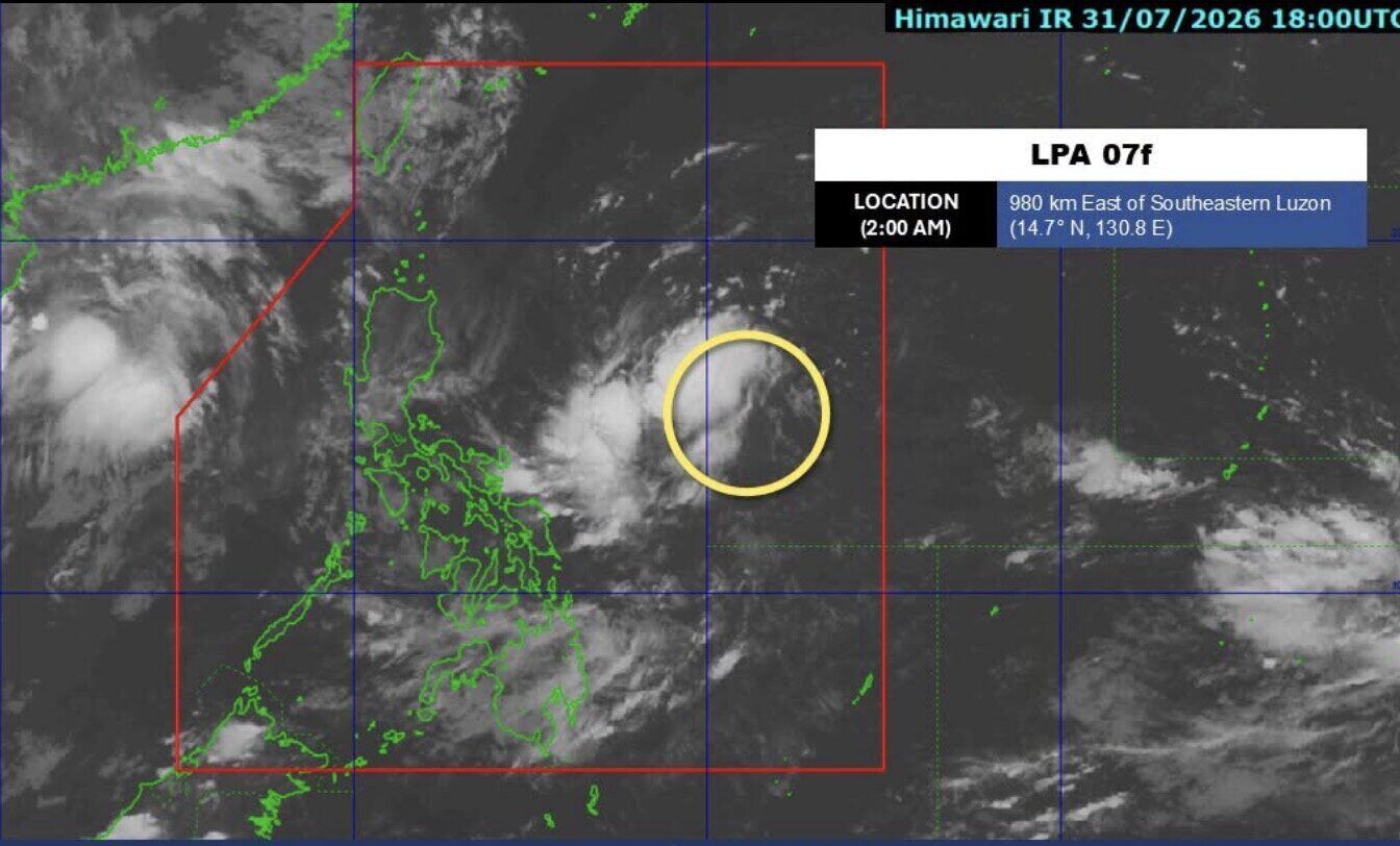
Experts also said that super typhoon Dolphin will not directly affect the Philippines. However, the combination of Dolphin and the low pressure near the Philippines named 07f, JTWC named 94W may strengthen the southwest monsoon in the Philippines from August 3rd, causing heavy rain in many areas.
According to PAGASA, on the morning of August 1st, low pressure 07f is 980km east of southeastern Luzon, in the Philippine Area of Responsibility (PAR) and is unlikely to strengthen into a tropical depression in the next 24 hours.
JTWC said that low pressure 94W is operating in the Philippine Sea, with maximum sustained winds of about 30 km/h. This system is forecast to have little chance of strengthening into a storm or tropical depression in the next 24 hours.


