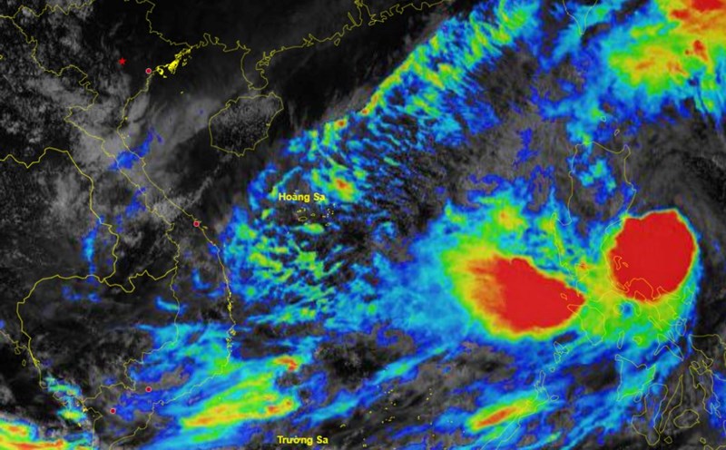
The latest storm and low pressure information from the Philippine Atmospheric, Geophysical and Astronomical Services Administration (PAGASA) said that at 2:00 p.m. on October 19, the low pressure area outside the Philippine forecast area (PAR) was 1,500 km east of southeast Luzon.
The Philippine state weather agency forecasts the low pressure system near the Philippines to move into the PAR region over the weekend. "The low pressure system is still far from the Philippine mainland and has not yet directly affected any part of the country," PAGASA weather forecaster Ana Clauren-Jorda said.
Forecaster Ana Clauren-Jorda added that as of 2 p.m. on October 18, the depression is forecast to have a moderate to high chance of becoming a typhoon within the next 24-48 hours. During the weekend, or possibly on October 20 or 21, the depression will enter the forecast area of the Philippines.
According to the PAGASA weekly weather forecast, the low pressure area is forecast to enter the PAR forecast area from October 20-21. The trough of this low pressure is expected to affect the weather in the Philippines during this period, causing cloudy and rainy conditions in Quezon, Mimaropa, Bicol, Visayas and Mindanao.
PAGASA also does not rule out the possibility that this low pressure will strengthen into a tropical depression on October 20 or 21.
The low pressure system near the Philippines has been named Invest 94W by the US Navy's Joint Typhoon Warning Center (JTWC). The latest storm and low pressure information from JTWC on October 19 stated that this low pressure system is currently located in the Philippine Sea. However, JTWC forecasts that Invest 94W is likely to strengthen into a tropical storm in the next 24 hours.
In addition to Invest 94W, the Joint Typhoon Warning Center is also monitoring two other new depressions forming near the Philippines: Invest 95W and Invest 96W.
Of the two new depressions, Invest 96W is active in the Philippine Sea. JTWC forecasters said that this depression has a moderate chance of strengthening into a tropical storm in the next 24 hours. Invest 96W has maximum sustained winds of about 25-35 km/h. The estimated minimum sea level pressure is near 1009 hPa.
JTWC's storm forecast models predict that a major storm could form from this low pressure within the next 1-3 days.
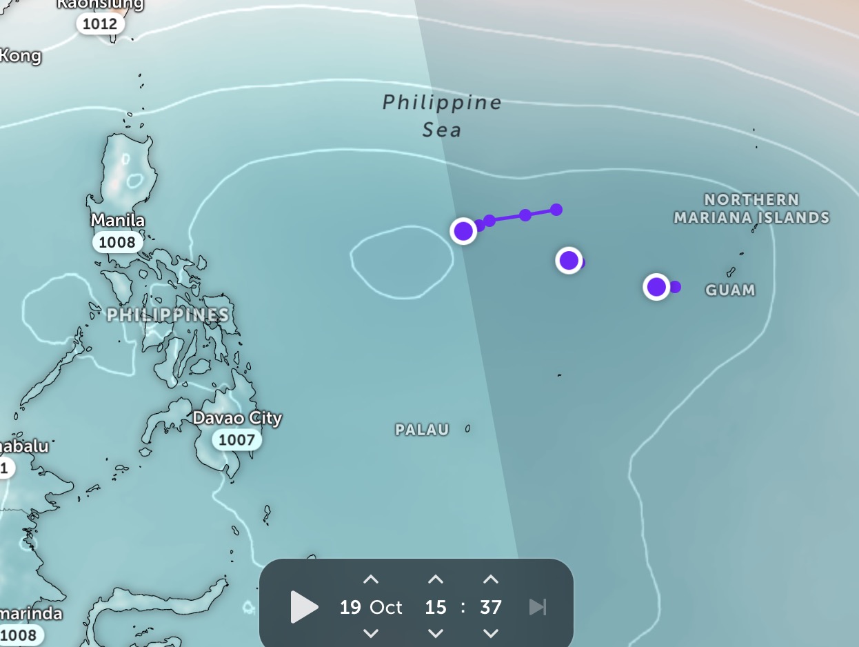
Meanwhile, Low Pressure Invest 95W is currently near Guam. The JTWC forecasts that this system has a low chance of strengthening into a tropical storm in the next 24 hours. Low Pressure Invest 95W is currently having maximum sustained winds of about 25-35 km/h. JTWC forecasters see Low Pressure Invest 95W in a favorable environment for further strengthening, with very warm sea surface temperatures (30-31 degrees Celsius) and low wind shear (10-15 knots).
The latest storm forecast models agree that low pressure Invest 95W will move slowly and erratically to the northeast over the next 2 days.