A weak La Nina is forecast to appear before winter arrives and could last until March next year, Yahoo News reported, citing the latest forecast from the US National Weather Service.
La Nina has a 60 percent chance of forming by November. For the United States, a much weaker-than-expected La Nina will not result in above-average winter temperatures overall, according to the long-range forecast released by the National Oceanic and Atmospheric Administration (NOAA) on October 17. However, in the southern United States, winter temperatures are expected to be above-normal. States in the Pacific Northwest and the Great Plains will be colder than average.
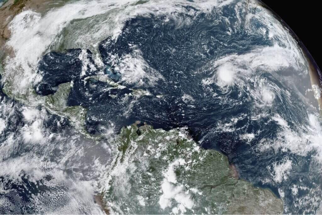
Hurricane forecasters predict the movement of jet streams due to La Nina could lead to warmer-than-normal temperatures across the South America and lead to a more severe 2025 hurricane season, NOAA noted.
"During La Nina, atmospheric conditions tend to be more favorable for hurricane formation and intensification in the Atlantic basin. The lack of strong wind shear makes it easier for hurricanes to develop and intensify, increasing the likelihood of landfall in Florida and the Gulf Coast," the Florida Oceanographic Society warned.
According to Bloomberg, Europe’s weather forecast for November will be cool and less windy as La Nina appears. However, a weak La Nina brings a higher risk of cold polar vortexes this winter.
While there is a 25% chance that La Nina will not occur, the baseline scenario is for a weak La Nina to develop, forecaster MetDesk predicts. Matthew Dobson, energy meteorologist at MetDesk, points out that during La Nina winters, the risk of an extreme weather event called “sudden stratospheric warming” can lead to cold spells in the Northern Hemisphere.
Since the 1980s, more than 70% of La Nina winters have seen at least one extreme cold front, including the February 2018 “Beast from the East” cold front that brought heavy snowfall and Arctic-like temperatures to the UK, depleting gas storage across Europe and sending energy prices soaring.
According to Ben Davis – another energy meteorologist at MetDesk – colder-than-normal weather is expected to hit in mid- to late November. He predicts that the rest of the winter could be milder.
December is forecast to be “relatively mild”, with temperatures around 1C above average across northern Europe. Temperatures in January 2025 are expected to be slightly above normal, but this forecast remains uncertain. There is a high probability of a mild, wet and windy February, around 1.9C above normal. But a sudden stratospheric warming in January could change this outlook.
For the US, La Nina could mean strong cold fronts in December and January, while mild weather is forecast for November and February. For Asia, La Nina could mean colder conditions in January and February, with warmer conditions forecast for November, according to MetDesk forecasters.