In June, there were just five rains in Kerrville County, Texas, and just a handful of light rains in early July. Meanwhile, 100% of the parishes around Kerrville were in drought in early July.
The drought was one of the factors that contributed to the flash floods on July 4 in the Kerrville area.
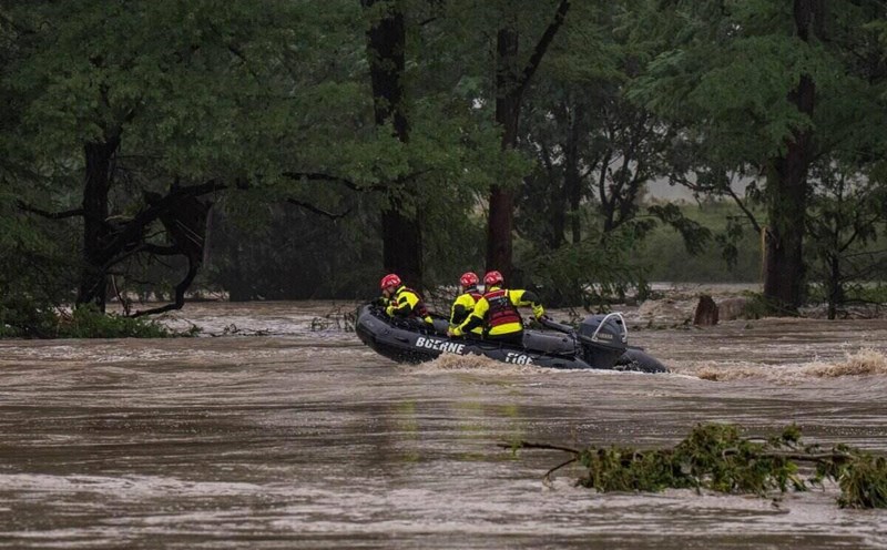
However, drought is just one of many causes. Unusually high temperatures in the Gulf of Mexico have also fueled a storm that killed 27 people at Camp Mystic summer camp, along with dozens of others across the state of Texas. To date, the death toll from the Texas tragedy has reached more than 100.
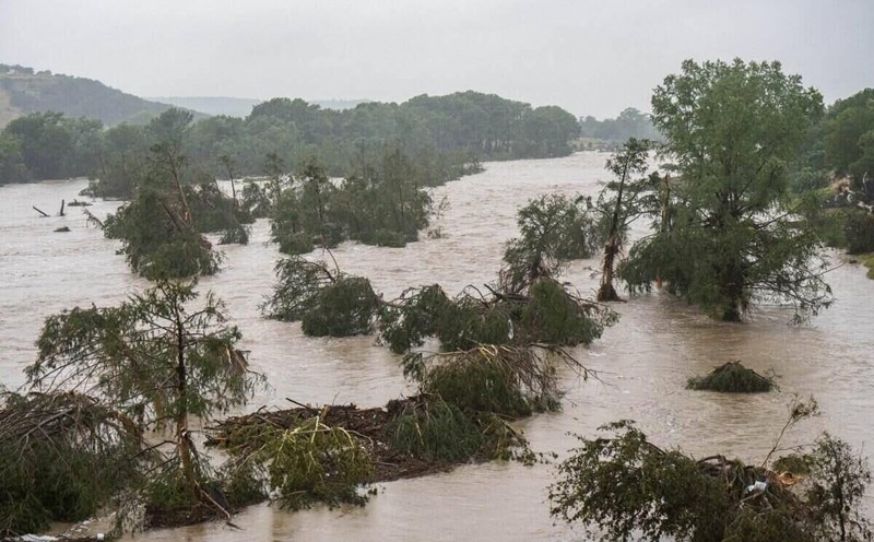
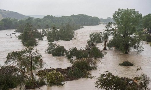
On July 4, rainfall exceeding 300 mm fell, causing the Guadalupe River and other rivers to overflow. One of the clearest signs of a climate crisis is increased extreme rains, as the tragedy in Texas this week. Texas is a vulnerable to flooding, as it is located close to the Gulf of Mexico, which provides abundant moisture to form storms, said climate scientist Jennifer Francis from the Woodwell Climate Research Center.
As the global climate warms, the atmosphere is likely to retain a lot of moisture. If the temperature increases by 1 degree Celsius, the air can retain about 7% of the evaporation. The likelihood of retaining steam increases exponentially as temperatures rise, notes Ryan Truchelut, chairman of WeatherTiger.
Another factor contributing to the disaster in Texas: Increased temperatures cause stronger evaporation, especially in the ocean. When humans emit more greenhouse gases, the oceans also heat up and evaporate more. This moisture not only makes more rain but also fuels stronger storms, explains Francis.
According to the National Weather Service (NWS), the circulation of Hurricane Barry after making landfall in eastern Mexico has pushed more moisture north, contributing to rain in Texas.
The prolonged drought in Texas has also made the situation worse. According to Mr. Truchelut, when the soil is too dry, the rainwater cannot seep down but flows over, causing flooding. Before the flood, nearly 90% of Kerr's counties were in severe or extreme droughts, the two highest on the US assessment scale.
While there are signs that climate change has contributed to extreme rains in Texas, large-scale weather patterns, typical of summer, are also contributing to the disaster.
The high pressure area covers the western United States and the Great Plains, leading to few upper-level winds, making thunderstorms unable to move from Texas. Therefore, storms gathered, almost standing still in the central state, and dumped rain in a narrow geographical area.
These storms remained in place through July 7, as part of a large-scale weather system, starting to absorb moisture from the Gulf of Mexico and surrounding areas. The system develops into a medium-sized convective storm complex, a rotating system, and is fueled by warm, moist air.
A few hours before the flash flood, the US Weather Center issued a series of medium-sized weather warnings, in which rainfall was forecast to reach 76 mm per hour in the area west of Federal Highway I-35, the route across the center of Austin City, Texas.